We use cookies for your personalized browsing experience, to personalize content and ads, to provide social media features, and to analyze traffic to our website. We also share information about your use of our website with our social media, advertising and analytics partners. Our partners may combine this information with other data that you have provided to them or that they have collected as part of your use of the Services. (incl. US providers)
Start Point

Seefeld little church Seekirchl

End Point

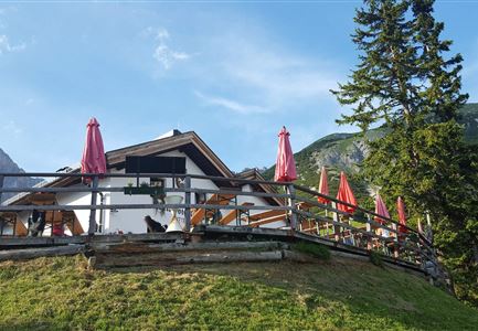
Wildmoosalm

Difficulty

Easy

Total Distance

5,80 km

Descent Meters

131 m

Highest Point

1305 m

Total Time

01:45 h

Map & Elevation Profile

Start Point

Seefeld little church Seekirchl

End Point

Wildmoosalm

Difficulty

Easy

Total Distance

5,80 km

Descent Meters

131 m

Highest Point

1305 m

Total Time

01:45 h

Hiking

Best Time

Jan

Feb

Mar

Apr

May

Jun

Jul

Aug

Sep

Oct

Nov

Dec

Hiking tour

Hut hikes

+2

Route: Seekirchl - Kirchwaldsiedlung - Hörmannweg - Wildmoosalm

Parking and public transport:

P13 and P14 as well as numerous other parking options.

By train to Seefeld station (10 minutes walk to the starting point).

Find all connections in real time with the Mobility-App "wegfinder".

Directions:

This hike starts directly at the Seekirchl in Seefeld. Walk through the Kirchwaldsiedlung in the direction of Brunschkopf (trail no. 2) and follow the Hörmannweg. Turn right at the fork in the trail towards Wildmoosalm and follow the trail to the alpine pasture. Enjoy the view of the village of Seefeld on the way.

Alternative hike to the Wildmoosalm:

Walk along the forest road, which starts on the left opposite the Reitanalge in Seefeld, to the Wildmoosalm.

Attention: General ban on driving cars! Therefore, the use of this path is only allowed on foot or by bike.

Alpine emergency call:

Call: 140

Features & Characteristics

Start Point

Seefeld little church Seekirchl

End Point

Wildmoosalm

Family hike

Yes

Hike suitable for prams

Yes

Similar Tour Suggestions

Ahrn Hochfluder Weidach.jpg

Hiking

Hike Hoher Sattel

Length

10,60 km

Duration

04:00 h

Uphill

524 hm

Altitude

1620 hm

Difficulty

Medium

E-Biken bei der Hochegg Alm - Seefeld

Hiking

Bike & Hike Seefelder Spitze Summit, 2,220 m

Length

13,00 km

Duration

04:30 h

Uphill

1094 hm

Downhill

799 hm

Altitude

2220 hm

Difficulty

Hard

Kurze Pause an der Leutascher Ache - mit den Mountainbikes im Gaistal

Hiking

Bike & Hike Gehrenspitze Summit, 2,367 m

Length

21,00 km

Duration

07:00 h

Uphill

1179 hm

Altitude

2367 hm

Difficulty

Hard

Nach Gießenbach und Scharnitz.jpg

Hiking

Hike from Seefeld to Scharnitz

Length

9,60 km

Duration

02:30 h

Uphill

27 hm

Downhill

288 hm

Altitude

1252 hm

Difficulty

Easy

Closed
Bodenalm Stall mit Brunnen

Hiking

Circular hiking traill to the Bodenalm alpine hut

Length

8,40 km

Duration

02:30 h

Uphill

180 hm

Altitude

1198 hm

Difficulty

Easy

Wettersteinhütte im Gaistal in Leutasch

Hiking

High Pasture alpine hut hike above the Gaistal Valley

Length

24,20 km

Duration

09:45 h

Uphill

1261 hm

Altitude

2132 hm

Difficulty

Medium

Spaziergang rund um den Moeserer See im Sommer

Hiking

Peace Walk

Length

4,60 km

Duration

02:00 h

Uphill

97 hm

Downhill

101 hm

Altitude

1287 hm

Difficulty

Easy

Luftaufnahme von der Rauthhuette - Leutasch

Hiking

Hike Hohe Munde Summit, 2.592 m

Length

11,30 km

Duration

09:00 h

Uphill

1410 hm

Altitude

2562 hm

Difficulty

Hard