We use cookies for your personalized browsing experience, to personalize content and ads, to provide social media features, and to analyze traffic to our website. We also share information about your use of our website with our social media, advertising and analytics partners. Our partners may combine this information with other data that you have provided to them or that they have collected as part of your use of the Services. (incl. US providers)
Start Point

Katzenkopfhütte

End Point

Weidach Leutasch

Difficulty

Hard

Total Distance

22,00 km

Descent Meters

175 m

Highest Point

1379 m

Status

Closed

Map & Elevation Profile

Start Point

Katzenkopfhütte

End Point

Weidach Leutasch

Difficulty

Hard

Total Distance

22,00 km

Descent Meters

175 m

Highest Point

1379 m

Status

Closed

Cross-country Skiing

Best Time

Closed

Jan

Feb

Mar

Apr

May

Jun

Jul

Aug

Sep

Oct

Nov

Dec

Ski-nordic

Ski-nordic-classic

+4

Access to the ski track:

Katzenkopfhütte (1,360 m), C4

Tracks:

C4 - C5 - A3 - B3 - C11 - C6 - C10 - A5 - A6 - A10

An overview of the entire cross-country skiing network (incl. trail status) and helpful cross-country skiing information (ticket machines, waxing and service points, changing facilities, ...) can be found in the cross-country skiing report.

Track Characteristics:

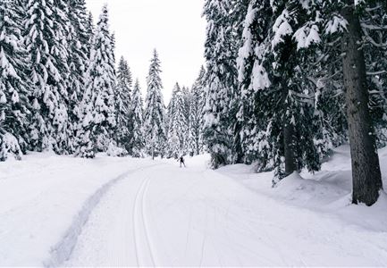
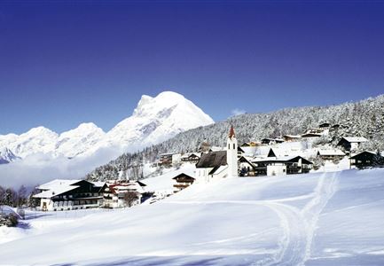
A spectacular cross-country skiing circuit through the Region Seefeld, starting directly from the summit of the Leutascher Katzenkopf. This round is something very special! The (free) ascent with the mountain railway saves you the strenuous metres in altitude and afterwards you can enjoy pure cross-country skiing pleasure. 

Description of direction:

At the valley station of the small Katzenkopf lift there are plenty of parking spaces available, but you can also easily reach the starting point by regional public transport (Leutasch Weidach Kreithkapelle stop). The cable car makes the first ascent to the summit easier and can be used free of charge with a cross-country ski pass & cross-country skiing equipment. 


Once at the top it is worth taking

Read More...

Features & Characteristics

Similar Tour Suggestions

B3 Wildmoos - Skaterin im Wald

Cross-country Skiing

B3 - Wildmoos See

Length

2,90 km

Uphill

49 hm

Altitude

1331 hm

Difficulty

Medium

Closed
B12 Mösern Ortszentrum

Cross-country Skiing

B12 - Mösern Ortszentrum

Length

1,00 km

Uphill

23 hm

Altitude

1248 hm

Difficulty

Medium

Closed
A1 Nachtloipe, Paar beim Langlaufen

Cross-country Skiing

A1 - Nachtloipe - flood light trail

Length

3,00 km

Uphill

19 hm

Altitude

1189 hm

Difficulty

Easy

Closed
Langlaufen-C10-Mundeknie-Loipe---Leutasch

Cross-country Skiing

C10 – Mundeknie

Length

2,50 km

Uphill

84 hm

Altitude

1263 hm

Difficulty

Hard

Closed
Luftaufnahme Loipe A2

Cross-country Skiing

A2 - Lenerwiese

Length

1,30 km

Uphill

11 hm

Altitude

1183 hm

Difficulty

Easy

Closed
B13-Loipeneinstieg-Lottensee

Cross-country Skiing

B13 - Lottensee-Möserer See

Length

2,90 km

Uphill

97 hm

Altitude

1325 hm

Difficulty

Medium

Closed
Klassische Langlauf Spur

Cross-country Skiing

B8 - Interalpen Connection West

Length

400 m

Uphill

24 hm

Altitude

1342 hm

Difficulty

Medium

Closed
B9_Triendlsaege.JPG

Cross-country Skiing

B9 - Triendlsäge

Length

3,00 km

Uphill

-120 hm

Altitude

1163 hm

Difficulty

Medium

Closed