Start Point

Katzenkopf Bergstation

End Point

Abzweigung zur Wildmoosalm
Difficulty

Easy

Total Distance

600 m

Ascent Meters

43 m

Highest Point

1360 m

Map & Elevation Profile

Start Point

Katzenkopf Bergstation

End Point

Abzweigung zur Wildmoosalm

Difficulty

Easy

Total Distance

600 m

Ascent Meters

43 m

Highest Point

1360 m

Cycling

Best Time

Jan

Feb

Mar

Apr

May

Jun

Jul

Aug

Sep

Oct

Nov

Dec

Cycling and mountain biking

Bikepark

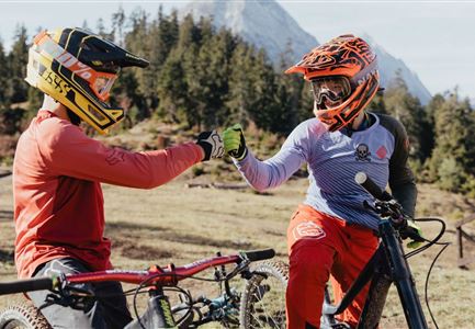
Very simply kept flat trail for MTB beginners, pleasure bikers and kids - created to simply get a taste of trail biking! The trail runs from the Katzenkopfhütte to the Wildmoosalm turnoff.

All information about the trail status here.

Features & Characteristics

Start Point

Katzenkopf Bergstation

End Point

Abzweigung zur Wildmoosalm

Similar Tour Suggestions

Wangalm im Wettersteingebirge

Hiking

Bike & Hike Gehrenspitze Summit, 2,367 m

Length

21,00 km

Duration

07:00 h

Uphill

1150 hm

Altitude

2367 hm

Difficulty

Hard

Symbolbild Biken

Cycling

Biketour No. 5049 Reith-Kaiserstandrunde

Length

6,60 km

Duration

01:10 h

Uphill

254 hm

Downhill

252 hm

Altitude

1318 hm

Difficulty

Hard

Gaistal

Cycling

Biketour Tillfussalm alpine hut

Length

9,60 km

Duration

01:20 h

Uphill

174 hm

Altitude

1358 hm

Difficulty

Easy

Gravelbiker auf der Gleirschhoehe im Hinterautal - Naturpark Karwendel

Cycling

Biketour No. 579 Gleirschtal-Möslalm

Length

22,60 km

Duration

02:30 h

Uphill

392 hm

Altitude

1272 hm

Difficulty

Medium

Möserer See im Frühling - Paar auf Liege vor Möserer Seestube von aus der Entfernung.jpg

Cycling

Biketour Seefeld - Mösern - Wildmoos - Katzenkopf - Fludertal - Seefeld

Length

27,20 km

Duration

04:00 h

Uphill

657 hm

Downhill

651 hm

Altitude

1368 hm

Difficulty

Medium

Gravelbike - Bikeweg im Gaistal.jpg

Cycling

Biketour No. 5047 Gaistal-Hämmermoosalm

Length

3,90 km

Duration

00:45 h

Uphill

171 hm

Downhill

172 hm

Altitude

1417 hm

Difficulty

Medium

Leutascher Ache im Sommer - Drohnenaufnahme Kurve im Fluss (1).jpg

Cycling

Biketour - Adventure Ride

Length

48,50 km

Duration

05:00 h

Uphill

1071 hm

Altitude

1510 hm

Difficulty

Medium

Gravelbike - Zum Isarursprung.jpg

Hiking

Bike & Hike Hoher Gleirsch Summit, 2,492 m

Length

31,00 km

Duration

09:30 h

Uphill

1772 hm

Altitude

2492 hm

Difficulty

Hard