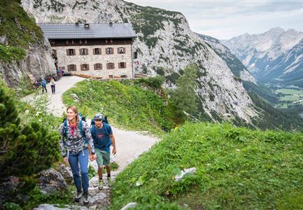
Start Point
Scharnitz Hallerangerhaus
End Point
Nordkette Innsbruck
Difficulty
Hard
Total Distance
13,00 km
Descent Meters
1150 m
Highest Point
2280 m
Total Time
05:30 h
Hiking
Best Time
Jan
Feb
Mar
Apr
May
Jun
Jul
Aug
Sep
Oct
Nov
Dec
Eagle walk
Multi-Day Tour Feature: Etappe
In front of the hut first on the trail towards "Lafatscher Joch". The trail leads into a scree cirque, which becomes increasingly steeper and narrower. The route then soon leads through the so-called "Durchschlag" (here the old mule track was broken through the rock) and a little later - past a cross - gently up on a ground (in the area branching possibility to the Speckkarspitze). Over the bottom it goes in a northerly direction comfortably to the Lafatscher Joch. At the Joch follow the signs to the "Pfeishütte".
On thedescend gently and orientate yourself at "Pfeishütte" or subsequently at "Pfeishütte via Wilde-Bande-Steig". On the primitive "Wilde-Bande-Steig" often through mountain pines, crossing gullies several times, slightly ascending over to the entrance to the cirque below the Stempeljoch. Here, orientate to "Stempeljoch" or "Pfeishütte". The path (built with boards, numerous wire ropes) through the cirque becomes increasingly steeper, the (initially gravelly) ground becomes firmer further up. From the yoke down to the right and through meadows or alpine pastures leisurely to the Pfeishütte.
Directly at the Pfeishütte begins thesignposted "Goetheweg" (No. 219). It leads as a footpath or later as a path with a gentle ascent into
Features & Characteristics
Start Point
Scharnitz Hallerangerhaus
End Point
Nordkette Innsbruck
Multi-Day Tour Feature
Etappe
