We use cookies for your personalized browsing experience, to personalize content and ads, to provide social media features, and to analyze traffic to our website. We also share information about your use of our website with our social media, advertising and analytics partners. Our partners may combine this information with other data that you have provided to them or that they have collected as part of your use of the Services. (incl. US providers)

Start Point

Seefeld Seekirchl

End Point

Seefeld Seekirchl

Difficulty

Easy

Total Distance

3,90 km

Descent Meters

59 m

Ascent Meters

59 m

Highest Point

1203 m

Map & Elevation Profile

Start Point

Seefeld Seekirchl

End Point

Seefeld Seekirchl

Difficulty

Easy

Total Distance

3,90 km

Descent Meters

59 m

Ascent Meters

59 m

Highest Point

1203 m

Running

Best Time

Jan

Feb

Mar

Apr

May

Jun

Jul

Aug

Sep

Oct

Nov

Dec

Nordic walking

Running tracks

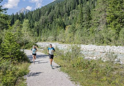
Profile: mainly flat running and nordic walking route

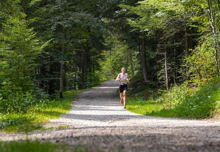
Surface: forest paths, meadow paths

Route: Seefeld Seekirchl - Wildsee / Restaurant Strandperle - Waldbad Strandcafé Sonja - Seefeld Seekirchl

Description:

This flat and easy loop takes you directly to the Wildsee, passing by the Restaurant and Strandbad Strandperle. It continues through the Reither Moor and along the Seefelder Finnenbahn, passing Sonja's Café and Waldbad, before returning to the starting point at Seefelder Seekirchl.

The indicated running time is a guideline and depends on personal fitness.

Features & Characteristics

Similar Tour Suggestions

Laufeinheit am frühen Morgen am Moeserer See

Running

Mösere See Running Route

Length

2,30 km

Uphill

79 hm

Downhill

82 hm

Altitude

1288 hm

Difficulty

Easy

Lottensee im Frühsommer - Drohnenaufnahme mit Lottenseehütte und Wettersteingebirge.jpg

Running

Lottensee Running Route

Length

6,40 km

Uphill

123 hm

Downhill

126 hm

Altitude

1344 hm

Difficulty

Easy

Teilnehmer des Ganghofer Trail in der Nähe des Waidachsees.jpg

Running

Half Marathon Seefeld-Scharnitz Running Route

Length

21,00 km

Uphill

347 hm

Altitude

1254 hm

Difficulty

Hard

Partially open
Bienenlehrpfad Reith - kleine Stadl am Anfang des Pfades bei Reith (1).jpg

Running

Auland Running Route

Length

7,20 km

Uphill

162 hm

Downhill

156 hm

Altitude

1203 hm

Difficulty

Medium

Skisprungschanzen kurz vorm Sonnenuntergang (1).jpg

Running

Stadium Running Route

Length

3,00 km

Uphill

50 hm

Altitude

1202 hm

Difficulty

Easy

Wildmoosalm im Sommer - Drohnenaufnahme aus der Distanz Richtung Hohe Munde.jpg

Running

Around the Brunschkopf Running Route

Length

9,40 km

Uphill

251 hm

Downhill

271 hm

Altitude

1370 hm

Difficulty

Medium

Ganghofertrail 2024 - Mitzieheraufnahme Läuferin bei Weidachsee - Hochformat.jpg

Running

Leutascher Half Marathon Running Route

Length

21,00 km

Uphill

310 hm

Downhill

315 hm

Altitude

1191 hm

Difficulty

Hard

Wanderweg Oberer Wiesenweg - Blick auf Stadl im Frühsommer (1).jpg

Running

Meadow Path Running Route

Length

6,60 km

Uphill

102 hm

Downhill

83 hm

Altitude

1192 hm

Difficulty

Medium