Start Point

Weidach Leutasch

End Point

Weidach Leutasch

Difficulty

Easy

Total Distance

10,00 km

Descent Meters

42 m

Highest Point

1167 m

Map & Elevation Profile

Start Point

Weidach Leutasch

End Point

Weidach Leutasch

Difficulty

Easy

Total Distance

10,00 km

Descent Meters

42 m

Highest Point

1167 m

Cross-country Skiing

Best Time

Jan

Feb

Mar

Apr

May

Jun

Jul

Aug

Sep

Oct

Nov

Dec

Attraction

Skating

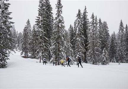
The 10 km fun course of the Ganghoferlauf with start and finish in the Ganghofer Ski Stadium leads along blue, less demanding trails in the direction of Obern and back. This route is ideal for anyone who wants to get a taste of competition for the first time. The race is run in free technique, with skating being favoured. A classic track is available for participants who would like to run in classic style. Further information on the programme and details on registration can be found here. More information about the program and details on registration can be found here.

Features & Characteristics

Start Point

Weidach Leutasch

End Point

Weidach Leutasch

Skating

Yes

Klassisch

Yes

Similar Tour Suggestions

Familie vor dem Seekirchl im Sommer - 2.jpg

Hiking

Circular walk Seefeld to the Jumping hill

Length

2,00 km

Duration

00:30 h

Uphill

10 hm

Altitude

1195 hm

Difficulty

Easy

Abendstimmung am Seekirchl in Seefeld im Sommer.jpg

Hiking

Circular walk in the Möserer valley

Length

3,10 km

Duration

00:45 h

Uphill

12 hm

Altitude

1196 hm

Difficulty

Easy

Höhenweg Leutasch_Aussichtsplattform Höhenweg.jpg

Hiking

Circular hike to the viewing platform on the Höhenweg - Runst

Length

7,40 km

Duration

02:00 h

Uphill

128 hm

Altitude

1156 hm

Difficulty

Easy

Möserer See im Frühling - Paar läuft entlang des Seeweges.jpg

Hiking

Circular walking path from Seefeld to the lake Möserer See

Length

8,80 km

Duration

02:30 h

Uphill

231 hm

Altitude

1297 hm

Difficulty

Easy

Herbst am Möserer See - Frau am Ufer (Edit 2).jpg

Hiking

Circular walking path lake Möserer See & Kalvarienberg

Length

3,00 km

Duration

01:00 h

Uphill

78 hm

Downhill

82 hm

Altitude

1291 hm

Difficulty

Easy

IML Teilnehmer bei Wald - Leutasch (1).jpg

Running

IML Unicorn March Day 3: 30 km - Gaistal Walk

Length

30,00 km

Duration

08:30 h

Uphill

778 hm

Downhill

765 hm

Altitude

1417 hm

Difficulty

Easy

IML Teilnehmer beim Wandern vor Berg - Leutasch (7).jpg

Running

IML Unicorn March Day 3: 20 km - Bichlwald Hike

Length

20,00 km

Duration

06:15 h

Uphill

534 hm

Downhill

510 hm

Altitude

1417 hm

Difficulty

Easy

Spaziergang mit Hund in Unterleutasch - Hund spricht ins Wasser an der Leutascher Ache.jpg

Hiking

Area for dogs (off-leash)

Length

1,50 km

Duration

00:30 h

Uphill

28 hm

Difficulty

Easy