Start Point

Information Office Mösern

End Point

Information Office Mösern

Difficulty

Easy

Total Distance

3,00 km

Descent Meters

78 m

Ascent Meters

82 m

Highest Point

1291 m

Total Time

01:00 h

Map & Elevation Profile

Start Point

Information Office Mösern

End Point

Information Office Mösern

Difficulty

Easy

Total Distance

3,00 km

Descent Meters

78 m

Ascent Meters

82 m

Highest Point

1291 m

Total Time

01:00 h

Hiking

Best Time

Jan

Feb

Mar

Apr

May

Jun

Jul

Aug

Sep

Oct

Nov

Dec

Hiking tour

Village walks

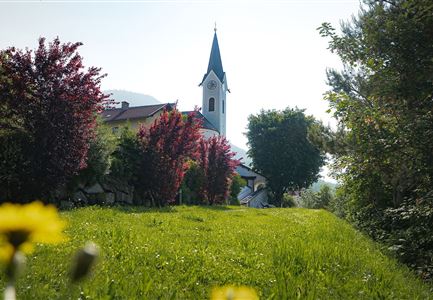
The hike begins at the Mösern Information Office and first passes the local history museum in Sterzingerhof. A short climb over the Kalvarienberg offers beautiful views before the path leads into the peaceful nature.

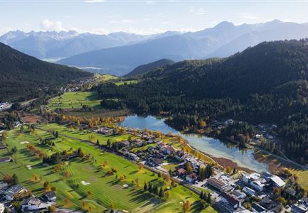
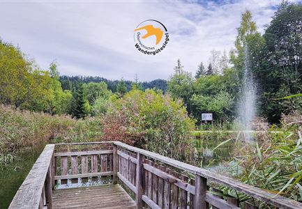
Soon, you reach the Möserer See, a picturesque lake nestled in the Seefeld Plateau. On calm days, the sky reflects on its smooth surface, and with a bit of luck, you may spot rare water lilies floating on the water. Right by the lake, the cozy Möserer Seestub’n restaurant invites you to take a break and enjoy delicious regional dishes.

Feeling refreshed, the trail continues to the Peace Bell of Mösern, one of the largest free-standing bells in the Alps. From here, you can enjoy a breathtaking view over the Inn Valley and the surrounding mountain peaks. As a symbol of peace, the bell rings every day at 17.00, creating a special moment of reflection and tranquility.

After this impressive experience, the path leads back to the starting point in Mösern, where the memories of this beautiful tour will stay with you for a long time.

Similar Tour Suggestions

Drohnenaufnahme Hämmermoosalm bei Sonnenuntergangsstimmung.jpg

Hiking

Hike to the Hämmermoosalm

Length

4,00 km

Duration

01:30 h

Uphill

175 hm

Altitude

1417 hm

Difficulty

Easy

Reith Wiesenweg im Frühling - Drohnenaufnahme strahlend grüne Wiese mit Blick zum Inntal.jpg

Hiking

Circular hiking traill Wiesenweg

Length

4,60 km

Duration

01:30 h

Uphill

109 hm

Altitude

1128 hm

Difficulty

Easy

Scharnitz - Wanderung zur Birzlkapelle - Kapelle mit Pausenbank.jpg

Hiking

Hike to the Birzlkapelle chapel

Length

4,60 km

Duration

01:30 h

Uphill

175 hm

Altitude

1130 hm

Difficulty

Easy

Abendstimmung am Seekirchl in Seefeld im Sommer.jpg

Hiking

Circular walk in the Möserer valley

Length

3,10 km

Duration

00:45 h

Uphill

12 hm

Altitude

1196 hm

Difficulty

Easy

Porta Claudia Scharnitz - Tor mit Weg.jpg

Hiking

Circular hiking trail Porta Claudia

Length

2,50 km

Duration

01:00 h

Uphill

125 hm

Downhill

120 hm

Altitude

1085 hm

Difficulty

Easy

Kulturwanderweg Reith im Sommer_Pfarrkirche Reith.jpg

Hiking

Cultural Hiking Trail Reith

Length

7,29 km

Duration

02:00 h

Uphill

140 hm

Altitude

1150 hm

Difficulty

Easy

Höhenweg Leutasch_Aussichtsplattform Höhenweg_Pfarrkirche St. Magdalena und Ganghofermuseum.jpg

Hiking

Wheelchair Circular Hike Runst-Achweg

Length

6,30 km

Duration

02:00 h

Uphill

40 hm

Altitude

1130 hm

Difficulty

Easy

Partially open
Spaziergang mit Hund in Unterleutasch - Mann läuft mit Hund entlang von Bäumen Aufnahme Richtung Sonne.jpg

Hiking

Tour of lawn "toler"

Length

4,20 km

Duration

00:45 h

Uphill

13 hm

Altitude

1072 hm

Difficulty

Easy