We use cookies for your personalized browsing experience, to personalize content and ads, to provide social media features, and to analyze traffic to our website. We also share information about your use of our website with our social media, advertising and analytics partners. Our partners may combine this information with other data that you have provided to them or that they have collected as part of your use of the Services. (incl. US providers)

Start Point

Leutasch Schanz

End Point

Leutasch Schanz

Difficulty

Medium

Total Distance

7,40 km

Descent Meters

590 m

Ascent Meters

590 m

Highest Point

1569 m

Total Time

04:00 h

Map & Elevation Profile

Start Point

Leutasch Schanz

End Point

Leutasch Schanz

Difficulty

Medium

Total Distance

7,40 km

Descent Meters

590 m

Ascent Meters

590 m

Highest Point

1569 m

Total Time

04:00 h

Hiking

Best Time

Jan

Feb

Mar

Apr

May

Jun

Jul

Aug

Sep

Oct

Nov

Dec

Hiking tour

Hut hikes

+2

Route: Leutasch/Schanz - Franzosensteig - Ederkanzel - Leutasch/Schanz

Parking and public transport:

P19 "Leutascher Geisterklamm".

By train to Seefeld train station and continue by bus to "Leutasch Schanz" stop.

You can find all connections in real time with the Mobility-App "wegfinder".

Directions:

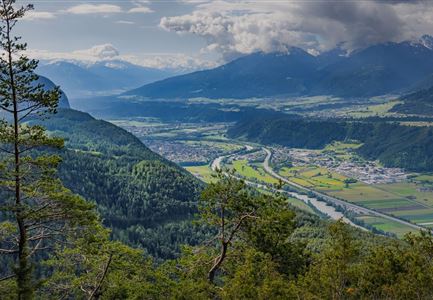
At the panorama panel in Schanz, the road leads over the Ache, along the Franzosensteig, to the ascent of the Grünkopf. After a magnificent panoramic view, the descent to the Ederkanzel or to Leutasch begins. From the Ederkanzel a piece on the same path back, then in the direction of Leutasch/Schanz back to the starting point.

Alpine emergency call:

Call: 140

Features & Characteristics

Start Point

Leutasch Schanz

End Point

Leutasch Schanz

Circular hike

Yes

Similar Tour Suggestions

Wanderung zur Eppzirler Alm im Karwendel - Scharnitz.jpg

Hiking

Hike to the Eppzirler Alm alpine hut

Length

12,40 km

Duration

04:00 h

Uphill

481 hm

Altitude

1453 hm

Difficulty

Medium

Durchs Karwendeltal aufs Karwendelhaus - Scharnitz

Hiking

Hike to the Karwendelhaus

Length

36,00 km

Duration

11:15 h

Uphill

839 hm

Altitude

1765 hm

Difficulty

Medium

Hallerangeralm

Hiking

Bike & Hike Sunntigerspitze Summit, 2,321 m

Length

42,00 km

Duration

09:00 h

Uphill

1396 hm

Altitude

2321 hm

Difficulty

Medium

Bikepause an der Isarquelle.jpg

Hiking

Bike & Hike Halleranger house - Halleranger alm

Length

38,00 km

Duration

06:00 h

Uphill

832 hm

Altitude

1768 hm

Difficulty

Medium

Kinder bei Infotafel in der Geisterklamm.jpg

Hiking

Short Gorge Trail (with theme path)

Length

500 m

Uphill

10 hm

Difficulty

Easy

Kurblhang - Leutasch (2).jpg

Hiking

Circular hiking trail viewpoint Kurblhang

Length

3,50 km

Duration

01:30 h

Uphill

181 hm

Altitude

1277 hm

Difficulty

Medium

Aufstieg auf die Pleisenspitze im Karwendel - Pleisenspitze bei Scharnitz

Hiking

Hike to the Pleisenspitze Summit, 2,569 m

Length

20,10 km

Duration

09:30 h

Uphill

1600 hm

Altitude

2569 hm

Difficulty

Hard

Reith im Frühling bei Morgenstimmung - Drohnenaufnahme Kirche mit Blick ins Inntal.jpg

Hiking

Cultural circular walking path Reith

Length

4,57 km

Duration

01:30 h

Uphill

113 hm

Altitude

1126 hm

Difficulty

Easy