Start Point

Scharnitz Parking P1 "Ried"

End Point

Scharnitz Parking P1 "Ried"
Difficulty

Medium

Total Distance

10,00 km

Descent Meters

668 m

Ascent Meters

668 m

Highest Point

1523 m

Total Time

04:30 h

Map & Elevation Profile

Start Point

Scharnitz Parking P1 "Ried"

End Point

Scharnitz Parking P1 "Ried"

Difficulty

Medium

Total Distance

10,00 km

Descent Meters

668 m

Ascent Meters

668 m

Highest Point

1523 m

Total Time

04:30 h

Hiking

Best Time

Jan

Feb

Mar

Apr

May

Jun

Jul

Aug

Sep

Oct

Nov

Dec

Hiking tour

Hut hike

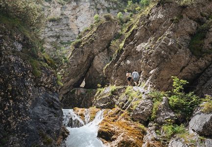
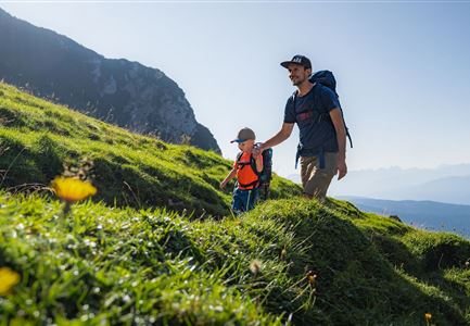
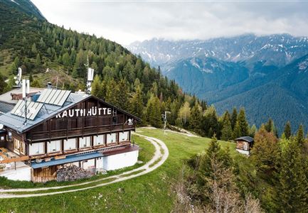
Starting at P1 Ried, head towards Mittenwald. Take the first right turn. Shortly after, take another right and cross the Isar bridge until you reach the B2 federal road. Cross this road slightly to the right towards the railroad crossing. Cross the tracks and follow a forest path towards Mittenwald. At the next junction, turn right and then immediately left. A well-marked path will lead you directly to the Brunnsteinhütte (1,560 m). Once you reach the second bench, take a short detour to the left and visit the suspension bridge over the Sulzleklamm gorge. Descend on the same route as the ascent.

Features & Characteristics

Stamina

Technique

Start Point

Scharnitz Parking P1 "Ried"

End Point

Scharnitz Parking P1 "Ried"
Similar Tour Suggestions

Brunschkopf_inkl_Logo.jpg

Hiking

Brunschkopf viewing platform via Geiernest from Seefeld, return via Wildmoosalm

Length

9,20 km

Duration

03:15 h

Uphill

316 hm

Downhill

313 hm

Altitude

1493 hm

Difficulty

Medium

Spaziergang an der Isar - Scharnitz (2).jpg

Hiking

Circular hiking trail to the Gleirschhöhe

Length

8,60 km

Duration

02:45 h

Uphill

212 hm

Altitude

1074 hm

Difficulty

Medium

Rotmoosalm im Gaistal beim Sonnenuntergang (C) Olympiaregion Seefeld - Stefan Schütz.jpg

Hiking

High Pasture alpine hut hike above the Gaistal Valley

Length

24,40 km

Duration

09:45 h

Uphill

1263 hm

Downhill

1264 hm

Altitude

2132 hm

Difficulty

Medium

Schlossbachklamm mit Bahnstrecke - Reith.jpg

Hiking

Hike through the Schlossbachklamm Gorge

Length

12,20 km

Duration

04:30 h

Uphill

488 hm

Downhill

482 hm

Altitude

1129 hm

Difficulty

Medium

Wanderweg zur Hohen Fluder mit Blick Richtung Hohe Munde.jpg

Hiking

Hike Hoher Sattel

Length

10,60 km

Duration

04:00 h

Uphill

524 hm

Altitude

1620 hm

Difficulty

Medium

Familie beim Wandern am Kaltwassersee - Seefeld (2).jpg

Hiking

Circular hiking traill to the Rosshütte alpine hut - Hochegg Alm alpine hut

Length

8,30 km

Duration

03:45 h

Uphill

515 hm

Altitude

1740 hm

Difficulty

Medium

Wanderung Oberbrunnalm im Karwendel - Scharnitz (1).jpg

Hiking

Circular hike over Zäunlkopf & Oberbrunnalm alpine hut

Length

15,20 km

Duration

06:00 h

Uphill

794 hm

Downhill

789 hm

Altitude

1743 hm

Difficulty

Medium

Familien-Weitwanderung im Gaistal - Familie spielt Engelchen.jpg

Hiking

Stage 3: To Hämmermoosalm & Wrap Up – Leutasch 3-Day Hut Hike for Families

Length

6,50 km

Uphill

10 hm

Downhill

840 hm

Altitude

2132 hm

Difficulty

Medium