Start Point

Seefeld Seekirchl

End Point

Seefeld Seekirchl

Difficulty

Medium

Total Distance

9,20 km

Descent Meters

316 m

Ascent Meters

313 m

Highest Point

1493 m

Total Time

03:15 h

Map & Elevation Profile

Start Point

Seefeld Seekirchl

End Point

Seefeld Seekirchl

Difficulty

Medium

Total Distance

9,20 km

Descent Meters

316 m

Ascent Meters

313 m

Highest Point

1493 m

Total Time

03:15 h

Hiking

Best Time

Jan

Feb

Mar

Apr

May

Jun

Jul

Aug

Sep

Oct

Nov

Dec

Hiking tour

Circular hike

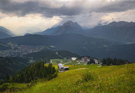
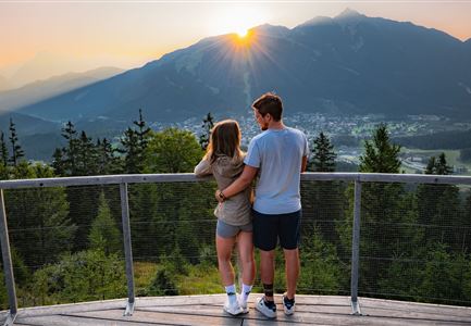
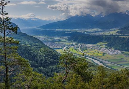
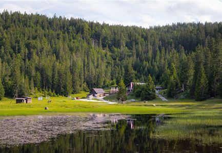
Many beautiful trails lead to the Brunschkopf. On this circular hike, you can enjoy the stunning view from the Brunschkopf Viewing Platform over Seefeld and then treat yourself to regional delicacies at the Wildmoosalm.

From the starting point at the Seefeld Seekirchl, follow the signs towards Brunschkopf/Wildmoosalm, walking along the footbridge by the stream until you reach the underpass. Turn right and head uphill towards the WM-Hall on Möserer Straße, then turn right and take the first left into the Kirchwaldsiedlung. Follow the street "Am Kirchwald", take the first left twice, then turn right and switch to the gravel path No. 2 between the houses. Continue uphill on the forest path to the next fork, then turn left towards Möserer See. Follow the wide forest road (path No. 60) until the junction at the stamp centre Geiernest, then take a right onto path No. 63 (Brunschkopf via Geiernest).

At the next junction, follow the left trail for the final steep section, which leads up a few steps to the Brunschkopf Viewing Platform (path No. 62), known as the "Sky Cinema". Here, you can enjoy the breathtaking mountain panorama

Videos

Similar Tour Suggestions

Familien-Weitwanderung im Gaistal - Familie spielt Engelchen.jpg

Hiking

Stage 3: To Hämmermoosalm & Wrap Up – Leutasch 3-Day Hut Hike for Families

Length

6,50 km

Uphill

10 hm

Downhill

840 hm

Altitude

2132 hm

Difficulty

Medium

Muggenmoosalm

Hiking

Circular hike from Seefeld to the Lottenseehütte alpine hut & Muggenmoosalm alpine hut

Length

15,30 km

Duration

04:30 h

Uphill

554 hm

Altitude

1398 hm

Difficulty

Medium

Partially open
Durch die Gleirschklamm - Scharnitz (1).jpg

Hiking

Circular hike through the Gleirsch Gorge and over the Zäunlkopf

Length

17,90 km

Duration

06:45 h

Uphill

907 hm

Altitude

1744 hm

Difficulty

Medium

Sonnenaufgang am Brunschkopf

Hiking

Circular hike to the Brunschkopf viewing platform starting in Mösern

Length

12,70 km

Duration

04:00 h

Uphill

382 hm

Altitude

1498 hm

Difficulty

Medium

Gleirschklamm - Scharnitz (17).jpg

Hiking

Hike through the Gleirschklamm to the Möslalm

Length

21,20 km

Duration

06:30 h

Uphill

505 hm

Downhill

498 hm

Altitude

1261 hm

Difficulty

Medium

Hallerangeralm

Hiking

Bike & Hike Sunntigerspitze Summit, 2,321 m

Length

42,00 km

Duration

09:00 h

Uphill

1396 hm

Altitude

2321 hm

Difficulty

Medium

Bike Tour durchs Karwendeltal aufs Karwendelhaus - Scharnitz (13).jpg

Hiking

Bike & Hike Kristenalm

Length

25,00 km

Duration

04:00 h

Uphill

420 hm

Altitude

1249 hm

Difficulty

Medium

Scharnitz - Wanderung zur Adlerkanzel - Adlerkanzel mit Ausblick auf Scharnitz.jpg

Hiking

Hike to the viewpoint Adlerkanzel (Eagle's pulpit)

Length

2,80 km

Duration

01:30 h

Uphill

230 hm

Altitude

1145 hm

Difficulty

Medium