Start Point
Naturpark Info Center Scharnitz (P2)
End Point
Naturpark Info Center Scharnitz (P2)
Difficulty
Medium
Total Distance
12,40 km
Descent Meters
880 m
Ascent Meters
880 m
Highest Point
1740 m
Total Time
06:00 h
Running
Best Time
Jan
Feb
Mar
Apr
May
Jun
Jul
Aug
Sep
Oct
Nov
Dec
Trailrunning
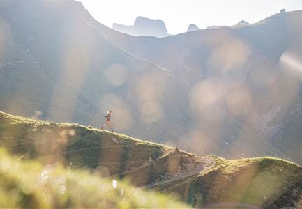
The starting point is the Nature Park Information Center in Scharnitz. The route first follows the road before reaching the forest path entry. From there, the Steinwand-Steig leads steadily uphill to the Oberbrunnalm, an ideal spot for a break.
The trail then continues for the last 200 meters of elevation gain to the Zäunlkopf. Shortly after, on the way toward Mittagskopf, a short detour (about 10 minutes) to the "Schöne Aussicht" viewpoint is well worth it, offering breathtaking views into the Karwendel valleys.
From this point, the route is entirely downhill, following varied trails and paths. After crossing the Bärenklamm gorge, the trail continues through the forest until reaching the railway tracks. Passing the campsite and the Banger Park—one of Europe's most modern and safest freestyle facilities, where you might even spot professionals training—the final stretch leads back to the starting point.
The estimated running time is a guideline and depends on personal fitness.
Features & Characteristics
Stamina
Technique
Start Point
Naturpark Info Center Scharnitz (P2)
End Point
Naturpark Info Center Scharnitz (P2)
