Start Point

Mösern Information Office

End Point

Mösern Information Office
Difficulty

Medium

Total Distance

8,70 km

Descent Meters

311 m

Ascent Meters

314 m

Highest Point

1499 m

Total Time

03:00 h

Map & Elevation Profile

Start Point

Mösern Information Office

End Point

Mösern Information Office
Difficulty

Medium

Total Distance

8,70 km

Descent Meters

311 m

Ascent Meters

314 m

Highest Point

1499 m

Total Time

03:00 h

Hiking

Best Time

Jan

Feb

Mar

Apr

May

Jun

Jul

Aug

Sep

Oct

Nov

Dec

Hiking tour

Viewing platforms

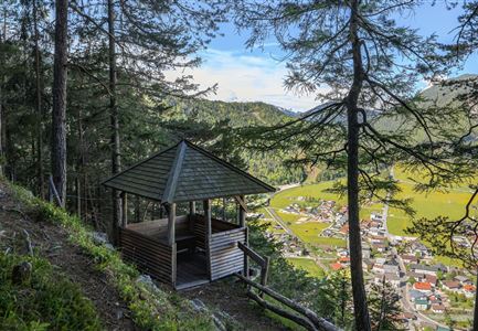
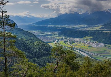
You can reach the Brunschkopf viewing platform from Mösern in two different ways. The following route takes the scenic forest trail. An alternative route follows a wide forest road, which is also used by cyclists.

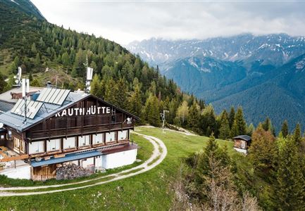
From the Mösern Information Office, first follow the Broch-Weg (signposted Möserer See/Brunschkopf) uphill. On the left, a path branches off to the Peace Bell: a short detour to this symbol of peace in the alpine countries rewards you with breathtaking panoramic views of the Inn Valley and surrounding mountain ranges. Back on the Broch-Weg, continue uphill on a path towards Möserer See. This trail leads you first to the picturesque and warmest swimming lake in Tyrol. Follow the shore to the right to reach the Möserer Seestub’n, offering seasonal delicacies and lake views. Pass the hut on the right, leave the lake, pass the beautiful forest playground on your right, and follow the small forest road until you reach an intersection, where you turn left and head uphill.

At the first intersection, turn right, following the signs for Brunschkopf/Wildmoosalm/Seefeld, and at the next opportunity, turn left

Features & Characteristics

Start Point

Mösern Information Office

End Point

Mösern Information Office
Videos

Similar Tour Suggestions

Isarursprung im Karwendel - Scharnitz (3).jpg

Hiking

Hike to the source of the river Isar & Kasten alpine hut

Length

28,20 km

Duration

06:00 h

Uphill

323 hm

Altitude

1227 hm

Difficulty

Medium

Leutascher Geisterklamm - Wasserfallsteig (2).jpg

Hiking

​Hike through the Leutasch Spirit Gorge and to the Waterfall Trail

Length

5,00 km

Duration

02:30 h

Uphill

225 hm

Downhill

221 hm

Altitude

1061 hm

Difficulty

Medium

Partially open
Wanderweg zur Hohen Fluder mit Blick Richtung Hohe Munde.jpg

Hiking

Hike Hoher Sattel

Length

10,60 km

Duration

04:00 h

Uphill

524 hm

Altitude

1620 hm

Difficulty

Medium

Scharnitz - Wanderung zur Adlerkanzel - Adlerkanzel mit Ausblick auf Scharnitz.jpg

Hiking

Hike to the viewpoint Adlerkanzel (Eagle's pulpit)

Length

2,80 km

Duration

01:30 h

Uphill

230 hm

Altitude

1145 hm

Difficulty

Medium

Wandern am Brunschkopf

Hiking

Brunschkopf viewing platform via Wildmoosalm from Leutasch

Length

12,80 km

Duration

04:30 h

Uphill

441 hm

Downhill

438 hm

Altitude

1493 hm

Difficulty

Medium

Pleisenhütte im Sommer - Scharnitz - quer.jpg

Hiking

Hike to the Pleisen alpine hut

Length

15,90 km

Duration

05:00 h

Uphill

780 hm

Downhill

774 hm

Altitude

1757 hm

Difficulty

Medium

Hallerangeralm

Hiking

Bike & Hike Sunntigerspitze Summit, 2,321 m

Length

42,00 km

Duration

09:00 h

Uphill

1396 hm

Altitude

2321 hm

Difficulty

Medium

Sonnenaufgang am Brunschkopf

Hiking

Circular hike to the Brunschkopf viewing platform starting in Mösern

Length

12,70 km

Duration

04:00 h

Uphill

382 hm

Altitude

1498 hm

Difficulty

Medium