Start Point

Seefeld Seekirchl

End Point

Seefeld Seekirchl

Difficulty

Medium

Total Distance

15,30 km

Descent Meters

554 m

Highest Point

1398 m

Total Time

04:30 h

Map & Elevation Profile

Start Point

Seefeld Seekirchl

End Point

Seefeld Seekirchl

Difficulty

Medium

Total Distance

15,30 km

Descent Meters

554 m

Highest Point

1398 m

Total Time

04:30 h

Hiking

Best Time

Jan

Feb

Mar

Apr

May

Jun

Jul

Aug

Sep

Oct

Nov

Dec

Hiking tour

Circular hike

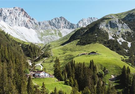
The hike starts at the well-known Seefeld Seekirchl and first leads towards the WM-Halle. Just before reaching it, the path turns left. A short but steep climb near the fitness studio takes you to Forest Trail No. 2, which you follow at a relaxed pace all the way to Mösern.

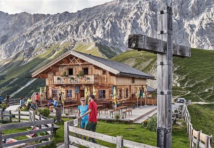
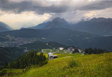
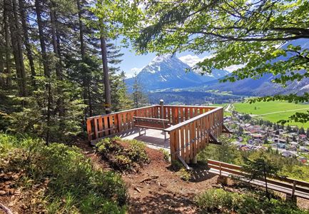
In Mösern, the route continues along the Broch Trail. A short stop at the Peace Bell is well worth it – a symbol of peace in the Alps. From here, you have an impressive view of the Inn Valley and the surrounding mountains, making this part of the hike truly special. The trail then leads along the Pirschtsteig to the Lottenseehütte, a perfect place to take a break. The hut offers delicious regional specialties and invites you to sit back and enjoy.

After a well-deserved rest, the hike continues to Gasthof Ropferstub’m and past the hut Buchener Höhe (not in operation). From there, you follow the Schlagweg into Muggenmoos, a peaceful and idyllic area. Here, you will find the Muggenmoosalm, a small, rustic hut that offers another great opportunity to rest. If you feel

Videos

Similar Tour Suggestions

Gleirschklamm - Scharnitz (17).jpg

Hiking

Hike through the Gleirschklamm to the Möslalm

Length

21,20 km

Duration

06:30 h

Uphill

505 hm

Downhill

498 hm

Altitude

1261 hm

Difficulty

Medium

Pleisenhütte im Sommer - Scharnitz - quer.jpg

Hiking

Hike to the Pleisen alpine hut

Length

15,90 km

Duration

05:00 h

Uphill

780 hm

Downhill

774 hm

Altitude

1757 hm

Difficulty

Medium

Wasserfall beim Karwendelsteg mit angeschnittenem Baum.jpg

Hiking

Circular hiking traill Karwendelsteg/Karwendelschlucht

Length

8,60 km

Duration

03:00 h

Uphill

352 hm

Altitude

1144 hm

Difficulty

Medium

Drohnenaufnahme Wettersteinhütte mit Nebel in den Bergen.jpg

Hiking

Circular hike Wettersteinhütte - Wangalm - Hämmermoosalm

Length

10,20 km

Duration

04:15 h

Uphill

562 hm

Altitude

1756 hm

Difficulty

Medium

Rauthhütte in Leutasch

Hiking

Circular hiking to Rauthhütte alpine hut & Inntal Valley view

Length

6,20 km

Duration

03:00 h

Uphill

439 hm

Altitude

1599 hm

Difficulty

Medium

Scharnitz - Wanderung zur Adlerkanzel - Adlerkanzel mit Ausblick auf Scharnitz.jpg

Hiking

Hike to the viewpoint Adlerkanzel (Eagle's pulpit)

Length

2,80 km

Duration

01:30 h

Uphill

230 hm

Altitude

1145 hm

Difficulty

Medium

Durch die Gleirschklamm - Scharnitz (1).jpg

Hiking

Circular hike through the Gleirsch Gorge and over the Zäunlkopf

Length

17,90 km

Duration

06:45 h

Uphill

907 hm

Altitude

1744 hm

Difficulty

Medium

Wandern am Brunschkopf

Hiking

Brunschkopf viewing platform via Wildmoosalm from Leutasch

Length

12,80 km

Duration

04:30 h

Uphill

441 hm

Downhill

438 hm

Altitude

1493 hm

Difficulty

Medium