We use cookies for your personalized browsing experience, to personalize content and ads, to provide social media features, and to analyze traffic to our website. We also share information about your use of our website with our social media, advertising and analytics partners. Our partners may combine this information with other data that you have provided to them or that they have collected as part of your use of the Services. (incl. US providers)

Start Point

Parking lot at the soccer field (P21)

End Point

Parking lot at the soccer field (P21)

Difficulty

Easy

Total Distance

6,20 km

Descent Meters

61 m

Highest Point

1193 m

Total Time

01:45 h

Map & Elevation Profile

Start Point

Parking lot at the soccer field (P21)

End Point

Parking lot at the soccer field (P21)

Difficulty

Easy

Total Distance

6,20 km

Descent Meters

61 m

Highest Point

1193 m

Total Time

01:45 h

Hiking

Best Time

Jan

Feb

Mar

Apr

May

Jun

Jul

Aug

Sep

Oct

Nov

Dec

Winter walking

Family-friendly

+1

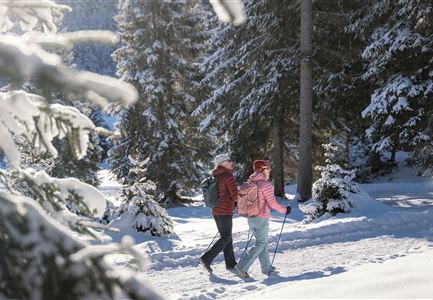
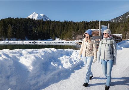
The winter hiking tour along the Wiesenweg leads through the beautiful and scenic Leutasch valley and starts directly from the small parking lot at the soccer field in the Leutasch district of Weidach. From here, you first walk along the gravel path westwards to the Leutascher Kirchplatzl, past the Kühtaierhof and Gasthof Birkegg and on to the Meadow path at the edge of the forest. Follow this to the second turn-off and continue via the Plaikner Mähder to Leutasch Klamm. Keep to the left along the gorge road and stroll around the small hamlet of Leutasch until you reach the Plaikner Mähder again from below.

Now turn left and walk through the sparse larch woods and from Kirchplatzl the way back to the starting point of the hike at the soccer field. If you walk a few more minutes from here, you will find many tempting wellness and feel-good offers in the ErlebnisWelt  Alpenbad Leutasch.

Features & Characteristics

Start Point

Parking lot at the soccer field (P21)

End Point

Parking lot at the soccer field (P21)

Family-friendly

Yes

Loop tour

Yes

Similar Tour Suggestions

Winterwandern Paar Seefeld Möserer Tal Paar läuft vor Seekirchel (2).jpg

Hiking

W29: Winter circular hike through the Möserer Valley

Length

3,10 km

Duration

01:00 h

Uphill

10 hm

Altitude

1197 hm

Difficulty

Easy

Winterwandern Paar Friedensglocke Drohnen Nahaufnahme Paar steht am Geländer Blick ins Inntal (1).jpg

Hiking

W30: Winter hiking "Path of Peace"

Length

4,60 km

Duration

01:30 h

Uphill

92 hm

Downhill

96 hm

Altitude

1292 hm

Difficulty

Easy

Drohnenaufnahme Reith im Winter - Ortszentrum mit Kirche und Reither Spitze im Hintergrund.jpg

Hiking

W33: Winter circular hike Hölltal

Length

5,00 km

Duration

02:00 h

Uphill

192 hm

Downhill

186 hm

Altitude

1303 hm

Difficulty

Medium

Weidachsee im Winter

Hiking

W9: Winter circular hike around Weidachsee lake

Length

3,80 km

Duration

01:00 h

Uphill

46 hm

Altitude

1156 hm

Difficulty

Easy

Katzenkopfhütte Winter

Hiking

Stage 1: Extension to Katzenkopf (2.9 km) – Tyrol’s 1. Winter Multi-day Hike

Length

2,90 km

Duration

01:15 h

Uphill

245 hm

Altitude

1360 hm

Difficulty

Medium

Gaistalalm im Winter - Drohnennahaufnahme von der Seite mit Wettersteingebirge (2).jpg

Hiking

W12: Winter hike to the Gaistalalm

Length

8,20 km

Duration

02:30 h

Uphill

182 hm

Altitude

1366 hm

Difficulty

Easy

Weitwandern Etappe 2 Teilnehmer am Weg bei Huette

Hiking

Stage 2: From Leutasch to Mösern – Tyrol’s 1. Winter Multi-day Hike

Length

16,00 km

Duration

05:00 h

Uphill

402 hm

Downhill

324 hm

Altitude

1393 hm

Difficulty

Medium

Triendlsäge im Winter - Gebäude mit Pferdekutsche.jpg

Hiking

W4: Winter Circular Hike Seefeld - Triendlsäge

Length

7,50 km

Duration

02:15 h

Uphill

147 hm

Altitude

1198 hm

Difficulty

Easy