Start Point

ErlebnisWelt Alpenbad Leutasch

End Point

ErlebnisWelt Alpenbad Leutasch

Difficulty

Medium

Total Distance

42,00 km

Descent Meters

820 m

Ascent Meters

820 m

Highest Point

1382 m

Total Time

11:00 h

Map & Elevation Profile

Start Point

ErlebnisWelt Alpenbad Leutasch

End Point

ErlebnisWelt Alpenbad Leutasch

Difficulty

Medium

Total Distance

42,00 km

Descent Meters

820 m

Ascent Meters

820 m

Highest Point

1382 m

Total Time

11:00 h

Running

Best Time

Jan

Feb

Mar

Apr

May

Jun

Jul

Aug

Sep

Oct

Nov

Dec

Attraction

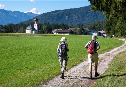
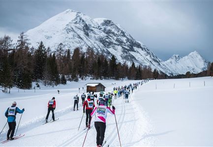
This route offers 42km full of adventure and changes in scenery. It starts out along the flat Leutasch valley in the direction of Germany and returns via Scharnitz and Gießenbach before skirting the Simmlberg to Neuleutasch. From there walkers make their way into the Fludertal valley, crossing it and making a big loop in the direction of Moos and Obern. At the entrance to the Gaistal the route turns back in the direction of the finish area at the ErlebnisWelt Alpenbad Leutasch. The difficulty of this route is graded as medium and it is thus a little bit more demanding.


Features & Characteristics

Start Point

ErlebnisWelt Alpenbad Leutasch

End Point

ErlebnisWelt Alpenbad Leutasch

Similar Tour Suggestions

Drohnenaufnahme Geisterklamm - zwei Personen laufen auf Steg reingezoomt.jpg

Running

IML Unicorn March Day 1: 30 km - Spirit Gorge Hike

Length

30,00 km

Duration

08:45 h

Uphill

841 hm

Downhill

821 hm

Altitude

1499 hm

Difficulty

Medium

Teilnehmer vom Einhornmarsch kurz vor Kirchplatzl (1).jpg

Running

IML Unicorn March Day 2: 42 km - Olympic Hike

Length

42,29 km

Duration

12:45 h

Uphill

886 hm

Downhill

691 hm

Altitude

1370 hm

Difficulty

Medium

Aussichtsplattform Kurblhang - Leutasch.jpg

Hiking

Circular hiking trail viewpoint Kurblhang

Length

3,50 km

Duration

01:30 h

Uphill

181 hm

Altitude

1277 hm

Difficulty

Medium

Friedensglocke im Frühling - Blick auf Fahnen mit Blumen.jpg

Running

IML Unicorn March Day 2: 30 km Inn Valley View Hike

Length

30,68 km

Duration

09:30 h

Uphill

731 hm

Downhill

551 hm

Altitude

1370 hm

Difficulty

Medium

Sonnenaufgang Aussichtsplattform Bruschkopf - Paar steht am Geländer der Plattform - Aufnahme von hinten - Paar schaut sich an.jpg

Hiking

Viewpoint Brunschkopf via Möserer Höhe

Length

8,70 km

Duration

03:00 h

Uphill

311 hm

Downhill

314 hm

Altitude

1499 hm

Difficulty

Medium

Brunschkopf_inkl_Logo.jpg

Hiking

Brunschkopf viewing platform via Geiernest from Seefeld, return via Wildmoosalm

Length

9,20 km

Duration

03:15 h

Uphill

316 hm

Downhill

313 hm

Altitude

1493 hm

Difficulty

Medium

Muggenmoosalm im Sommer mit Bauemen - Drohnenaufnahme.jpg

Hiking

Circular hike from Seefeld to the Lottenseehütte alpine hut & Muggenmoosalm alpine hut

Length

15,30 km

Duration

04:30 h

Uphill

554 hm

Altitude

1398 hm

Difficulty

Medium

Brunschkopf während der Goldenen Stunde.jpg

Hiking

Viewpoint Brunschkopf via forest road from Mösern

Length

9,10 km

Duration

03:00 h

Uphill

279 hm

Downhill

272 hm

Altitude

1496 hm

Difficulty

Medium