Start Point

ErlebnisWelt Alpenbad Leutasch

End Point

ErlebnisWelt Alpenbad Leutasch

Difficulty

Easy

Total Distance

42,00 km

Descent Meters

1102 m

Ascent Meters

1068 m

Highest Point

1417 m

Total Time

10:00 h

Map & Elevation Profile

Start Point

ErlebnisWelt Alpenbad Leutasch

End Point

ErlebnisWelt Alpenbad Leutasch

Difficulty

Easy

Total Distance

42,00 km

Descent Meters

1102 m

Ascent Meters

1068 m

Highest Point

1417 m

Total Time

10:00 h

Running

Best Time

Jan

Feb

Mar

Apr

May

Jun

Jul

Aug

Sep

Oct

Nov

Dec

Attraction

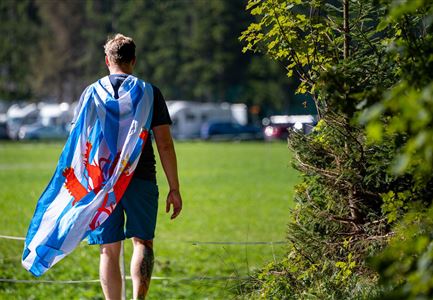
A tour which has 42km of varied mountain meadows and viewpoints – the Almenparadies (Alpine pasture paradise) Walk certainly lives up to its name. The tour starts early in the morning towards the Hämmermoosalm and onwards to the Gaistalalm, both located in the impressive Gaistal. Heading out of the valley, walkers reach the hamlet of Moos. From there the tour heads via Buchen to the Lottensee and Wildmoossee (the two are periodic lakes) and past the Wildmoosalm. Adventurous trails lead to the hamlet of Weidach (Leutasch) and in a loop back to the starting point.

Features & Characteristics

Start Point

ErlebnisWelt Alpenbad Leutasch

End Point

ErlebnisWelt Alpenbad Leutasch

Similar Tour Suggestions

Abendstimmung am Seekirchl in Seefeld im Sommer.jpg

Hiking

Circular walk in the Möserer valley

Length

3,10 km

Duration

00:45 h

Uphill

12 hm

Altitude

1196 hm

Difficulty

Easy

Golfclub Wildmoos - Drohnen-Zoomaufnahme.jpg

Running

IML Unicorn March Day 2: 20 km - Wildmoos Mountain Hike

Length

21,35 km

Duration

06:30 h

Uphill

519 hm

Downhill

324 hm

Altitude

1370 hm

Difficulty

Easy

Teilnehmer-im-Zielbereich---Ganghoferlauf-Leutasch-(13)-(1).jpg

Cross-country Skiing

Race Euroloppet Ganghoferlauf - 10 km fun course

Length

10,00 km

Uphill

42 hm

Altitude

1167 hm

Difficulty

Easy

Teilnehmer_innen des Einhornmarsches von hinten auf einer Brücke in Reindlau, Leutasch (1).jpg

Running

IML Unicorn March Day 1: 10km - Runst-Hike

Length

10,20 km

Duration

02:45 h

Uphill

80 hm

Altitude

1148 hm

Difficulty

Easy

Herbst am Möserer See - Frau am Ufer (Edit 2).jpg

Hiking

Circular walking path lake Möserer See & Kalvarienberg

Length

3,00 km

Duration

01:00 h

Uphill

78 hm

Downhill

82 hm

Altitude

1291 hm

Difficulty

Easy

Einhornmarsch-Teilnehmer laufen an der Leutascher Ache entlang (1).jpg

Running

IML Unicorn March Day 1: Achen Walk

Length

20,00 km

Duration

05:15 h

Uphill

315 hm

Altitude

1172 hm

Difficulty

Easy

IML Teilnehmer beim Wandern vor Berg - Leutasch (7).jpg

Running

IML Unicorn March Day 3: 20 km - Bichlwald Hike

Length

20,00 km

Duration

06:15 h

Uphill

534 hm

Downhill

510 hm

Altitude

1417 hm

Difficulty

Easy

Katzenkopfhuette mit Sonnenterrasse und Bahn im Sommer (1).jpg

Running

IML Unicorn March Day 2: KatzenkopfHike

Length

9,90 km

Duration

03:15 h

Uphill

290 hm

Downhill

61 hm

Altitude

1370 hm

Difficulty

Easy