Start Point

Weidach Leutasch

End Point

Weidach Leutasch

Difficulty

Hard

Total Distance

42,00 km

Descent Meters

203 m

Highest Point

1199 m

Map & Elevation Profile

Start Point

Weidach Leutasch

End Point

Weidach Leutasch

Difficulty

Hard

Total Distance

42,00 km

Descent Meters

203 m

Highest Point

1199 m

Cross-country Skiing

Best Time

Jan

Feb

Mar

Apr

May

Jun

Jul

Aug

Sep

Oct

Nov

Dec

Attraction

Skating

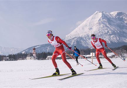
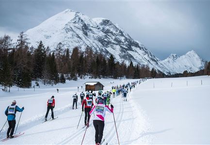
The 42km skating tracks takes in the whole Leutasch valley at an altitude of 1130m. Following the start the field will start to separate on the short climb to Lehner (A8) and competitors will pass the Start/Finish line in groups once again before heading down to the end of the valley in the direction of Unterleutasch. From this, the lowest point of the course, the tracks climbs gradually and passes the Start/Finish line again to the highest point after Moos (C10). Here at the skating centre (B4) there are two short climbs to master before heading back down into the valley via the new Alpenbad tracks (A6) to the finish line.

More information about the program and details on registration can be found here.

Features & Characteristics

Start Point

Weidach Leutasch

End Point

Weidach Leutasch

Skating

Yes
Similar Tour Suggestions

(c)Olympiaregion-Seefeld-Sebastian-Marko-Ganghoferlauf-Leutasch-(76).jpg

Cross-country Skiing

Race Euroloppet Ganghoferlauf - classic 25 km

Length

25,00 km

Uphill

253 hm

Altitude

1226 hm

Difficulty

Hard

Ganghoferlauf_Leutasch_2022

Cross-country Skiing

Race Euroloppet Ganghoferlauf - skating 22 km

Length

22,00 km

Uphill

122 hm

Altitude

1199 hm

Difficulty

Hard