Start Point

Parking lot P5 'Salzbach' in Gaistal
End Point

Parking lot P5 'Salzbach' in Gaistal

Difficulty

Medium

Total Distance

9,00 km

Descent Meters

842 m

Ascent Meters

842 m

Highest Point

2037 m

Total Time

05:30 h

Map & Elevation Profile

Start Point

Parking lot P5 'Salzbach' in Gaistal
End Point

Parking lot P5 'Salzbach' in Gaistal
Difficulty

Medium

Total Distance

9,00 km

Descent Meters

842 m

Ascent Meters

842 m

Highest Point

2037 m

Total Time

05:30 h

Hiking

Best Time

Jan

Feb

Mar

Apr

May

Jun

Jul

Aug

Sep

Oct

Nov

Dec

Hiking tour

Hut hike

At the end of parking lot P5 Salzbach, the ascent to Rotmoosalm begins. There are two options here: to the left over the bridge is the wide forest road, but for this tour, we take the narrow trail that starts to the right of the parking lot.

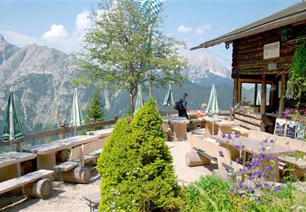
The path follows the Jägersteig and continues onto the Rigelesteig, steadily climbing through the untouched mountain landscape. The narrow trail winds steeply uphill in sections, always following the gently flowing Salzbach, until finally reaching the Schäferhütte. This is a perfect spot for a well-earned rest, with a stunning view over the Gaistal and the surrounding mountain scenery.

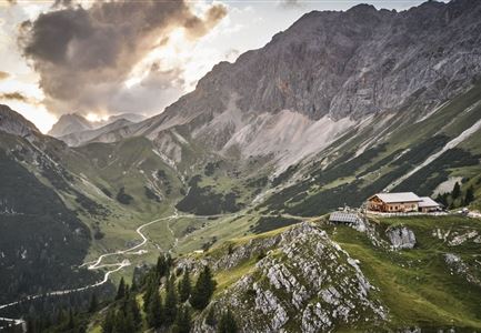
From here, the route continues toward Schönberg and eventually reaches Rotmoosalm, nestled beautifully in the alpine meadows. The hut not only offers a cozy place to stop, but also impressive views of the vast alpine pastures of the Gaistal and the towering peaks of the Mieminger Range, the Wetterstein Mountains, and the Hohe Munde.

After a relaxed break, the return follows the same trail back down into the valley. A varied and rewarding hike, featuring narrow natural trails, breathtaking views, and an authentic alpine atmosphere.

Features & Characteristics

Stamina

Technique

Start Point

Parking lot P5 'Salzbach' in Gaistal

End Point

Parking lot P5 'Salzbach' in Gaistal
Videos

Similar Tour Suggestions

Durch die Gleirschklamm bei Scharnitz.jpg

Hiking

Circular hiking trail Gleirschklamm Gorge

Length

13,10 km

Duration

04:00 h

Uphill

416 hm

Downhill

410 hm

Altitude

1152 hm

Difficulty

Medium

Leutascher Geisterklamm - Wasserfallsteig (2).jpg

Hiking

​Hike through the Leutasch Spirit Gorge and to the Waterfall Trail

Length

5,00 km

Duration

02:30 h

Uphill

225 hm

Downhill

221 hm

Altitude

1061 hm

Difficulty

Medium

Gleirschklamm - Scharnitz (17).jpg

Hiking

Hike through the Gleirschklamm to the Möslalm

Length

21,20 km

Duration

06:30 h

Uphill

505 hm

Downhill

498 hm

Altitude

1261 hm

Difficulty

Medium

Lärchenwald in Reith - Drohnenaufnahme - Paar läuft zur den Wald - Aufnahme Richtung Sonne.jpg

Hiking

Circular Walk around the Gschwandtkopf Hill

Length

10,60 km

Duration

03:30 h

Uphill

226 hm

Downhill

220 hm

Altitude

1344 hm

Difficulty

Medium

Wanderung zur Eppzirler Alm im Sommer - Mann und Frau von hinten mit Eppzirler Alm.jpg

Hiking

Hike to the Eppzirler Alm alpine hut

Length

12,40 km

Duration

04:00 h

Uphill

475 hm

Altitude

1459 hm

Difficulty

Medium

Familien-Weitwanderung im Gaistal - Familie spielt Engelchen.jpg

Hiking

Stage 3: To Hämmermoosalm & Wrap Up – Leutasch 3-Day Hut Hike for Families

Length

6,50 km

Uphill

10 hm

Downhill

840 hm

Altitude

2132 hm

Difficulty

Medium

Brunschkopf_inkl_Logo.jpg

Hiking

Brunschkopf viewing platform via Geiernest from Seefeld, return via Wildmoosalm

Length

9,20 km

Duration

03:15 h

Uphill

316 hm

Downhill

313 hm

Altitude

1493 hm

Difficulty

Medium

Pleisenhütte im Sommer - Scharnitz - quer.jpg

Hiking

Hike to the Pleisen alpine hut

Length

15,90 km

Duration

05:00 h

Uphill

780 hm

Downhill

774 hm

Altitude

1757 hm

Difficulty

Medium