Start Point

Seefeld Seekirchl

End Point

Seefeld Seekirchl

Difficulty

Medium

Total Distance

15,30 km

Descent Meters

554 m

Highest Point

1398 m

Total Time

04:30 h

Status

Partially open

Map & Elevation Profile

Start Point

Seefeld Seekirchl

End Point

Seefeld Seekirchl

Difficulty

Medium

Total Distance

15,30 km

Descent Meters

554 m

Highest Point

1398 m

Total Time

04:30 h

Status

Partially open

Hiking

Best Time

Partially open

Jan

Feb

Mar

Apr

May

Jun

Jul

Aug

Sep

Oct

Nov

Dec

Viewing platforms

Circular hike

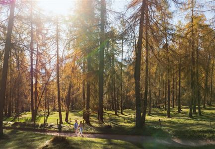
The hike starts at the well-known Seefeld Seekirchl and first leads towards the WM-Halle. Just before reaching it, the path turns left. A short but steep climb near the fitness studio takes you to Forest Trail No. 2, which you follow at a relaxed pace all the way to Mösern.

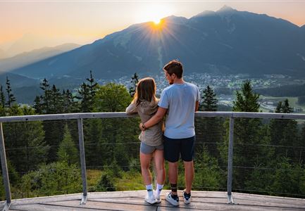
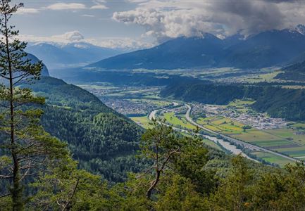
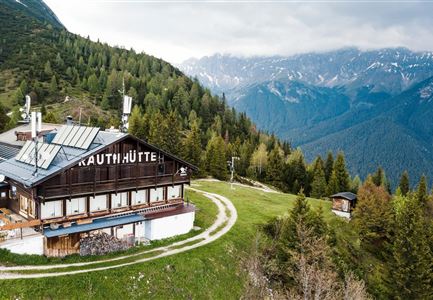
In Mösern, the route continues along the Broch Trail. A short stop at the Peace Bell is well worth it – a symbol of peace in the Alps. From here, you have an impressive view of the Inn Valley and the surrounding mountains, making this part of the hike truly special. The trail then leads along the Pirschtsteig to the Lottenseehütte, a perfect place to take a break. The hut offers delicious regional specialties and invites you to sit back and enjoy.

After a well-deserved rest, the hike continues to Gasthof Ropferstub’m and past the hut Buchener Höhe (not in operation). From there, you follow the Schlagweg into Muggenmoos, a peaceful and idyllic area. Here, you will find the Muggenmoosalm, a small, rustic hut that offers another great opportunity to rest. If you feel

Features & Characteristics

Videos

Similar Tour Suggestions

Wanderung über der Karwendelschlucht - Scharnitz.jpg

Hiking

Circular hiking trail Karwendel Gorge

Length

8,90 km

Duration

03:00 h

Uphill

240 hm

Altitude

1140 hm

Difficulty

Medium

Pleisenhütte im Sommer - Scharnitz - quer.jpg

Hiking

Hike to the Pleisen alpine hut

Length

15,90 km

Duration

05:00 h

Uphill

780 hm

Downhill

774 hm

Altitude

1757 hm

Difficulty

Medium

Brunschkopf_inkl_Logo.jpg

Hiking

Brunschkopf viewing platform via Geiernest from Seefeld, return via Wildmoosalm

Length

9,20 km

Duration

03:15 h

Uphill

316 hm

Downhill

313 hm

Altitude

1493 hm

Difficulty

Medium

Radtour ins Gaistal - Bruecke am Eingang vom Gaistal

Hiking

Bike & Hike lake Seebensee & lake Drachensee

Length

31,00 km

Duration

04:45 h

Uphill

820 hm

Altitude

1897 hm

Difficulty

Medium

Leutascher Geisterklamm - Wasserfallsteig (2).jpg

Hiking

​Hike through the Leutasch Spirit Gorge and to the Waterfall Trail

Length

5,00 km

Duration

02:30 h

Uphill

225 hm

Downhill

221 hm

Altitude

1061 hm

Difficulty

Medium

Closed
Gravelbike - an der türkisblauen Isar.jpg

Hiking

Bike & Hike Halleranger house - Halleranger alm

Length

38,00 km

Duration

06:00 h

Uphill

832 hm

Altitude

1768 hm

Difficulty

Medium

Ederkanzel contwise.jpg

Hiking

Circular Hike via the Franzosensteig to Grünkopf and Ederkanzel

Length

7,40 km

Duration

04:00 h

Uphill

590 hm

Altitude

1569 hm

Difficulty

Medium

Bike Tour durchs Karwendeltal aufs Karwendelhaus - Scharnitz (13).jpg

Hiking

Bike & Hike Kristenalm

Length

25,00 km

Duration

04:00 h

Uphill

420 hm

Altitude

1249 hm

Difficulty

Medium