Start Point

Leutasch Moos, Parking Lot Rödlach (P11)

End Point

Leutasch Moos, Parking Lot Rödlach (P11)
Difficulty

Easy

Total Distance

3,60 km

Descent Meters

80 m

Highest Point

1252 m

Total Time

01:15 h

Status

Partially open

Map & Elevation Profile

Start Point

Leutasch Moos, Parking Lot Rödlach (P11)

End Point

Leutasch Moos, Parking Lot Rödlach (P11)
Difficulty

Easy

Total Distance

3,60 km

Descent Meters

80 m

Highest Point

1252 m

Total Time

01:15 h

Status

Partially open

Hiking

Best Time

Partially open

Jan

Feb

Mar

Apr

May

Jun

Jul

Aug

Sep

Oct

Nov

Dec

Hiking tour

Hut hike

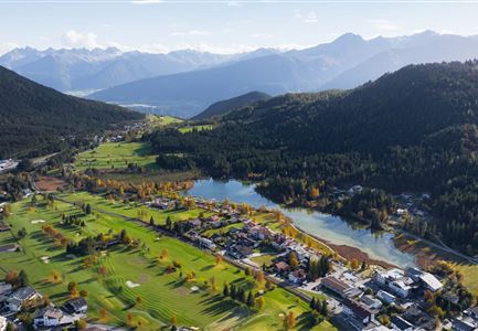
The tour starts at parking lot P11 Rödlach in the Moos district of Leutasch. Right at the beginning, the main road must be crossed – be sure to watch for traffic! After that, the trail follows the road for a short stretch before turning left onto the hiking path towards Muggenmoos.

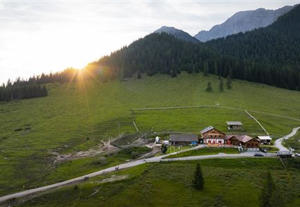
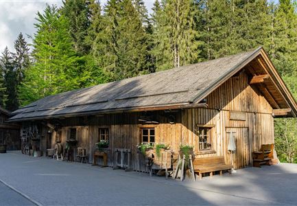
Once away from the road, the path gently ascends through the forest. Along the way, small clearings open up, offering beautiful views of the surrounding mountains. After a relaxed hike, the Muggenmoos Alm is reached – a rustic mountain hut with a sun terrace and a view of the summer meadows, where horses are often seen.

The return route can follow the same path or take a longer loop via Buchen and Katzenloch back to parking lot Moos. A short but scenic hike, offering nature, great views, and a cozy place to stop and relax.

Features & Characteristics

Start Point

Leutasch Moos, Parking Lot Rödlach (P11)

End Point

Leutasch Moos, Parking Lot Rödlach (P11)
Similar Tour Suggestions

Familien-Weitwanderung im Gaistal - Familie am Zaun vor Gaistalalm.jpg

Hiking

Hike to the Gaistalalm & Tillfussalm alpine hut

Length

9,70 km

Duration

03:00 h

Uphill

230 hm

Altitude

1400 hm

Difficulty

Easy

Reith - Wanderung Frau Häusl Kapelle - Frau Häusl Kapelle mit Farn im Vordergrund.jpg

Hiking

On the rosary walking trail to the Frau Häusl chapel

Length

1,20 km

Duration

01:15 h

Uphill

100 hm

Altitude

1220 hm

Difficulty

Easy

Fischerrei am Weidachsee - Leutasch

Hiking

Circular walk around Weidachsee lake

Length

3,80 km

Duration

01:00 h

Uphill

46 hm

Altitude

1156 hm

Difficulty

Easy

Schausäge der Triendlsäge

Hiking

Circular walking path to the Inn Triendlsäge

Length

4,80 km

Duration

01:15 h

Uphill

101 hm

Altitude

1215 hm

Difficulty

Easy

Herbstwanderung am Oberen Wiesenweg_Paar läuft entlang von Wiese_Aufnahme gegen die Sonne mit Lärchen im Hintergrund.jpg

Hiking

Circular hiking traill Oberer & Unterer Wiesenweg

Length

6,10 km

Duration

02:00 h

Uphill

64 hm

Altitude

1194 hm

Difficulty

Easy

Ropferstubm im Herbst - Moesern-Buchen

Hiking

Hike to the Inn Ropferstub'm

Length

9,20 km

Duration

03:00 h

Uphill

246 hm

Altitude

1316 hm

Difficulty

Easy

Friedensglocke im Herbst - Frau steht am Geländer und blickt ins Inntal beim Sonnenuntergang- Sonnenstern an der Glocke.jpg

Hiking

Peace Bell Hiking Trail

Length

4,60 km

Duration

01:30 h

Uphill

92 hm

Downhill

96 hm

Altitude

1292 hm

Difficulty

Easy

Familie vor dem Seekirchl im Sommer - 2.jpg

Hiking

Circular walk Seefeld to the Jumping hill

Length

2,00 km

Duration

00:30 h

Uphill

10 hm

Altitude

1195 hm

Difficulty

Easy