We use cookies for your personalized browsing experience, to personalize content and ads, to provide social media features, and to analyze traffic to our website. We also share information about your use of our website with our social media, advertising and analytics partners. Our partners may combine this information with other data that you have provided to them or that they have collected as part of your use of the Services. (incl. US providers)

Start Point

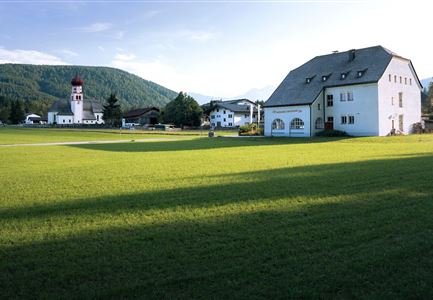
Music Pavilion Weidach (P15)

End Point

Music Pavilion Weidach (P15)

Difficulty

Easy

Total Distance

3,80 km

Descent Meters

46 m

Highest Point

1156 m

Total Time

01:00 h

Map & Elevation Profile

Start Point

Music Pavilion Weidach (P15)

End Point

Music Pavilion Weidach (P15)

Difficulty

Easy

Total Distance

3,80 km

Descent Meters

46 m

Highest Point

1156 m

Total Time

01:00 h

Hiking

Best Time

Jan

Feb

Mar

Apr

May

Jun

Jul

Aug

Sep

Oct

Nov

Dec

Hiking tour

Village walks

+4

Route: Music Pavilion Weidach - Lake Weidach - Music Pavilion Weidach

Parking and public transport:
Please use the following parking options: P15 | P21 | P23
Note: Parking at the lake is only allowed for fishermen!
By train to Seefeld train station and continue with the Regio-/Skibus to the stop "Weidach Zentrum".
Find all connections in real time with the Mobility-App "wegfinder".

Directions:
From the "Musikpavillon" follow the road to the until you reach the Leutascherhof, when you reach the cross road follow the road to the left until you reach the Hotel Quellenhof Leutasch, from there turn left until you reach the Weidachsee. Turn left along the lake shore, a short ascent follows until above the hatchery. Keep to the right and descend again along the lakeshore to the starting point.

Alpine emergency call:
Call: 140

Features & Characteristics

Start Point

Music Pavilion Weidach (P15)

End Point

Music Pavilion Weidach (P15)

Family hike

Yes

Hike suitable for prams

Yes

Circular hike

Yes

Similar Tour Suggestions

Wanderung über der Karwendelschlucht - Scharnitz.jpg

Hiking

Circular hiking trail Karwendelschlucht/Karwendelsteg

Length

7,40 km

Duration

03:00 h

Uphill

266 hm

Altitude

1143 hm

Difficulty

Medium

Herbst am Möserer See - Frau am Ufer (Edit 2).jpg

Hiking

Circular walking path lake Möserer See & Kalvarienberg

Length

2,70 km

Duration

01:15 h

Uphill

73 hm

Altitude

1288 hm

Difficulty

Easy

Gipfel Grosse Arnspitze - Scharnitz

Hiking

Hike to the Große Arnspitze Summit, 2,196 m

Length

9,00 km

Duration

07:30 h

Uphill

1214 hm

Altitude

2196 hm

Difficulty

Hard

Hohe Gleirsch_2.jpg

Hiking

Bike & Hike Hoher Gleirsch Summit, 2,492 m

Length

31,00 km

Duration

09:30 h

Uphill

1772 hm

Altitude

2492 hm

Difficulty

Hard

Durchs Karwendeltal aufs Karwendelhaus - Scharnitz

Hiking

Hike to the Karwendelhaus

Length

36,00 km

Duration

11:15 h

Uphill

839 hm

Altitude

1765 hm

Difficulty

Medium

Falkenhütte neu

Hiking

Karwendelmarsch 52 km

Length

52,00 km

Duration

19:00 h

Uphill

2281 hm

Downhill

2217 hm

Altitude

1903 hm

Difficulty

Hard

Kuschlhitte im Sommer - Leutasch

Hiking

Circular hike Wettersteinhütte alpine hut - Wangalm alpine hut - Hämmermoosalm alpine hut

Length

10,20 km

Duration

04:15 h

Uphill

562 hm

Altitude

1756 hm

Difficulty

Medium

Oberer Wiesenweg in Leutasch

Hiking

Circular hiking traill Oberer & Unterer Wiesenweg

Length

4,30 km

Duration

01:30 h

Uphill

54 hm

Altitude

1193 hm

Difficulty

Easy