Start Point

Parking lot P5 'Salzbach' in Gaistal

End Point

Parking lot P5 'Salzbach' in Gaistal

Difficulty

Easy

Total Distance

4,00 km

Descent Meters

175 m

Ascent Meters

175 m

Highest Point

1417 m

Total Time

01:30 h

Map & Elevation Profile

Start Point

Parking lot P5 'Salzbach' in Gaistal

End Point

Parking lot P5 'Salzbach' in Gaistal

Difficulty

Easy

Total Distance

4,00 km

Descent Meters

175 m

Ascent Meters

175 m

Highest Point

1417 m

Total Time

01:30 h

Hiking

Best Time

Jan

Feb

Mar

Apr

May

Jun

Jul

Aug

Sep

Oct

Nov

Dec

Hiking tour

Hut hike

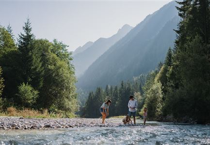
This short and family-friendly hike starts either at the information hut at the entrance to Gaistal, where the path follows the Leutascher Ache and goes upstream until reaching the sign for Hämmermoosalm, or directly from the last (paid) parking lot at Salzbach (P3-5), which provides direct access to the hut's ascent.

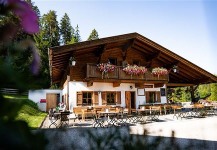
The ascent is easy and follows a wide trail that gradually climbs until reaching the Hämmermoosalm at 1,417 meters. The cozy hut offers a wonderful view and serves delicious local specialties and seasonal dishes.

The return follows the same path back to the starting point. Alternatively, the hike can continue to the Gaistalalm (1,366 m) before heading back. A relaxed hike suitable for the whole family, rewarded with a cozy stop at the hut.

Features & Characteristics

Start Point

Parking lot P5 'Salzbach' in Gaistal

End Point

Parking lot P5 'Salzbach' in Gaistal

Family-friendly

Yes
Similar Tour Suggestions

kinder_bei_infotafel_in_der_geisterklamm.jpg

Hiking

Short circular trail at the Spirit Gorge

Length

500 m

Duration

00:15 h

Uphill

10 hm

Altitude

1027 hm

Difficulty

Easy

Möserer See im Frühling - Paar läuft entlang des Seeweges.jpg

Hiking

Circular walking path from Seefeld to the lake Möserer See

Length

8,80 km

Duration

02:30 h

Uphill

231 hm

Altitude

1297 hm

Difficulty

Easy

Wanderung durchs Katzenloch im Frühherbst - Wanderer mit Hunde auf dem Weg bei einer Lichtung.jpg

Hiking

Hike through the Katzenloch

Length

7,10 km

Duration

02:00 h

Uphill

155 hm

Downhill

154 hm

Altitude

1280 hm

Difficulty

Easy

Partially open
Porta Claudia Scharnitz - Tor mit Weg.jpg

Hiking

Circular hiking trail Porta Claudia

Length

2,50 km

Duration

01:00 h

Uphill

125 hm

Downhill

120 hm

Altitude

1085 hm

Difficulty

Easy

Pfarrhuegel-in-Seefeld_WaLogo.jpg

Hiking

Village tour Pfarrhügel, Wildsee & Seekirchl

Length

4,70 km

Duration

01:30 h

Uphill

48 hm

Altitude

1208 hm

Difficulty

Easy

Herbst am Möserer See - Frau am Ufer (Edit 2).jpg

Hiking

Circular walking path lake Möserer See & Kalvarienberg

Length

3,00 km

Duration

01:00 h

Uphill

78 hm

Downhill

82 hm

Altitude

1291 hm

Difficulty

Easy

Reith - Wanderung Frau Häusl Kapelle - Frau Häusl Kapelle mit Farn im Vordergrund.jpg

Hiking

On the rosary walking trail to the Frau Häusl chapel

Length

1,20 km

Duration

01:15 h

Uphill

100 hm

Altitude

1220 hm

Difficulty

Easy

Familie vor dem Seekirchl im Sommer - 2.jpg

Hiking

Circular walk Seefeld to the Jumping hill

Length

2,00 km

Duration

00:30 h

Uphill

10 hm

Altitude

1195 hm

Difficulty

Easy