Start Point

Reith Railway Station

End Point

Reith Railway Station

Difficulty

Easy

Total Distance

7,29 km

Descent Meters

140 m

Ascent Meters

140 m

Highest Point

1150 m

Total Time

02:00 h

Map & Elevation Profile

Start Point

Reith Railway Station

End Point

Reith Railway Station

Difficulty

Easy

Total Distance

7,29 km

Descent Meters

140 m

Ascent Meters

140 m

Highest Point

1150 m

Total Time

02:00 h

Hiking

Best Time

Jan

Feb

Mar

Apr

May

Jun

Jul

Aug

Sep

Oct

Nov

Dec

Hiking tour

Thematic route

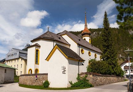
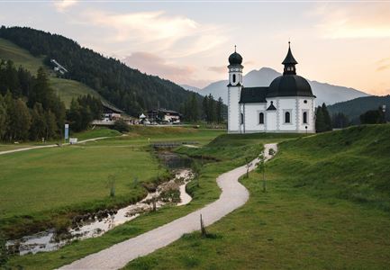
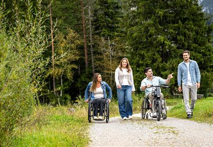
The educational cultural hiking trail starts in Reith and leads through the two neighboring villages of the community, via Leithen and Auland, and then back to the starting point. Along the trail, you pass 14 historical landmarks that tell stories about the history and culture of Reith. This trail is a great way to explore the beautiful and historic mountain village of Reith bei Seefeld and is perfect for a family walk.

A fun quiz is also part of the trail. Each of the 14 information boards hides a specific letter. If you manage to guess the solution word, you can pick up a small surprise at the Citizen and Tourism Service Reith or the Seefeld Information and Mobility Center.

Station 1: The Coat of Arms & Ichthyol
Reith's coat of arms reminds us of a medieval legend. It tells the story of a duel between the giants Thyrsus and Haymon. According to local belief, the oil shale found in the Reith-Scharnitz area is linked to this tale. In 1576, a healing thick oil was first made from it. People called it "Thyrsus’ Blood," and it is still known today as "Ichthyol" or "Tyrolean

Similar Tour Suggestions

Drohnenaufnahme Hämmermoosalm bei Sonnenuntergangsstimmung.jpg

Hiking

Hike to the Hämmermoosalm

Length

4,00 km

Duration

01:30 h

Uphill

175 hm

Altitude

1417 hm

Difficulty

Easy

Friedensglocke im Herbst - Frau steht am Geländer und blickt ins Inntal beim Sonnenuntergang- Sonnenstern an der Glocke.jpg

Hiking

Peace Bell Hiking Trail

Length

4,60 km

Duration

01:30 h

Uphill

92 hm

Downhill

96 hm

Altitude

1292 hm

Difficulty

Easy

Höhenweg Leutasch_Aussichtsplattform Höhenweg.jpg

Hiking

Circular hike to the viewing platform on the Höhenweg - Runst

Length

7,40 km

Duration

02:00 h

Uphill

128 hm

Altitude

1156 hm

Difficulty

Easy

Lottensee im Frühsommer - See und Hütte.jpg

Hiking

Circular hike to the Wildmossalm alpine hut & Lottenseehütte alpine hut

Length

7,10 km

Duration

02:30 h

Uphill

250 hm

Altitude

1420 hm

Difficulty

Easy

Scharnitz - Wanderung Dorfrunde - Scharnitz im Überblick.jpg

Hiking

Hike from Seefeld to Scharnitz

Length

9,60 km

Duration

02:45 h

Uphill

35 hm

Downhill

301 hm

Altitude

1252 hm

Difficulty

Easy

Partially open
Fischerrei am Weidachsee - Leutasch

Hiking

Circular walk around Weidachsee lake

Length

3,80 km

Duration

01:00 h

Uphill

46 hm

Altitude

1156 hm

Difficulty

Easy

Spaziergang mit Hund in Unterleutasch - Mann läuft mit Hund entlang von Bäumen Aufnahme Richtung Sonne.jpg

Hiking

Tour of lawn "toler"

Length

4,20 km

Duration

00:45 h

Uphill

13 hm

Altitude

1072 hm

Difficulty

Easy

Bienenlehrpfad Reith - Infotafel am Bienenhotel (1).jpg

Hiking

Hike Bee Nature Trail

Length

2,50 km

Duration

01:00 h

Uphill

72 hm

Altitude

1185 hm

Difficulty

Easy