We use cookies for your personalized browsing experience, to personalize content and ads, to provide social media features, and to analyze traffic to our website. We also share information about your use of our website with our social media, advertising and analytics partners. Our partners may combine this information with other data that you have provided to them or that they have collected as part of your use of the Services. (incl. US providers)

Start Point

Katzenkopf parking area (P14)

End Point

Katzenkopf parking area (P14)

Difficulty

Medium

Total Distance

10,00 km

Descent Meters

437 m

Ascent Meters

437 m

Highest Point

1544 m

Total Time

04:00 h

Map & Elevation Profile

Start Point

Katzenkopf parking area (P14)

End Point

Katzenkopf parking area (P14)

Difficulty

Medium

Total Distance

10,00 km

Descent Meters

437 m

Ascent Meters

437 m

Highest Point

1544 m

Total Time

04:00 h

Hiking

Best Time

Jan

Feb

Mar

Apr

May

Jun

Jul

Aug

Sep

Oct

Nov

Dec

Hiking tour

Circular hike

+2

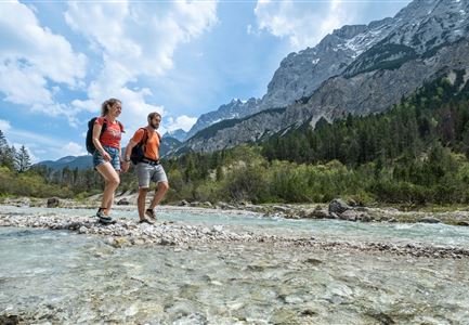
Route: Leutasch Katzenkopf - Fludertal - Wildmoosalm - Ferienkolonie Wildmoos - Hochmoos - Schlagwald - Leutasch Katzenkopf.

Parking and public transport:

P14 "Katzenkopf".

Take the train to Seefeld station and continue with the Regiobus to the stop "Leutasch Kreithkapelle".

You can find all connections in real time with the Mobility-App "wegfinder".

Directions:

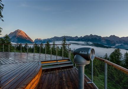
At the valley station of the Katzenkopf Leutasch go left past the Kreithalm. Follow trail no. 3 towards Wildmoosalm through the Fludertal valley until you reach Wildmoos. Pass the alpine pasture until you reach the Ferienkolonie Wildmoos, infront of them turn right to Hochmoos, trail no. 37. Wonderful viewpoint. On the remaining, the descent takes place in a northerly direction to the hut Katzenkopfhütte. From there you get back to the starting point via the forest road.

Alpine emergency call:

Call: 140

Features & Characteristics

Start Point

Katzenkopf parking area (P14)

End Point

Katzenkopf parking area (P14)

Family hike

Yes

Loop tour

Yes

Similar Tour Suggestions

Luftaufnahme von der Rauthhuette - Leutasch

Hiking

Hike Hohe Munde Summit, 2.592 m

Length

11,30 km

Duration

09:00 h

Uphill

1410 hm

Altitude

2562 hm

Difficulty

Hard

Pfarrhuegel in Seefeld.jpg

Hiking

Village tour lake Wildsee via Pfarrhügel

Length

3,20 km

Duration

01:00 h

Uphill

23 hm

Altitude

1203 hm

Difficulty

Easy

Kurblhang - Leutasch (2).jpg

Hiking

Circular hiking trail viewpoint Kurblhang

Length

3,50 km

Duration

01:30 h

Uphill

181 hm

Altitude

1277 hm

Difficulty

Medium

Panoramarestaurant Rosshütte

Hiking

Hiking to the Seefelder Spitze, 2,221 m and Seefelder Joch

Length

7,40 km

Duration

04:30 h

Uphill

1007 hm

Altitude

2221 hm

Difficulty

Medium

Open
Gaistalalm im Herbst - Leutasch

Hiking

Hike to the Gaistalalm & Tillfussalm alpine hut

Length

9,70 km

Duration

03:00 h

Uphill

244 hm

Altitude

1404 hm

Difficulty

Easy

Steg zum Wandern entlang der Gleirschklamm.jpg

Hiking

Circular hike over Zäunlkopf & Oberbrunnalm alpine hut

Length

17,80 km

Duration

06:45 h

Uphill

867 hm

Altitude

1744 hm

Difficulty

Medium

Wettersteinhütte -Familientag in Leutasch im Somme

Hiking

Hike to the Wettersteinhütte alpine hut - Wang alpine hut

Length

7,30 km

Duration

04:00 h

Uphill

566 hm

Altitude

1717 hm

Difficulty

Medium

Pfarrkirche im Sommer - Moesern

Hiking

Hike to the Inn Ropferstub'm

Length

9,20 km

Duration

03:00 h

Uphill

246 hm

Altitude

1316 hm

Difficulty

Easy