We use cookies for your personalized browsing experience, to personalize content and ads, to provide social media features, and to analyze traffic to our website. We also share information about your use of our website with our social media, advertising and analytics partners. Our partners may combine this information with other data that you have provided to them or that they have collected as part of your use of the Services. (incl. US providers)

Start Point

Parking lot P6 Maxhütte – Reith by Seefeld

End Point

Parking lot P6 Maxhütte – Reith by Seefeld

Difficulty

Hard

Total Distance

9,90 km

Descent Meters

1191 m

Ascent Meters

1191 m

Highest Point

2374 m

Total Time

07:30 h

Map & Elevation Profile

Start Point

Parking lot P6 Maxhütte – Reith by Seefeld

End Point

Parking lot P6 Maxhütte – Reith by Seefeld

Difficulty

Hard

Total Distance

9,90 km

Descent Meters

1191 m

Ascent Meters

1191 m

Highest Point

2374 m

Total Time

07:30 h

Hiking

Best Time

Jan

Feb

Mar

Apr

May

Jun

Jul

Aug

Sep

Oct

Nov

Dec

Hiking tour

Hut hikes

+2

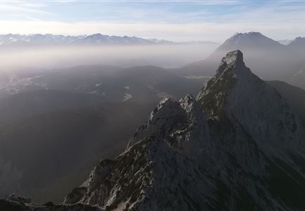
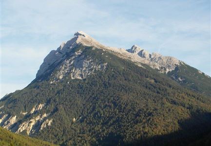
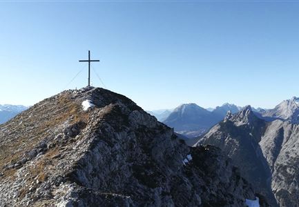
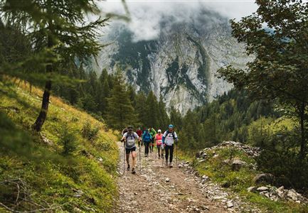
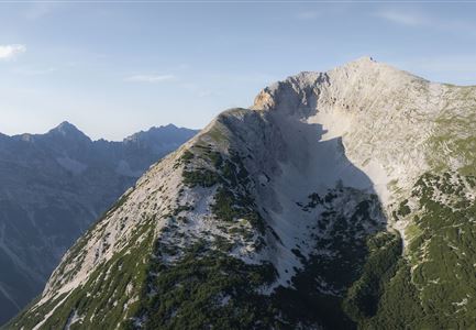
The starting point of this challenging tour is parking lot P6 near the Maxhütte. From there, you pass the Ichthyol factory and follow hiking trail No. 84 to the Reitherjochalm at 1,505 meters. The path initially follows a forest road until, after crossing the Mühlbach stream, trail No. 84 turns into a steeper footpath that leads through the forest. You pass under the cable lift that supplies the hut with food and quickly gain altitude on the winding trail. Finally, you reach the Nördlinger Hütte at 2,238 meters, the highest hut in the Karwendel range. From there, the trail continues along the "Reither Spitze Normal Route" to the Reither Spitze peak (2,374 meters). From the top, you can enjoy a beautiful view of the surrounding mountain ranges and a wide panorama across the entire plateau. This route is suited for experienced and sure-footed hikers.

For the descent, there are two options:

  • Option 1 (as shown on the map): From the Nördlinger Hütte, continue to the Reither Spitze (2,374 meters), then to the Härmelekopf (this part is only for experienced hikers; it includes a ladder). Continue to the

    Read More...

Features & Characteristics

Start Point

Parking lot P6 Maxhütte – Reith by Seefeld

End Point

Parking lot P6 Maxhütte – Reith by Seefeld

Loop tour

Yes
Similar Tour Suggestions

Wanderung über der Karwendelschlucht - Scharnitz.jpg

Hiking

Circular hiking trail Karwendelschlucht/Karwendelsteg

Length

7,40 km

Duration

03:00 h

Uphill

266 hm

Altitude

1143 hm

Difficulty

Medium

Leutasch Sommer 2022 Wandern Hoehenweg Panoramaplattform

Hiking

Circular walk Höhenweg - Runst

Length

7,40 km

Duration

02:00 h

Uphill

128 hm

Altitude

1156 hm

Difficulty

Easy

Rauthhütte in Leutasch

Hiking

Circular hiking to Rauthhütte alpine hut & Inntal Valley view

Length

6,20 km

Duration

03:00 h

Uphill

439 hm

Altitude

1599 hm

Difficulty

Medium

Wanderung ins Gaistal - Wanderer schauen auf Gaistalalm.jpg

Hiking

Hike to the Gaistalalm & Tillfussalm alpine hut

Length

9,70 km

Duration

03:00 h

Uphill

229 hm

Altitude

1404 hm

Difficulty

Easy

Hölzernes Herz am Mühlberg in Scharnitz - Perspektive durch Gebüsch (1).jpg

Hiking

Hike to the Mühlberg Scharnitz

Length

6,50 km

Duration

02:30 h

Uphill

334 hm

Downhill

328 hm

Altitude

1315 hm

Difficulty

Medium

Leutascher Geisterklamm mit Blick Richtung Mittenwald.jpg

Hiking

Long Gorge Trail through the Leutasch Spirit Gorge with Themed Trail

Length

3,20 km

Duration

01:30 h

Uphill

129 hm

Downhill

127 hm

Altitude

1060 hm

Difficulty

Medium

Hallerangeralm

Hiking

Bike & Hike Sunntigerspitze Summit, 2,321 m

Length

42,00 km

Duration

09:00 h

Uphill

1396 hm

Altitude

2321 hm

Difficulty

Medium

Radtour ins Gaistal - Bruecke am Eingang vom Gaistal

Hiking

Bike & Hike lake Seebensee & lake Drachensee

Length

31,00 km

Duration

04:45 h

Uphill

820 hm

Downhill

815 hm

Altitude

1897 hm

Difficulty

Medium