Start Point

Karwendelhaus

End Point

Karwendelhaus
Difficulty

Hard

Total Distance

9,50 km

Descent Meters

1210 m

Ascent Meters

1210 m

Highest Point

2740 m

Total Time

08:30 h

Map & Elevation Profile

Start Point

Karwendelhaus

End Point

Karwendelhaus
Difficulty

Hard

Total Distance

9,50 km

Descent Meters

1210 m

Ascent Meters

1210 m

Highest Point

2740 m

Total Time

08:30 h

Hiking

Best Time

Jan

Feb

Mar

Apr

May

Jun

Jul

Aug

Sep

Oct

Nov

Dec

Hiking tour

Summit hike

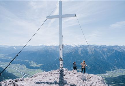
Great tour in high-alpine terrain for very experienced mountaineers.

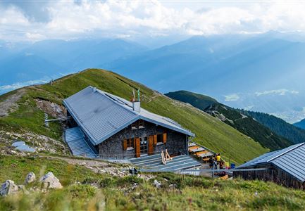
The circular route starts at the Karwendelhaus. Right at the beginning, special caution and increased attention are required: the path leads, partly with wire-rope protection, over earthy, often slippery rocks through avalanche barriers.

After a short stretch of mountain pines, the trail climbs gently into the wide Schlauchkar. At a distinctive junction, turn right onto the Brendlsteig and follow it further across alpine meadows, before the terrain becomes increasingly rocky and exposed. Eventually, you reach a narrow gully, which often remains filled with hard old snow well into summer and can therefore pose significant dangers. Crampons or microspikes are strongly recommended for crossing.

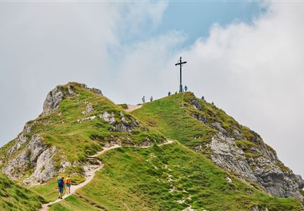
The route continues through steep, earthy rock terrain, where currently no complete rope protection exists, and finally leads up to a broad mountain ridge, the northernmost extension of the Western Ödkarspitze. Here the path divides. To the right, the trail descends into the Marxenkar and via the Toni Gaugg Trail to the Pleisenhütte. However, we keep left and follow the ridge steeply and exposed uphill over rocky terrain. In many sections, the path is now well secured with steel ropes. Finally, it curves right past a massive rock

Features & Characteristics

Stamina

Technique

Start Point

Karwendelhaus

End Point

Karwendelhaus
Similar Tour Suggestions

Weidachsee in Leutasch am Morgen - Luftaufnahme.jpg

Hiking

Wheelchair Circular Walk around the Weidachs

Length

3,00 km

Duration

00:45 h

Uphill

10 hm

Altitude

1120 hm

Difficulty

Hard

Wanderung auf die Birkkarspitze - Scharnitz (65).jpg

Hiking

Hike from the Karwendelhaus to the Hinterautal

Length

9,20 km

Duration

07:00 h

Uphill

883 hm

Altitude

2642 hm

Difficulty

Hard

Falkenhütte neu

Hiking

Karwendelmarsch 52 km

Length

52,00 km

Duration

19:00 h

Uphill

2281 hm

Downhill

2217 hm

Altitude

1903 hm

Difficulty

Hard

Grosse Arnspitze Blick ins Karwendel - Scharnitz.jpg

Hiking

Hike Hoher Sattel - Große Arnspitze Summit, 2,196 m

Length

10,30 km

Duration

08:00 h

Uphill

1313 hm

Altitude

2196 hm

Difficulty

Hard

Blick auf Arnspitzen Ueberschreitung - Scharnitz

Hiking

Mountain tour crossing of the Arnspitzen

Length

11,50 km

Duration

08:30 h

Uphill

1353 hm

Altitude

2196 hm

Difficulty

Hard

Wanderer auf dem Predigtstuhl.jpg

Hiking

Bike & Hike Predigtstuhl Summit, 2,234 m

Length

19,00 km

Duration

04:30 h

Uphill

1015 hm

Altitude

2234 hm

Difficulty

Hard

Hohe Gleirsch_2.jpg

Hiking

Bike & Hike Hoher Gleirsch Summit, 2,492 m

Length

31,00 km

Duration

09:30 h

Uphill

1772 hm

Altitude

2492 hm

Difficulty

Hard

Ausblick von der Arnplattenspitze auf die Gehrenspitze, Hohe Munde und Leutasch im Herbst - Leutasch.jpg

Hiking

Circular hike Arnplattenspitze, 2,171 m

Length

8,60 km

Duration

07:00 h

Uphill

1106 hm

Altitude

2171 hm

Difficulty

Hard