We use cookies for your personalized browsing experience, to personalize content and ads, to provide social media features, and to analyze traffic to our website. We also share information about your use of our website with our social media, advertising and analytics partners. Our partners may combine this information with other data that you have provided to them or that they have collected as part of your use of the Services. (incl. US providers)

Start Point

Parkplatz Geisterklamm (P19)

End Point

Parkplatz Geisterklamm (P19)

Difficulty

Medium

Total Distance

3,20 km

Descent Meters

68 m

Ascent Meters

68 m

Total Time

01:30 h

Status

Closed

Map & Elevation Profile

Start Point

Parkplatz Geisterklamm (P19)

End Point

Parkplatz Geisterklamm (P19)

Difficulty

Medium

Total Distance

3,20 km

Descent Meters

68 m

Ascent Meters

68 m

Total Time

01:30 h

Status

Closed

Hiking

Best Time

Closed

Jan

Feb

Mar

Apr

May

Jun

Jul

Aug

Sep

Oct

Nov

Dec

Hiking

Hiking tour

+3

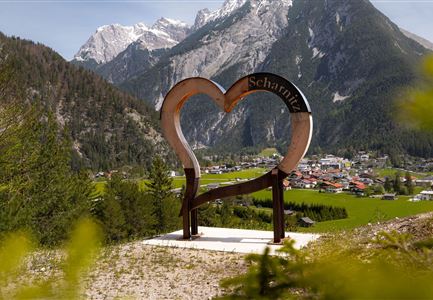
Route: Leutasch/Schanz car park (P19) - Leutascher Geisterklamm - Panorama bridge - Leutasch/Schanz car park.

Parking and public connections:

P19 "Leutascher Geisterklamm".

By train to Seefeld station and continue by bus to the "Leutasch Geisterklamm" stop.

Find all connections in real time with the mobility app "wegfinder".

Directions:

The Long GorgeTrail climbs from the Geisterklamm car park (P19) in the Leutasch district of Schanz into the spirit gorge and runs along a bold, 800 m long footbridge to the Panorama bridge. After the panorama bridge, turn right into the forest again, and from here continue to follow the gorge trail and the signs back to the starting point.

Important note: The narrow gorge walkway is not suitable for prams and dogs.

The Geisterklamm is open from 1 May to 31 October

Alpine emergency call & mountain rescue:

Tel.: 140

Features & Characteristics

Start Point

Parkplatz Geisterklamm (P19)

End Point

Parkplatz Geisterklamm (P19)

Family hike

Yes

Loop tour

Yes

Similar Tour Suggestions

Sonnenaufgang am Brunschkopf

Hiking

Circular hike to the Brunschkopf viewing platform starting in Mösern

Length

12,00 km

Duration

04:00 h

Uphill

386 hm

Altitude

1497 hm

Difficulty

Medium

Seekirchl in Seefeld

Hiking

Circular walking path from Seefeld to the lake Möserer See

Length

8,80 km

Duration

02:30 h

Uphill

231 hm

Altitude

1297 hm

Difficulty

Easy

Reitherjoch Alm in Seefeld

Hiking

Circular hike to the Reitherjochalm alpine hut

Length

6,60 km

Duration

02:30 h

Uphill

321 hm

Altitude

1479 hm

Difficulty

Easy

Ahrn Hochfluder Weidach.jpg

Hiking

Hike Hoher Sattel

Length

10,60 km

Duration

04:00 h

Uphill

524 hm

Altitude

1620 hm

Difficulty

Medium

Blick in Karwendeltal vom Karwendelhaus

Hiking

Hike to the Karwendelhaus

Length

36,00 km

Duration

11:15 h

Uphill

839 hm

Altitude

1765 hm

Difficulty

Medium

Wanderung-auf-die-Birkkarspitze

Hiking

Eagle Walk Stage 11: Karwendelhaus - Birkkarspitze - Hallerangerhaus

Length

14,00 km

Duration

08:30 h

Uphill

1440 hm

Altitude

2750 hm

Difficulty

Hard

Wanderer auf dem Weg auf die Seefelder Spitze - Blick ins Karwendelgebirge und die Region Seefeld - Panoramabild.jpg

Hiking

"Königstour" The royal's hiking tour

Length

4,40 km

Duration

04:00 h

Uphill

502 hm

Downhill

464 hm

Altitude

2364 hm

Difficulty

Hard

Weg zum Katzenkopf

Hiking

Hike to the Katzenkopfhütte alpine hut

Length

5,20 km

Duration

02:00 h

Uphill

243 hm

Altitude

1360 hm

Difficulty

Easy