Start Point

Parking Lot P19 Leutasch Spirit Gorge

End Point

Parking Lot P19 Leutasch Spirit Gorge

Difficulty

Medium

Total Distance

5,00 km

Descent Meters

225 m

Ascent Meters

221 m

Highest Point

1061 m

Total Time

02:30 h

Map & Elevation Profile

Start Point

Parking Lot P19 Leutasch Spirit Gorge

End Point

Parking Lot P19 Leutasch Spirit Gorge

Difficulty

Medium

Total Distance

5,00 km

Descent Meters

225 m

Ascent Meters

221 m

Highest Point

1061 m

Total Time

02:30 h

Hiking

Best Time

Jan

Feb

Mar

Apr

May

Jun

Jul

Aug

Sep

Oct

Nov

Dec

Hiking tour

Thematic route

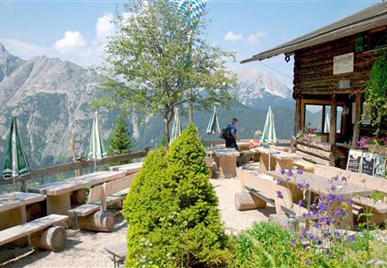
The hike starts at Parking Lot Spirit Gorge (P19) in the Schanz district. Right at the beginning, the cozy Leutascher Klammstüberl invites you to enjoy regional specialties—perfect before or after your hike.

The path leads into the impressive Spirit Gorge. A 800-meter-long walkway takes you to the panoramic bridge. Before reaching the bridge, a path to the left leads down to Mittenwald, where you’ll find the entrance to the Waterfall Trail and the Gorge kiosk. If you wish, you can visit the waterfall. The Waterfall Trail, 500 meters long and built just three meters above the water, leads to the imposing 23-meter-high waterfall (admission fee — cash only). A head for heights and sturdy footwear are required.

The path follows the themed trail “The Legend of the Gorge Spirit”. Various stations tell the story of the Gorge Spirit, who has lived in the Spirit Gorge since the beginning of time. He knows every stone, every bird, and every little moss plant. He watches over everyone and settles all disputes. But recently, the Gorge Spirit has lost interest. When his friends, the nature spirits Flora and Einstein, hear this, they are

Features & Characteristics

Start Point

Parking Lot P19 Leutasch Spirit Gorge

End Point

Parking Lot P19 Leutasch Spirit Gorge

Family-friendly

Yes

Loop tour

Yes

Videos

Similar Tour Suggestions

Familien-Weitwanderung im Gaistal - Familie steht auf Terasse bei der Wettersteinhütte - Vater zeigt auf etwas.jpg

Hiking

Stage 1: To Wettersteinhütte or Wangalm – Leutasch 3-Day Hut Hike for Families

Length

4,70 km

Uphill

550 hm

Altitude

1716 hm

Difficulty

Medium

Drohnenaufnahme Gschwandtkopf Speichersee - Person läuft entlang des Speichersees mit Hohe Munde im Hintergrund (3).jpg

Hiking

Hike on the Gschwandtkopf mountain

Length

11,60 km

Duration

03:30 h

Uphill

297 hm

Altitude

1485 hm

Difficulty

Medium

Wanderung Oberbrunnalm im Karwendel - Scharnitz (1).jpg

Hiking

Circular hike over Zäunlkopf & Oberbrunnalm alpine hut

Length

15,20 km

Duration

06:00 h

Uphill

794 hm

Downhill

789 hm

Altitude

1743 hm

Difficulty

Medium

Familien-Weitwanderung im Gaistal - Vater und Sohn auf schmalem Weg durch grüne Wiese (1).jpg

Hiking

Stage 2: To Rotmoosalm – Leutasch 3-Day Hut Hike for Families

Length

5,00 km

Uphill

400 hm

Downhill

130 hm

Altitude

2132 hm

Difficulty

Medium

Wanderweg Hochleithenkopf - Ausblick ins Inntal.jpg

Hiking

Hike to the Hochleithenkopf

Length

8,20 km

Duration

02:30 h

Uphill

200 hm

Altitude

1187 hm

Difficulty

Medium

Brunschkopf während der Goldenen Stunde.jpg

Hiking

Viewpoint Brunschkopf via forest road from Mösern

Length

9,10 km

Duration

03:00 h

Uphill

279 hm

Downhill

272 hm

Altitude

1496 hm

Difficulty

Medium

Familie beim Wandern am Kaltwassersee - Seefeld (2).jpg

Hiking

Circular hiking traill to the Rosshütte alpine hut - Hochegg Alm alpine hut

Length

8,30 km

Duration

03:45 h

Uphill

515 hm

Altitude

1740 hm

Difficulty

Medium

Drohnenaufnahme Wettersteinhütte mit Nebel in den Bergen.jpg

Hiking

Circular hike Wettersteinhütte - Wangalm - Hämmermoosalm

Length

10,20 km

Duration

04:15 h

Uphill

562 hm

Altitude

1756 hm

Difficulty

Medium