Start Point

Naturpark Info Center Scharnitz (P2)

End Point

Naturpark Info Center Scharnitz (P2)

Difficulty

Hard

Total Distance

36,00 km

Descent Meters

839 m

Ascent Meters

839 m

Highest Point

1765 m

Total Time

11:15 h

Map & Elevation Profile

Start Point

Naturpark Info Center Scharnitz (P2)

End Point

Naturpark Info Center Scharnitz (P2)

Difficulty

Hard

Total Distance

36,00 km

Descent Meters

839 m

Ascent Meters

839 m

Highest Point

1765 m

Total Time

11:15 h

Hiking

Best Time

Jan

Feb

Mar

Apr

May

Jun

Jul

Aug

Sep

Oct

Nov

Dec

Hiking tour

Hut hike

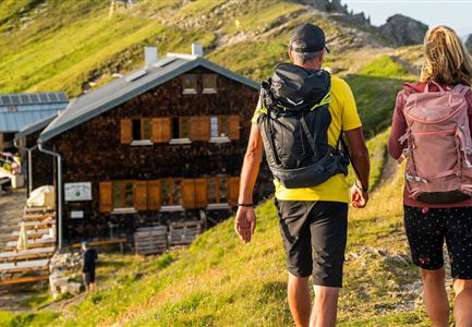
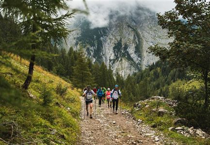
The starting point for this tour is the Nature Park Info Center in Scharnitz. From there, the trail follows the Hinterautalstraße towards the impressive Karwendel valleys. After about 500 meters, the path crosses the Isar. Immediately after the bridge, it heads uphill to the left for about 50 meters, before turning right at the next junction into the Karwendel Valley. Here, the route continues along a forest road that winds steadily through the valley.

A worthwhile detour along the way is the Birzlkapelle, a small chapel nestled in the forest, which can be reached in about five minutes from the junction. Another highlight is the Karwendelsteg, accessible in another 10 to 15 minutes, offering a spectacular view of the stunning Karwendelbach waterfall.

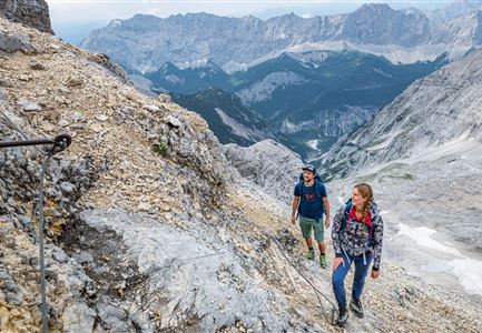
After these short side trips, the main trail continues deeper into the valley. The forest road stretches through the vast Karwendel landscape, surrounded by towering peaks. While the path may seem gentle at first, the final section is more challenging: a steeper ascent through broad switchbacks leads past the unserviced Hochalm.

After roughly 18 kilometers, the Karwendelhaus is finally reached – a place where all the

Read More...

Features & Characteristics

Start Point

Naturpark Info Center Scharnitz (P2)

End Point

Naturpark Info Center Scharnitz (P2)
Similar Tour Suggestions

Grosse Arnspitze Blick ins Karwendel - Scharnitz

Hiking

Hike Hoher Sattel - Große Arnspitze Summit, 2,196 m

Length

10,30 km

Duration

08:00 h

Uphill

1313 hm

Altitude

2196 hm

Difficulty

Hard

Drohnenaufnahme Pleisenspitze im Sommer.jpg

Hiking

Hike to the Pleisenspitze Summit, 2,569 m

Length

20,10 km

Duration

10:30 h

Uphill

1600 hm

Altitude

2569 hm

Difficulty

Hard

Wanderer auf der Gehrenspitze ueber Leutasch im Sonnenaufgang - Panoramaaufnahme.jpg

Hiking

Hike to the Gehrenspitze, 2,367 m

Length

22,80 km

Duration

10:00 h

Uphill

1319 hm

Altitude

2367 hm

Difficulty

Hard

Sonnenaufgang im Karwendel_Speckkarspitze

Hiking

Bike & Hike Speckkarspitze, 2,621 m

Length

44,00 km

Duration

11:00 h

Uphill

1794 hm

Altitude

2621 hm

Difficulty

Hard

Gravelbike - Zum Isarursprung.jpg

Hiking

Bike & Hike Hoher Gleirsch Summit, 2,492 m

Length

31,00 km

Duration

09:30 h

Uphill

1772 hm

Altitude

2492 hm

Difficulty

Hard

Sonnenuntergang Hohe Munde_Ostgipfel

Hiking

Hike Hohe Munde Summit, 2.592 m

Length

11,30 km

Duration

09:00 h

Uphill

1410 hm

Altitude

2562 hm

Difficulty

Hard

Ausblick von der Arnplattenspitze auf die Gehrenspitze, Hohe Munde

Hiking

Circular hike Arnplattenspitze, 2,171 m

Length

8,60 km

Duration

07:00 h

Uphill

1106 hm

Altitude

2171 hm

Difficulty

Hard

Falkenhütte neu

Hiking

Karwendelmarsch 52 km

Length

52,00 km

Duration

19:00 h

Uphill

2281 hm

Downhill

2217 hm

Altitude

1903 hm

Difficulty

Hard