Start Point

Parking lot P4 "Mühlberg"

End Point

Parking lot P4 "Mühlberg"
Difficulty

Medium

Total Distance

6,50 km

Descent Meters

334 m

Ascent Meters

328 m

Highest Point

1315 m

Total Time

02:30 h

Map & Elevation Profile

Start Point

Parking lot P4 "Mühlberg"

End Point

Parking lot P4 "Mühlberg"
Difficulty

Medium

Total Distance

6,50 km

Descent Meters

334 m

Ascent Meters

328 m

Highest Point

1315 m

Total Time

02:30 h

Hiking

Best Time

Jan

Feb

Mar

Apr

May

Jun

Jul

Aug

Sep

Oct

Nov

Dec

Hiking tour

Viewing platforms

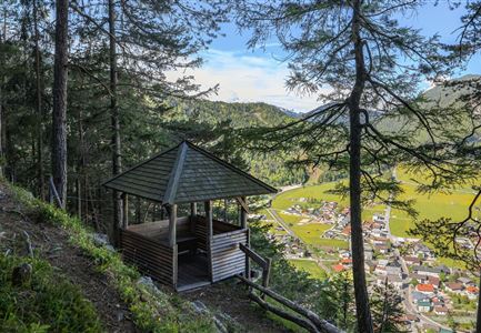
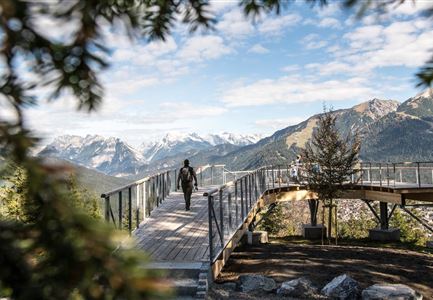
The starting point is at the Mühlberg parking lot P4. First, follow the railroad tracks towards Gießenbach/Seefeld until the forest road turns sharply left. Continue on this forest road up to the plateau and the former lift station. On the way to Mühlberg, there is also a Heart viewing platform, which offers a wonderful view of Scharnitz and the surrounding mountains. After this short detour, return to the hiking trail where you will be rewarded with a panoramic view at the top of the Mühlberg. Return via the same path. As a variation, sure-footed hikers can take a path through the so-called Bärenklamm gorge. This path starts approximately 100 meters before the Mühlberg parking lot and ascends along a narrow trail with steep hairpin bends (a small stream must be crossed once). After a while, the path rejoins the forest road as described above.

Similar Tour Suggestions

Gleirschklamm - Scharnitz (17).jpg

Hiking

Hike through the Gleirschklamm to the Möslalm

Length

21,20 km

Duration

06:30 h

Uphill

505 hm

Downhill

498 hm

Altitude

1261 hm

Difficulty

Medium

Partially open
Brunschkopf während der Goldenen Stunde.jpg

Hiking

Viewpoint Brunschkopf via forest road from Mösern

Length

9,10 km

Duration

03:00 h

Uphill

279 hm

Downhill

272 hm

Altitude

1496 hm

Difficulty

Medium

Brunnsteinhütte

Hiking

Hike to the Brunnsteinhütte

Length

10,00 km

Duration

04:30 h

Uphill

668 hm

Altitude

1523 hm

Difficulty

Medium

Wettersteinhuette (l) und Wangalm (r) im Wettersteingebirge.jpg

Hiking

Hike to the Wettersteinhütte alpine hut - Wang alpine hut

Length

7,30 km

Duration

04:00 h

Uphill

566 hm

Altitude

1717 hm

Difficulty

Medium

Personen bei der Rotmoosalm im Sommer - auf der Terrasse (1).jpg

Hiking

Hike to the Rotmoosalm alpine hut

Length

9,00 km

Duration

05:30 h

Uphill

842 hm

Altitude

2037 hm

Difficulty

Medium

Muggenmoosalm im Sommer mit Bauemen - Drohnenaufnahme.jpg

Hiking

Circular hike from Seefeld to the Lottenseehütte alpine hut & Muggenmoosalm alpine hut

Length

15,30 km

Duration

04:30 h

Uphill

554 hm

Altitude

1398 hm

Difficulty

Medium

Familie beim Wandern am Kaltwassersee - Seefeld (2).jpg

Hiking

Circular hiking traill to the Rosshütte alpine hut - Hochegg Alm alpine hut

Length

8,30 km

Duration

03:45 h

Uphill

515 hm

Altitude

1740 hm

Difficulty

Medium

Gravelbike - an der türkisblauen Isar.jpg

Hiking

Bike & Hike Halleranger house - Halleranger alm

Length

38,00 km

Duration

06:00 h

Uphill

832 hm

Altitude

1768 hm

Difficulty

Medium