Start Point

Seefeld band stand (parc)

End Point

Middle station Rosshütte

Difficulty

Medium

Total Distance

4,8 km

Descent Meters

548 m

Ascent Meters

10 m

Highest Point

1750 m

Total Time

02:30 h

Start Point

Seefeld band stand (parc)

End Point

Middle station Rosshütte

Difficulty

Medium

Total Distance

4,8 km

Descent Meters

548 m

Ascent Meters

10 m

Highest Point

1750 m

Total Time

02:30 h

Hiking

Best Time

Jan

Feb

Mar

Apr

May

Jun

Jul

Aug

Sep

Oct

Nov

Dec

Hiking tour

Thematic route

+1

Route: Seefeld spa park - Andreas-Hofer-Strasse - Rosshütte valley station - Woldrichsteig/Hermannstal - Rosshütte panorama restaurant

Parking and public transport:

P5 "Bahnhof", P8 "Apothekenparkplatz" and numerous other parking options.

By train to Seefeld train station.

Find all connections in real time with the Mobility-App "wegfinder".

Directions:

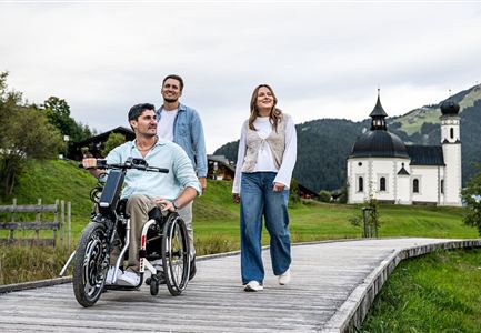
Starting from Seefeld's Kurpark, this educational rock path leads over seven stations through the Hermannstal valley and up to the Rosshütte panorama restaurant. At the total of seven way stations, various rocky fines from the region are presented and their origin and composition are described: Granite and mica schist, flasergneiss, metaandesite and biotite gneiss - expert knowledge you can touch.


From the start at the Kurpark, the Andreas-Hofer-Strasse first leads eastwards and then left at the traffic circle to the parking lot of the Rosshütte cable cars at the back. Cross this straight ahead and change between the two buildings on the ski run. After two comfortable serpentines, the trail changes to the Woldrichsteig through the Hermannstal valley and, after crossing it, finally takes the access to the left to the panoramic restaurant Rosshütte. With a beautiful view of the mountains, you can end the hike here in comfort,

Read More...

Features & Characteristics

Start Point

Seefeld band stand (parc)

End Point

Middle station Rosshütte

Family hike

Yes

Map & Elevation Profile

Similar Tour Suggestions

Hiking

Circular hike Wettersteinhütte alpine hut - Wangalm alpine hut - Hämmermoosalm alpine hut

Length

10,2 km

Duration

04:15 h

Uphill

562 hm

Altitude

1756 hm

Difficulty

Medium

Hiking

Circular hike Arnplattenspitze, 2,171 m

Length

8,6 km

Duration

07:00 h

Uphill

1106 hm

Altitude

2171 hm

Difficulty

Hard

Hiking

Viewpoint Brunschkopf via Möserer Höhe

Length

8,0 km

Duration

03:00 h

Uphill

284 hm

Altitude

1498 hm

Difficulty

Medium

Hiking

Circular hiking traill to the Rosshütte alpine hut - Hochegg Alm alpine hut

Length

8,3 km

Duration

03:45 h

Uphill

515 hm

Altitude

1740 hm

Difficulty

Medium

Hiking

Circular walk around Weidachsee lake

Length

3,8 km

Duration

01:00 h

Uphill

46 hm

Altitude

1156 hm

Difficulty

Easy

Hiking

Bike & Hike lake Seebensee & lake Drachensee

Length

31,0 km

Duration

04:45 h

Uphill

820 hm

Altitude

1897 hm

Difficulty

Medium

Hiking

Kneipp facility & reflection walk in Seefeld

Length

7,6 km

Duration

02:00 h

Uphill

36 hm

Downhill

32 hm

Altitude

1250 hm

Difficulty

Easy

Hiking

Karwendel High Trail (Trail 4): Pfeishütte - Bettelwurfhütte

Length

8,9 km

Duration

04:30 h

Uphill

590 hm

Downhill

390 hm

Altitude

2215 hm

Difficulty

Hard