Start Point

Parking P15 Music Pavilion Leutasch

End Point

Parking P15 Music Pavilion Leutasch

Difficulty

Medium

Total Distance

12,80 km

Descent Meters

441 m

Ascent Meters

438 m

Highest Point

1493 m

Total Time

04:30 h

Map & Elevation Profile

Start Point

Parking P15 Music Pavilion Leutasch

End Point

Parking P15 Music Pavilion Leutasch

Difficulty

Medium

Total Distance

12,80 km

Descent Meters

441 m

Ascent Meters

438 m

Highest Point

1493 m

Total Time

04:30 h

Hiking

Best Time

Jan

Feb

Mar

Apr

May

Jun

Jul

Aug

Sep

Oct

Nov

Dec

Hiking tour

Viewing platforms

One of the most scenic ways to reach the Brunschkopf viewpoint is from the Weidach area in Leutasch. At the starting point near the Leutasch music pavilion, there are some (paid) parking spots available. If you take the regional bus instead, you’ll not only save the parking fee but also a few minutes of walking.

From the music pavilion, follow the main road along the sidewalk towards Seefeld for a short distance before turning right towards the Katzenkopf base station. Walk past the Kreithalm on your right and follow the forest path towards Fludertal, always keeping an eye on the signs for Brunschkopf.

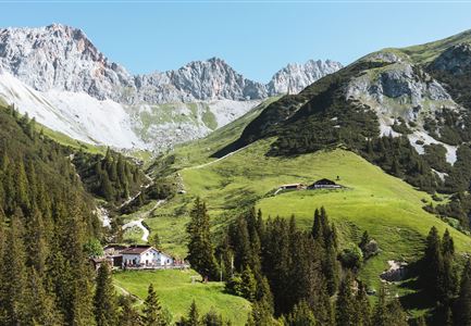
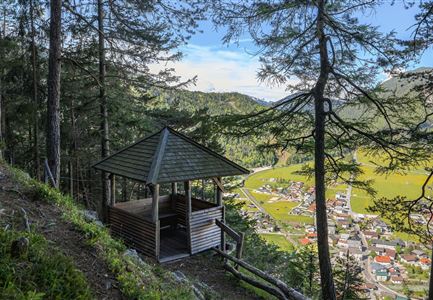
Once you’ve crossed the Fludertal, the Kaserwald opens up into a beautiful clearing on the Wildmoos Plateau, where the Wildmoosalm offers a welcome stop with a sunny terrace. To the left of the Wildmoosalm, a trail (path no. 63, signposted Brunschkopf) continues upwards. Shortly after, turn sharply to the right (path no. 62, still following signs for Brunschkopf) and climb a few steps leading to the viewpoint at Brunschkopf. The stunning mountain panorama can be enjoyed even more clearly with the

Features & Characteristics

Start Point

Parking P15 Music Pavilion Leutasch

End Point

Parking P15 Music Pavilion Leutasch

Family-friendly

Yes
Videos

Similar Tour Suggestions

Sonnenaufgang Aussichtsplattform Bruschkopf - Paar steht am Geländer der Plattform - Aufnahme von hinten - Paar schaut sich an.jpg

Hiking

Viewpoint Brunschkopf via Möserer Höhe

Length

8,70 km

Duration

03:00 h

Uphill

311 hm

Downhill

314 hm

Altitude

1499 hm

Difficulty

Medium

Brunschkopf_inkl_Logo.jpg

Hiking

Brunschkopf viewing platform via Geiernest from Seefeld, return via Wildmoosalm

Length

9,20 km

Duration

03:15 h

Uphill

316 hm

Downhill

313 hm

Altitude

1493 hm

Difficulty

Medium

Ederkanzel contwise.jpg

Hiking

Circular Hike via the Franzosensteig to Grünkopf and Ederkanzel

Length

7,40 km

Duration

04:00 h

Uphill

590 hm

Altitude

1569 hm

Difficulty

Medium

Gravelbike - an der türkisblauen Isar.jpg

Hiking

Bike & Hike Halleranger house - Halleranger alm

Length

38,00 km

Duration

06:00 h

Uphill

832 hm

Altitude

1768 hm

Difficulty

Medium

Isarursprung im Karwendel - Scharnitz (3).jpg

Hiking

Hike to the source of the river Isar & Kasten alpine hut

Length

28,20 km

Duration

06:00 h

Uphill

323 hm

Altitude

1227 hm

Difficulty

Medium

Blick auf das Wettersteingebirge mit Neuleutasch im Sommer - Luftaufnahme.jpg

Hiking

Circular hike from Seefeld to Gießenbach & Leutasch

Length

21,50 km

Duration

06:30 h

Uphill

773 hm

Downhill

815 hm

Altitude

1616 hm

Difficulty

Medium

Familie beim Wandern am Kaltwassersee - Seefeld (2).jpg

Hiking

Circular hiking traill to the Rosshütte alpine hut - Hochegg Alm alpine hut

Length

8,30 km

Duration

03:45 h

Uphill

515 hm

Altitude

1740 hm

Difficulty

Medium

Durch die Gleirschklamm bei Scharnitz.jpg

Hiking

Circular hiking trail Gleirschklamm Gorge

Length

13,10 km

Duration

04:00 h

Uphill

416 hm

Downhill

410 hm

Altitude

1152 hm

Difficulty

Medium