Start Point

ErlebnisWelt Alpenbad Leutasch

End Point

ErlebnisWelt Alpenbad Leutasch

Difficulty

Medium

Total Distance

42,0 km

Descent Meters

820 m

Ascent Meters

820 m

Highest Point

1382 m

Start Point

ErlebnisWelt Alpenbad Leutasch

End Point

ErlebnisWelt Alpenbad Leutasch

Difficulty

Medium

Total Distance

42,0 km

Descent Meters

820 m

Ascent Meters

820 m

Highest Point

1382 m

Running

Best Time

Jan

Feb

Mar

Apr

May

Jun

Jul

Aug

Sep

Oct

Nov

Dec

Running

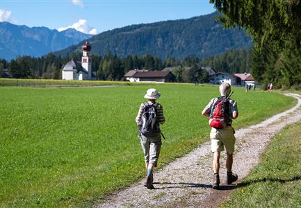
This route offers 42km full of adventure and changes in scenery. It starts out along the flat Leutasch valley in the direction of Germany and returns via Scharnitz and Gießenbach before skirting the Simmlberg to Neuleutasch. From there walkers make their way into the Fludertal valley, crossing it and making a big loop in the direction of Moos and Obern. At the entrance to the Gaistal the route turns back in the direction of the finish area at the ErlebnisWelt Alpenbad Leutasch. The difficulty of this route is graded as medium and it is thus a little bit more demanding.


Features & Characteristics

Refreshment stops

Show More

Start Point

ErlebnisWelt Alpenbad Leutasch

End Point

ErlebnisWelt Alpenbad Leutasch

Map & Elevation Profile

Similar Tour Suggestions

Running

IML Unicorn March Day 1: Achen Walk

Length

20,0 km

Uphill

315 hm

Altitude

1172 hm

Difficulty

Easy

Running

Leutascher Half Marathon

Length

21,0 km

Uphill

310 hm

Downhill

315 hm

Altitude

1191 hm

Difficulty

Hard

Running

IML Unicorn March Day 1: 10km - Runst-Hike

Length

10,2 km

Uphill

195 hm

Downhill

80 hm

Altitude

1148 hm

Difficulty

Easy

Running

Gschwandtkopf Run

Length

5,5 km

Uphill

355 hm

Downhill

52 hm

Altitude

1475 hm

Difficulty

Medium

Running

Verbindungsstrecke Seefeld-Leutasch

Length

14,5 km

Uphill

338 hm

Downhill

250 hm

Altitude

1226 hm

Difficulty

Medium

Running

Circuit run around the Lottensee lake

Length

6,4 km

Uphill

123 hm

Downhill

126 hm

Altitude

1344 hm

Difficulty

Easy

Running

Gschwandtkopf Trail

Length

10,3 km

Uphill

343 hm

Downhill

332 hm

Altitude

1334 hm

Difficulty

Hard

Running

Fischerrun

Length

3,7 km

Uphill

63 hm

Downhill

64 hm

Altitude

1156 hm

Difficulty

Easy