We use cookies for your personalized browsing experience, to personalize content and ads, to provide social media features, and to analyze traffic to our website. We also share information about your use of our website with our social media, advertising and analytics partners. Our partners may combine this information with other data that you have provided to them or that they have collected as part of your use of the Services. (incl. US providers)

Start Point

Bettelwurfhütte

End Point

Hallerangerhaus

Difficulty

Hard

Total Distance

9,00 km

Descent Meters

800 m

Ascent Meters

1100 m

Highest Point

2183 m

Total Time

06:00 h

Map & Elevation Profile

Start Point

Bettelwurfhütte

End Point

Hallerangerhaus

Difficulty

Hard

Total Distance

9,00 km

Descent Meters

800 m

Ascent Meters

1100 m

Highest Point

2183 m

Total Time

06:00 h

Hiking

Best Time

Jan

Feb

Mar

Apr

May

Jun

Jul

Aug

Sep

Oct

Nov

Dec

Long distance trails

Route: Bettelwurf hut - summit Großer Bettelwurf - Bettelwurf hut - Lafatscher Joch - Hallerangerhaus

Directions:

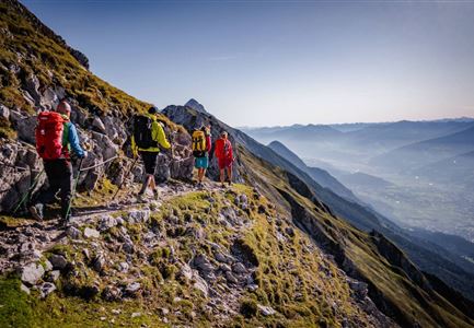
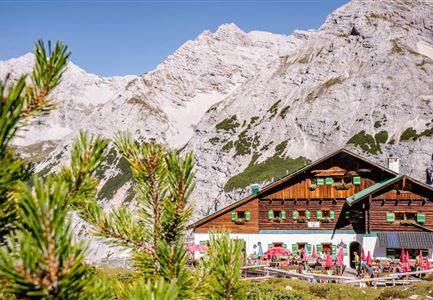
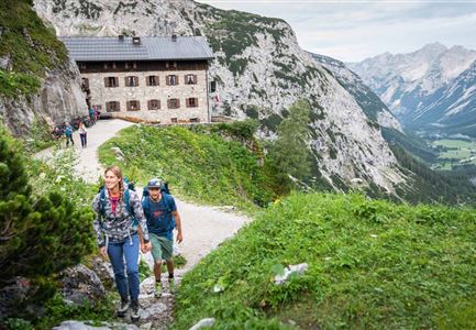
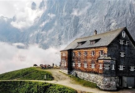
After spending the night at the Bettelwurfhütte hut, the eagle’s nest of the Karwendel mountains, you take trail 222 back to the Lafatscher Joch (2081 m). Once there, you turn on to trail 223 heading north. As part of the famous Adlerweg long-distance hiking trail, this guides you between the Lafatscher, Roßkopf and Speckkarspitze mountains on a continuous descent to the Hallerangerhaus hut. After spending the night at the Bettelwurfhütte hut, the eagle’s nest of the Karwendel mountains, the route climbs a little eastward, well signposted, where the trail leads up from the Halltal valley and then continues climbing southeastward to the “Eisengattergrat”, the southern ridge of the Großer Bettelwurf mountain. From here, keep north, steadily uphill along the Eisengattergrat towards the summit until you reach the rocky outcrop and the first wire-rope-secured passages. The following, partly secured and partly in easy climbing (I) to overcome in good grip limestone, now leads mostly to the right of a diagonally descending gully to the summit ridge and overcomes some partly exposed rock bands. Towards the top, the path becomes somewhat steeper. Shortly below the summit

Read More...

Recommended Equipment

knöchelhohe Bergschuhe, ausreichend Wasser

Features & Characteristics

Start Point

Bettelwurfhütte

End Point

Hallerangerhaus

Similar Tour Suggestions

Noerdlinger Huette - Karwendel Hoehenweg Etappe 1 & 2

Hiking

Karwendel High Trail (Trail 2): Nördlinger Hütte - Solsteinhaus

Length

6,70 km

Duration

04:00 h

Uphill

370 hm

Downhill

795 hm

Altitude

2239 hm

Difficulty

Hard

Aufstieg Eppzirler Scharte - Karwendel Hoehenweg Etappe 2

Hiking

Karwendel High Trail

Length

70,00 km

Duration

27:30 h

Uphill

4470 hm

Downhill

4600 hm

Altitude

2699 hm

Difficulty

Hard

Falkenhütte neu

Hiking

Karwendelmarsch 52 km

Length

52,00 km

Duration

19:00 h

Uphill

2281 hm

Downhill

2217 hm

Altitude

1903 hm

Difficulty

Hard

Bike Tour durchs Karwendeltal aufs Karwendelhaus - Scharnitz

Hiking

Karwendel March 35 km

Length

35,00 km

Duration

12:30 h

Uphill

1664 hm

Downhill

1358 hm

Altitude

1843 hm

Difficulty

Hard

Solsteinhaus - Karwendel Hoehenweg Etappe 2 & 3

Hiking

Karwendel High Trail (Trail 3): Solsteinhaus - Pfeishütte

Length

16,50 km

Duration

09:00 h

Uphill

1150 hm

Downhill

1400 hm

Altitude

2314 hm

Difficulty

Hard

Schartlehnerhaus zur Noerdlinger Huette - Karwendel Hoehenweg Etappe 1

Hiking

Karwendel High Trial (Trail 1): Reith bei Seefeld - Nördlinger Hütte

Length

6,50 km

Duration

04:30 h

Uphill

1130 hm

Downhill

10 hm

Altitude

2239 hm

Difficulty

Medium

Aufstieg Stempeljoch - Karwendel Hoehenweg Etappe 4

Hiking

Karwendel High Trail (Trail 4): Pfeishütte - Bettelwurfhütte

Length

8,90 km

Duration

04:30 h

Uphill

590 hm

Downhill

390 hm

Altitude

2215 hm

Difficulty

Hard

Lafatscher Niederleger - Karwendel Hoehenweg Etappe 6

Hiking

Karwendel Hight Trail (Trail 6): Hallerangerhaus - Scharnitz

Length

19,30 km

Duration

05:30 h

Uphill

30 hm

Downhill

835 hm

Altitude

1768 hm

Difficulty

Medium