Start Point
ErlebnisWelt Alpenbad Leutasch
End Point
ErlebnisWelt Alpenbad Leutasch
Difficulty
Hard
Total Distance
25,40 km
Descent Meters
1410 m
Ascent Meters
1430 m
Highest Point
2317 m
Total Time
09:00 h
Running
Best Time
Jan
Feb
Mar
Apr
May
Jun
Jul
Aug
Sep
Oct
Nov
Dec
Trailrunning
Attention: The Wetterstein Hut remains closed until further notice.
The starting point of this challenging trail run is parking lot P23 at Alpenbad Leutasch. From here, you initially cross the Weidach Bridge, then follow the Lehnerberg Runsen Way through the hamlets Gasse and Lehner.
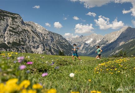
Follow the signs to Puitegg and on into the Puittal. This secluded valley captivates with its untouched nature and fantastic views of the surrounding peaks. Beneath the imposing towers of Öfelekopf, Leutascher Dreitorspitze, and Gehrenspitze, the trail steadily climbs through lush alpine meadows. The variety of mountain herbs is impressive, and with a bit of luck, you might spot chamois or marmots.
The first steep elevation gains test your strength, but the climb is rewarding: after about three hours, you reach Scharnitzjoch (2,048 m). From there, an awe-inspiring view of Gaistal unfolds, with Wangalm and Wettersteinhütte already in sight.
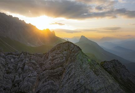
The route then continues past the small, unstaffed Erinnerungshütte towards Gehrenspitze. The trail becomes increasingly narrow and exposed — sure-footedness and a head for heights are essential. Those who reach the summit (2,340 m) are rewarded with a spectacular 360°
Features & Characteristics
Stamina
Technique
Start Point
ErlebnisWelt Alpenbad Leutasch
End Point
ErlebnisWelt Alpenbad Leutasch


