Start Point

Parking lot P2 'Stupfer' in Gaistal

End Point

Wettersteinhütte/ Wangalm

Difficulty

Medium

Total Distance

4,70 km

Descent Meters

550 m

Highest Point

1716 m

Map & Elevation Profile

Start Point

Parking lot P2 'Stupfer' in Gaistal

End Point

Wettersteinhütte/ Wangalm

Difficulty

Medium

Total Distance

4,70 km

Descent Meters

550 m

Highest Point

1716 m

Hiking

Best Time

Jan

Feb

Mar

Apr

May

Jun

Jul

Aug

Sep

Oct

Nov

Dec

Hiking tour

Hut hike

+4

Discover, marvel, and enjoy! Stage 1 of the Leutasch family hiking trail is perfect for curious kids – a real adventure through the forests of Leutasch.

After arriving by car or bus in the alpine paradise of Gaistal, the hike starts with a refreshing highlight: the Kneipp facility right next to the Salzbach parking area (P3, P4, P5) is the perfect way to wake up your senses. A gentle start takes you along the rushing Leutascher Ache for a few hundred meters. Back on the other side of the stream, at the eastern end of the parking lot Stupfer P2, the real adventure begins.

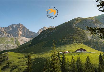
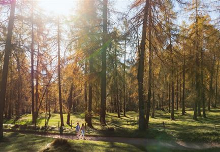
Over the next 500 meters of elevation gain, children will find a playground for discoveries. The root-covered trail is never boring, with fascinating plants and animals to spot along the way. The paths are exciting for kids but always safe – there are no dangerous drop-offs. After the most challenging stage of the multi-day hike, two alpine huts await the hard-working hikers at the top.

Wettersteinhütte and Wangalm are just a ten-minute walk apart and are quite similar in

Read More...

Features & Characteristics

Start Point

Parking lot P2 'Stupfer' in Gaistal

End Point

Wettersteinhütte/ Wangalm

Family-friendly

Yes

Multiday hike

Yes

Multi-Day Tour Feature

Etappe
Videos

01

Similar Tour Suggestions

Familien-Weitwanderung im Gaistal - Familie spielt Engelchen.jpg

Hiking

Stage 3: To Hämmermoosalm & Wrap Up – Leutasch 3-Day Hut Hike for Families

Length

6,50 km

Uphill

10 hm

Downhill

840 hm

Altitude

2132 hm

Difficulty

Medium

Hölzernes Herz am Mühlberg in Scharnitz - Perspektive durch Gebüsch (1).jpg

Hiking

Hike to the Mühlberg Scharnitz

Length

6,50 km

Duration

02:30 h

Uphill

334 hm

Downhill

328 hm

Altitude

1315 hm

Difficulty

Medium

Sonnenuntergang Hohe Munde_Ostgipfel

Hiking

Hike Hohe Munde Summit, 2.592 m

Length

11,30 km

Duration

09:00 h

Uphill

1410 hm

Altitude

2562 hm

Difficulty

Hard

Wildmoosalm im Sommer - Alm aus der Distanz mit Gewässer im Vordergrund.jpg

Hiking

Circular hiking trail Wildmoos-Hochmoos

Length

10,00 km

Duration

04:00 h

Uphill

437 hm

Altitude

1544 hm

Difficulty

Medium

Familie in der Region Seefeld - Spielen am Fluss - Leutascher Ache.jpg

Hiking

Hike to Unterleutasch Along the Achweg

Length

9,10 km

Duration

02:30 h

Uphill

3 hm

Downhill

77 hm

Altitude

1174 hm

Difficulty

Easy

Brunnsteinhütte

Hiking

Hike to the Brunnsteinhütte

Length

10,00 km

Duration

04:30 h

Uphill

668 hm

Altitude

1523 hm

Difficulty

Medium

Reith - Wanderung Frau Häusl Kapelle - Bank und Bildstock mit Aussicht ins Inntal.jpg

Hiking

Circular hike panoramic path

Length

6,70 km

Duration

02:15 h

Uphill

289 hm

Altitude

1306 hm

Difficulty

Easy

Wanderer auf dem Predigtstuhl.jpg

Hiking

Bike & Hike Predigtstuhl Summit, 2,234 m

Length

19,00 km

Duration

04:30 h

Uphill

1015 hm

Altitude

2234 hm

Difficulty

Hard