Start Point

Rotmoosalm

End Point

Parking lot P2 'Stupfer' in Gaistal

Difficulty

Medium

Total Distance

6,50 km

Descent Meters

10 m

Ascent Meters

840 m

Highest Point

2132 m

Map & Elevation Profile

Start Point

Rotmoosalm

End Point

Parking lot P2 'Stupfer' in Gaistal

Difficulty

Medium

Total Distance

6,50 km

Descent Meters

10 m

Ascent Meters

840 m

Highest Point

2132 m

Hiking

Best Time

Jan

Feb

Mar

Apr

May

Jun

Jul

Aug

Sep

Oct

Nov

Dec

Hiking tour

Hut hike

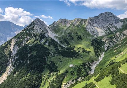
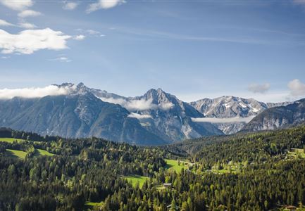
It doesn’t get more enjoyable than this: Stage 3 of the Leutasch family long-distance hike offers the perfect conclusion.

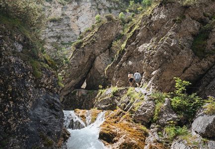
Following the motto "A good hike deserves good food and drink", the final day is all about culinary delights. After another delicious hut breakfast, the route follows the Jägersteig trail downhill for about two hours. There’s also the option to take the forest road into the valley – but naturally, there’s much less to discover there!

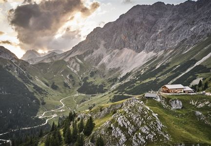
The narrow path leads from Rotmoosalm in a wide right-hand curve past a shepherd’s hut, down through the Gutwald forest, and to Hämmermoosalm – the last stop before the journey’s end. The fact that "Hämmermoos" was named Gault&Millau Alpine Hut of the Year 2025 might not impress the kids as they dig into their Kaspressknödel, but the special charm of the hut can be felt by even the youngest visitors.

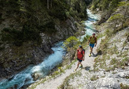
Happy and well-fed, the final kilometers back to the valley are a relaxed stroll. Again, there’s a choice between the forest road and the hiking trail. On hot days, a quick splash in the Leutascher Ache or a final stop at the Kneipp facility is a

Features & Characteristics

Start Point

Rotmoosalm

End Point

Parking lot P2 'Stupfer' in Gaistal

Family-friendly

Yes

Multiday hike

Yes

Multi-Day Tour Feature

Etappe

Videos

Similar Tour Suggestions
Wanderweg zur Hohen Fluder mit Blick Richtung Hohe Munde.jpg

Hiking

Hike Hoher Sattel

Length

10,60 km

Duration

04:00 h

Uphill

524 hm

Altitude

1620 hm

Difficulty

Medium

Radtour ins Gaistal - Bruecke am Eingang vom Gaistal

Hiking

Bike & Hike lake Seebensee & lake Drachensee

Length

31,00 km

Duration

04:45 h

Uphill

820 hm

Altitude

1897 hm

Difficulty

Medium

Wanderung zur Eppzirler Alm im Sommer - Mann und Frau von hinten mit Eppzirler Alm.jpg

Hiking

Hike to the Eppzirler Alm alpine hut

Length

12,40 km

Duration

04:00 h

Uphill

475 hm

Altitude

1459 hm

Difficulty

Medium

Muggenmoosalm

Hiking

Circular hike from Seefeld to the Lottenseehütte alpine hut & Muggenmoosalm alpine hut

Length

15,30 km

Duration

04:30 h

Uphill

554 hm

Altitude

1398 hm

Difficulty

Medium

Partially open
Spaziergang an der Isar - Scharnitz (2).jpg

Hiking

Circular hiking trail to the Gleirschhöhe

Length

8,60 km

Duration

02:45 h

Uphill

212 hm

Altitude

1074 hm

Difficulty

Medium

Brunschkopf während der Goldenen Stunde.jpg

Hiking

Viewpoint Brunschkopf via forest road from Mösern

Length

9,10 km

Duration

03:00 h

Uphill

279 hm

Downhill

272 hm

Altitude

1496 hm

Difficulty

Medium

Sonnenaufgang am Brunschkopf

Hiking

Circular hike to the Brunschkopf viewing platform starting in Mösern

Length

12,70 km

Duration

04:00 h

Uphill

382 hm

Altitude

1498 hm

Difficulty

Medium

Ederkanzel contwise.jpg

Hiking

Circular Hike via the Franzosensteig to Grünkopf and Ederkanzel

Length

7,40 km

Duration

04:00 h

Uphill

590 hm

Altitude

1569 hm

Difficulty

Medium