Start Point

Ostbach Leutasch

End Point

Alpenbad Leutasch

Difficulty

Medium

Total Distance

2,70 km

Descent Meters

51 m

Highest Point

1183 m

Status

Closed

Map & Elevation Profile

Start Point

Ostbach Leutasch

End Point

Alpenbad Leutasch

Difficulty

Medium

Total Distance

2,70 km

Descent Meters

51 m

Highest Point

1183 m

Status

Closed

Cross-country Skiing

Best Time

Closed

Jan

Feb

Mar

Apr

May

Jun

Jul

Aug

Sep

Oct

Nov

Dec

Ski-nordic-classic

Ski-nordic-skating

+2

Trail Entry:
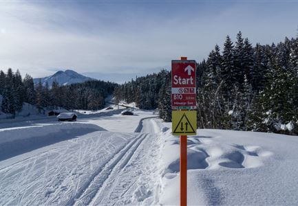
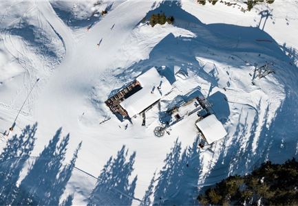
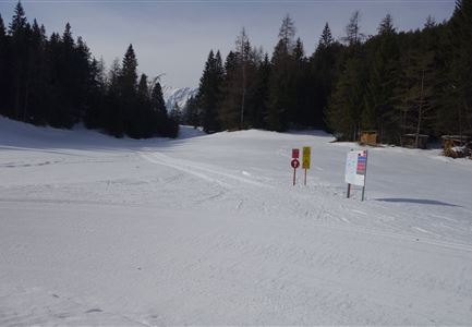
Access via A6 Alpenbad. If you follow the A6 loop to the turnaround point in Ostbach, shortly after the houses, there is a small climb leading to the B11 trail.

Trail Character:
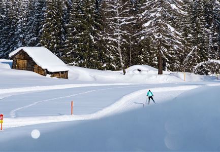
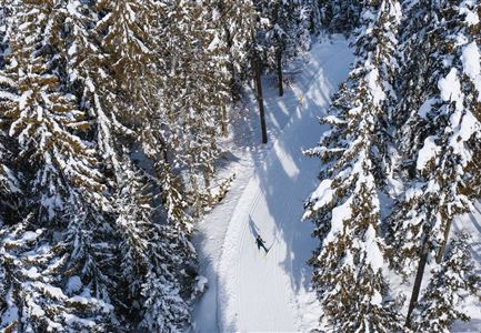
The B11 Forest Trail is a very idyllic route, starting through the woods and ascending from the Ostbach district (approx. 250 m after the Ostbach underpass). Crossing the hiking path twice, the trail descends back to the Alpenbad. This trail is better suited for experienced cross-country skiers.

Connecting Trails:
A6 Alpenbad 
An overview of the entire trail network (including trail status) and useful cross-country skiing information (ticket machines, waxing and service stations, changing facilities,...) can be found in the trail report

Features & Characteristics

Stamina

Technique

Start Point

Ostbach Leutasch

End Point

Alpenbad Leutasch

Skating

Yes

Klassisch

Yes
Similar Tour Suggestions

Luftaufnahme der Loipe A10 Weidach mit Langlaeuferin und Hoher Munde.jpg

Cross-country Skiing

A10 – Weidach

Length

1,70 km

Uphill

14 hm

Altitude

1120 hm

Difficulty

Easy

Closed
Leutasch Katzenkopf

Cross-country Skiing

C4 - Katzenkopf

Length

2,20 km

Uphill

45 hm

Altitude

1373 hm

Difficulty

Hard

Closed
C3 Neuleutasch - Skating in Wildmoos

Cross-country Skiing

C3 – Neuleutasch

Length

5,10 km

Uphill

142 hm

Altitude

1335 hm

Difficulty

Hard

Closed
A13 Scharnitz

Cross-country Skiing

A13 - Scharnitz-Klassik

Length

2,00 km

Uphill

32 hm

Altitude

998 hm

Difficulty

Easy

Closed
Loipe bei der Ropferstub'm mit Blick ins Inntal - Moesern-Buchen

Cross-country Skiing

B5 - Katzenloch

Length

5,00 km

Uphill

67 hm

Altitude

1260 hm

Difficulty

Medium

Closed
C10-Mundeknie-Loipe---Leutasch

Cross-country Skiing

C10 – Mundeknie

Length

2,50 km

Uphill

84 hm

Altitude

1263 hm

Difficulty

Hard

Closed
Langlaufen in Seefeld - Langläufer auf der A1 beim Seekirchl in Seefeld - Tirols Hochplateau (1).jpg

Cross-country Skiing

A1 - Seekirchl Loipe

Length

3,00 km

Uphill

19 hm

Altitude

1189 hm

Difficulty

Easy

Closed
B1-Loipe-Moesern

Cross-country Skiing

B1 - Mösern

Length

5,50 km

Uphill

110 hm

Altitude

1228 hm

Difficulty

Medium

Closed