Start Point

Reith Railway Station

End Point

Bee Academy

Difficulty

Easy

Total Distance

2,50 km

Descent Meters

72 m

Highest Point

1185 m

Total Time

01:00 h

Map & Elevation Profile

Start Point

Reith Railway Station

End Point

Bee Academy

Difficulty

Easy

Total Distance

2,50 km

Descent Meters

72 m

Highest Point

1185 m

Total Time

01:00 h

Hiking

Best Time

Jan

Feb

Mar

Apr

May

Jun

Jul

Aug

Sep

Oct

Nov

Dec

Hiking tour

Thematic route

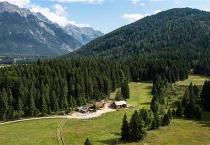
The newly designed Bee Nature Trail follows the Reither Forest Path, offering a fascinating look into the world of wild and honeybees. Over a distance of about three kilometers, 14 stations with informative display boards explain the vital role of these small pollinators and many other helpful creatures that contribute to the forest ecosystem.

The trail provides insights into the life of bees – from the structure of honeycombs to the bee dance and their winter survival in the hive. It also highlights their diverse habitats: forest clearings, deadwood, water sources, and gardens all serve as vital food and shelter areas. The close relationship between humans and bees is another important topic along the route.

This path invites visitors to observe, listen, and develop a deeper understanding of nature. It helps explain why bees are essential for the entire ecosystem and shows how everyone can play a role in protecting them.

Stations of the Bee Discovery Trail

Similar Tour Suggestions

Höhenweg Leutasch_Aussichtsplattform Höhenweg.jpg

Hiking

Circular hike to the viewing platform on the Höhenweg - Runst

Length

7,40 km

Duration

02:00 h

Uphill

128 hm

Altitude

1156 hm

Difficulty

Easy

Reith Wiesenweg im Frühling - Drohnenaufnahme strahlend grüne Wiese mit Blick zum Inntal.jpg

Hiking

Circular hiking traill Wiesenweg

Length

4,60 km

Duration

01:30 h

Uphill

109 hm

Altitude

1128 hm

Difficulty

Easy

Reitherjoch Alm in Seefeld

Hiking

Circular hike to the Reitherjochalm alpine hut

Length

7,00 km

Duration

02:30 h

Uphill

370 hm

Altitude

1500 hm

Difficulty

Easy

Wildsee im Herbst - Drohnenaufnahme - Blick auf Golfplatz und See mit Bergpanorama.jpg

Hiking

Circular hike from Seefeld to Auland & Reith

Length

9,30 km

Duration

02:45 h

Uphill

139 hm

Downhill

141 hm

Altitude

1199 hm

Difficulty

Easy

Blick ueber Wildmoos nach Seefeld.jpg

Hiking

Circular tour around the Brunschkopf

Length

13,10 km

Duration

04:00 h

Uphill

275 hm

Downhill

272 hm

Altitude

1369 hm

Difficulty

Easy

Familie beim Wandern am Kaltwassersee - Seefeld (1) Kopie.jpg

Hiking

Stone Pine Trail Rosshütte Mountain Station

Length

662 m

Duration

00:15 h

Uphill

28 hm

Downhill

24 hm

Difficulty

Easy

Scharnitz - Wanderung Dorfrunde - Scharnitz im Überblick.jpg

Hiking

Hike from Seefeld to Scharnitz

Length

9,60 km

Duration

02:45 h

Uphill

35 hm

Downhill

301 hm

Altitude

1252 hm

Difficulty

Easy

Scharnitz - Wanderung zur Adlerkanzel - Blick auf die Isar.jpg

Hiking

Circular village walk Scharnitz - Gießenbach

Length

6,10 km

Duration

01:30 h

Uphill

42 hm

Altitude

1013 hm

Difficulty

Easy