Start Point

Reith Railway Station

End Point

Reith Railway Station

Difficulty

Easy

Total Distance

6,70 km

Descent Meters

289 m

Ascent Meters

289 m

Highest Point

1306 m

Total Time

02:15 h

Map & Elevation Profile

Start Point

Reith Railway Station

End Point

Reith Railway Station

Difficulty

Easy

Total Distance

6,70 km

Descent Meters

289 m

Ascent Meters

289 m

Highest Point

1306 m

Total Time

02:15 h

Hiking

Best Time

Jan

Feb

Mar

Apr

May

Jun

Jul

Aug

Sep

Oct

Nov

Dec

Hiking tour

Circular hike

The hike starts at Reith train station and follows the railway line at first. The path gently winds through the landscape until it reaches the turnoff to Nördlinger Hütte. Here, the trail branches off to the right, leading onto the Panorama Trail.

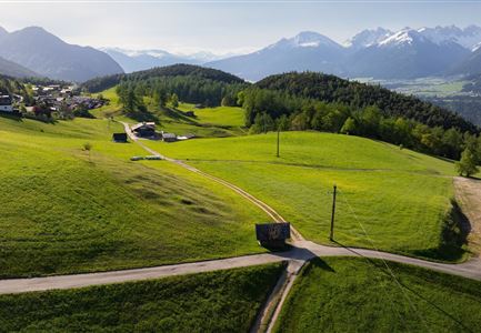
Above Reith, a wide view of Hölltal opens up. The path meanders through small forest sections and along steep rock faces, offering stunning views into the valley along the way. Eventually, the route reaches the Kaiserstand, a scenic viewpoint with an impressive panorama over the Inn Valley and the surrounding mountains.

There are several options for the way back:

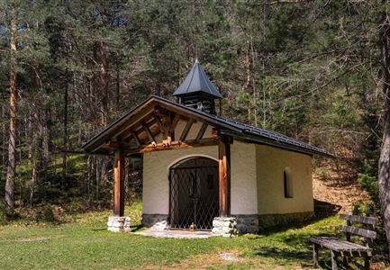
  • Option 1: The return follows the same route back to the "Frau Häusl" turnoff. Here, a small chapel stands next to a waterfall. From there, the route continues down to the village via the Rosenkranz Trail, a reflective path lined with several wayside shrines.
  • Option 2: The same trail leads all the way back to Reith train station – a simple way to enjoy the scenery once more.
  • Option 3: A more direct but steeper alternative is the Kaiserstand Trail, which descends into the village via gravel and asphalt

Features & Characteristics

Start Point

Reith Railway Station

End Point

Reith Railway Station

Family-friendly

Yes

Loop tour

Yes

Similar Tour Suggestions

Scharnitz - Wanderung zur Birzlkapelle - Kapelle mit Pausenbank.jpg

Hiking

Hike to the Birzlkapelle chapel

Length

4,60 km

Duration

01:30 h

Uphill

175 hm

Altitude

1130 hm

Difficulty

Easy

Familie beim Wandern am Kaltwassersee - Seefeld (1) Kopie.jpg

Hiking

Stone Pine Trail Rosshütte Mountain Station

Length

662 m

Duration

00:15 h

Uphill

28 hm

Downhill

24 hm

Difficulty

Easy

Wildsee im Herbst - Drohnenaufnahme - Blick auf Golfplatz und See mit Bergpanorama.jpg

Hiking

Circular hike from Seefeld to Auland & Reith

Length

9,30 km

Duration

02:45 h

Uphill

139 hm

Downhill

141 hm

Altitude

1199 hm

Difficulty

Easy

Bienenlehrpfad Reith - Infotafel am Bienenhotel (1).jpg

Hiking

Hike Bee Nature Trail

Length

2,50 km

Duration

01:00 h

Uphill

72 hm

Altitude

1185 hm

Difficulty

Easy

Friedensglocke im Herbst - Frau steht am Geländer und blickt ins Inntal beim Sonnenuntergang- Sonnenstern an der Glocke.jpg

Hiking

Peace Bell Hiking Trail

Length

4,60 km

Duration

01:30 h

Uphill

92 hm

Downhill

96 hm

Altitude

1292 hm

Difficulty

Easy

Schausäge der Triendlsäge

Hiking

Circular walking path to the Inn Triendlsäge

Length

4,80 km

Duration

01:15 h

Uphill

101 hm

Altitude

1215 hm

Difficulty

Easy

Familien-Weitwanderung im Gaistal - Familie am Zaun vor Gaistalalm.jpg

Hiking

Hike to the Gaistalalm & Tillfussalm alpine hut

Length

9,70 km

Duration

03:00 h

Uphill

229 hm

Altitude

1404 hm

Difficulty

Easy

Höhenweg Leutasch_Aussichtsplattform Höhenweg.jpg

Hiking

Circular hike to the viewing platform on the Höhenweg - Runst

Length

7,40 km

Duration

02:00 h

Uphill

128 hm

Altitude

1156 hm

Difficulty

Easy