Start Point

Information office Seefeld

End Point

Seefeld-Rosshütte Top Station

Difficulty

Hard

Total Distance

5,00 km

Descent Meters

423 m

Ascent Meters

416 m

Highest Point

1601 m

Total Time

01:20 h

Map & Elevation Profile

Start Point

Information office Seefeld

End Point

Seefeld-Rosshütte Top Station

Difficulty

Hard

Total Distance

5,00 km

Descent Meters

423 m

Ascent Meters

416 m

Highest Point

1601 m

Total Time

01:20 h

Cycling

Best Time

Jan

Feb

Mar

Apr

May

Jun

Jul

Aug

Sep

Oct

Nov

Dec

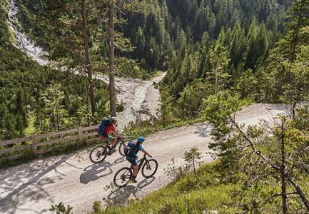
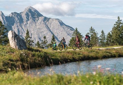
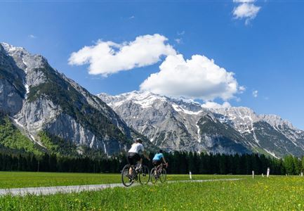
Mountainbike tour

Attention: This bike tour should only be tackled by the utterly fit with solid off-road experience - the steep gravelled sections are very challenging, both uphill and downhill! Keep your distance from grazing cattle and cross the area calmly and quickly. Families better choose one of the tours in the nearby Gaistal alpine paradise.

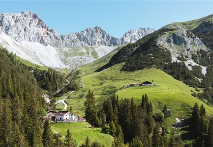
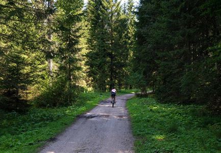
If you are looking for a real challenge in the saddle, this demanding bike tour to the Rauthhütte is definitely the right choice: From the Munde car park in the Leutasch hamlet of Moos, the ascent starts immediately to the right of the Mundestadl into the forest. Follow the gravel path steeply but with few bends uphill - keep right at the first junction, left at the second.

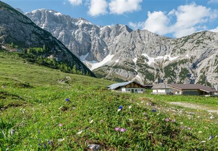
The last third of the demanding tour then distracts you from the burning calves with impressive panoramic views, after which you finally reach the delicious rest at the foot of the Hohe Munde. The "Kuchl" of the Rauthhütte really does live up to its many culinary awards - there are homemade delicacies with old traditional recipes, dumpling variations to melt away and homemade cakes that are always worth a sweet sin.

A little further on, from the Zugspitzblick view point, you can

Read More...

Features & Characteristics

Start Point

Information office Seefeld

End Point

Seefeld-Rosshütte Top Station

Similar Tour Suggestions

Scharnitz - Wanderung Dorfrunde - Weg bei Gießenbach (1).jpg

Cycling

Radwanderroute: Reith - Seefeld - Scharnitz

Length

18,50 km

Duration

01:45 h

Uphill

140 hm

Downhill

320 hm

Altitude

1200 hm

Difficulty

Easy

Reitherjoch-Alm (c) Anna Rieder

Cycling

Biketour No. 5032 Reitherjoch Alm

Length

12,60 km

Duration

02:00 h

Uphill

372 hm

Downhill

368 hm

Altitude

1495 hm

Difficulty

Medium

Gravelbike Asphaltstraße mit Bergpanorama - Leutasch

Cycling

Bike-tour Wettersteinrunde

Length

77,80 km

Duration

06:30 h

Uphill

1754 hm

Altitude

1599 hm

Difficulty

Hard

Muggenmoosalm bei Leutasch im Sommer - Drohnenaufnahme.jpg

Cycling

Biketour No. 5048 Muggenmoosalm

Length

14,80 km

Duration

01:45 h

Uphill

326 hm

Downhill

323 hm

Altitude

1370 hm

Difficulty

Medium

Drohnenaufnahme Gschwandtkopf - Speichersee mit Bäumen und Hohe Munde bei Sonnenuntergang.jpg

Cycling

Biketour No. 545 Gschwandtkopf

Length

6,40 km

Duration

00:45 h

Uphill

267 hm

Downhill

263 hm

Altitude

1486 hm

Difficulty

Hard

Reith-Wiesenwegrunde (c) Anna Rieder

Cycling

Biketour No. 5031 Reith-Wiesenweg

Length

4,60 km

Duration

00:35 h

Uphill

109 hm

Downhill

110 hm

Altitude

1129 hm

Difficulty

Medium

Verbindung-Seefeld-Reith Pfarrhügel (c) Anna Rieder

Cycling

Bike-connection No. 5030 Seefeld-Reith

Length

10,20 km

Duration

00:35 h

Uphill

120 hm

Downhill

115 hm

Altitude

1193 hm

Difficulty

Easy

Ebiken

Cycling

Biketour No. 588 Reith-Eigenhofen

Length

5,70 km

Duration

00:30 h

Uphill

6 hm

Downhill

528 hm

Altitude

1123 hm

Difficulty

Hard

Closed