Start Point

Leutasch parking Salzbach (P5)

End Point

Wettersteinhütte or Wangalm Gaistal

Difficulty

Hard

Total Distance

14,00 km

Descent Meters

618 m

Ascent Meters

618 m

Highest Point

1761 m

Total Time

01:30 h

Map & Elevation Profile

Start Point

Leutasch parking Salzbach (P5)

End Point

Wettersteinhütte or Wangalm Gaistal

Difficulty

Hard

Total Distance

14,00 km

Descent Meters

618 m

Ascent Meters

618 m

Highest Point

1761 m

Total Time

01:30 h

Cycling

Best Time

Jan

Feb

Mar

Apr

May

Jun

Jul

Aug

Sep

Oct

Nov

Dec

Mountainbike tour

Loop tour

Caution: Above the tree line at the junction (about 100 altitude meters below the Wetterstein hut and the Wangalm): please lock your bikes and take the last section on foot. From here on the trail becomes very steep and rough. Please keep your distance from grazing cattle and cross the grazing area calmly and quickly.

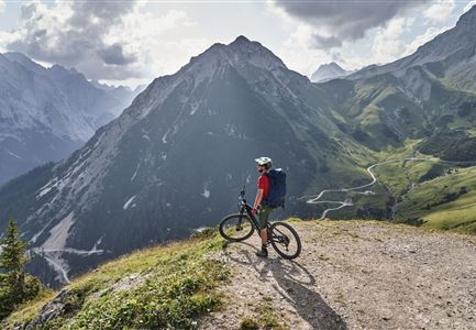
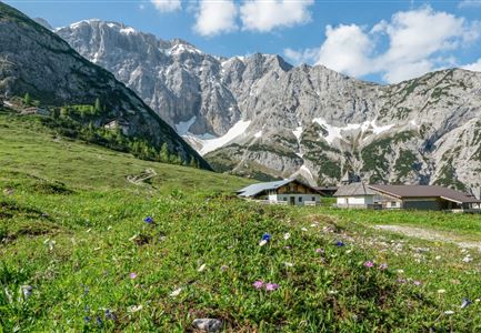
One of the most beautiful views of the entire Region Seefeld - Tirols Hochplateau: Wettersteinhütte and Wangalm
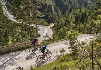
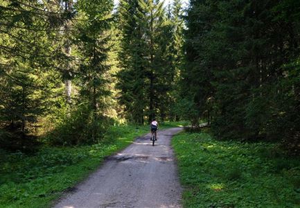
This tour starts directly at the Salzbach car park, in the very west of Leutasch. However, do not ride further into the valley but along the asphalted road back to the district Klamm. Then you turn north at the "Fiakerstüberl", follow the municipal road before you reach the forest road (gravel). From now on, the route continues uphill all the time. The beauty of the tour is the dense forest with its shady trees and many nice resting places. The forest road is very easy to ride on and meanders uphill in several hairpin bends, but also in long, almost flat sections. Lock your bikes at the junction above the tree line and hike the last 100  altitude meters. After 10 minutes of walking you can decide: To the right is the

Read More...

Features & Characteristics

Start Point

Leutasch parking Salzbach (P5)

End Point

Wettersteinhütte or Wangalm Gaistal

Loop tour

Yes

Similar Tour Suggestions

Reitherjoch-Alm (c) Anna Rieder

Cycling

Biketour No. 5032 Reitherjoch Alm

Length

12,60 km

Duration

02:00 h

Uphill

372 hm

Downhill

368 hm

Altitude

1495 hm

Difficulty

Medium

Erfrischende Rast an den Isarquellen

Cycling

Biketour No. 578 Hinterautal-Isarursprung-Kastenalm

Length

28,30 km

Duration

02:30 h

Uphill

327 hm

Downhill

324 hm

Altitude

1220 hm

Difficulty

Easy

Radfahrer unterwegs im Gaistal mit Blick auf die Leutascher Ache

Cycling

Biketour No. 552 Gaistal-Hochfeldern Alm

Length

20,20 km

Duration

02:00 h

Uphill

539 hm

Downhill

536 hm

Altitude

1733 hm

Difficulty

Hard

Wildmoos (c) Anna Rieder

Cycling

Biketour No. 5069 Seefeld-Wildmoos

Length

6,30 km

Duration

00:30 h

Uphill

122 hm

Downhill

120 hm

Altitude

1308 hm

Difficulty

Medium

Kapelle unterhalb vom Karwendelhaus - Scharnitz

Cycling

Bike Trail Tirol Etappe 07: Scharnitz-Achensee

Length

61,50 km

Duration

06:00 h

Uphill

1850 hm

Downhill

1880 hm

Altitude

1800 hm

Difficulty

Hard

Wildmoosalm im Sommer - Hütte mit Kuh.jpg

Cycling

Gravelbiketour Wildmoos

Length

20,00 km

Duration

03:15 h

Uphill

450 hm

Altitude

1510 hm

Difficulty

Medium

Möserer See im Frühling - Paar auf Liege vor Möserer Seestube von aus der Entfernung.jpg

Cycling

Biketour No. 544 Mösern-Wildmoos around the Brunschkopf

Length

11,50 km

Duration

01:30 h

Uphill

300 hm

Altitude

1387 hm

Difficulty

Medium

Symbolbild Biken

Cycling

Biketour No. 5049 Reith-Kaiserstandrunde

Length

6,60 km

Duration

01:10 h

Uphill

254 hm

Downhill

252 hm

Altitude

1318 hm

Difficulty

Hard