Start Point

Parking lot Kirchplatzl (P9)

End Point

Parking lot Kirchplatzl (P9)

Difficulty

Easy

Total Distance

6,30 km

Descent Meters

40 m

Ascent Meters

40 m

Highest Point

1130 m

Total Time

02:00 h

Status

Partially open

Map & Elevation Profile

Start Point

Parking lot Kirchplatzl (P9)

End Point

Parking lot Kirchplatzl (P9)

Difficulty

Easy

Total Distance

6,30 km

Descent Meters

40 m

Ascent Meters

40 m

Highest Point

1130 m

Total Time

02:00 h

Status

Partially open

Hiking

Best Time

Partially open

Jan

Feb

Mar

Apr

May

Jun

Jul

Aug

Sep

Oct

Nov

Dec

Hiking tour

Village walks

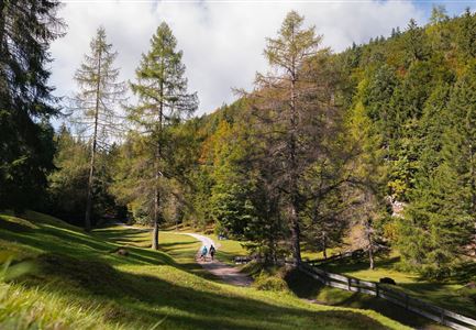
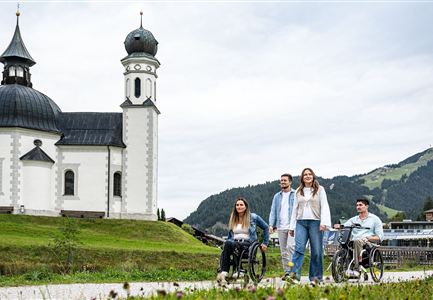
This easy, wheelchair-accessible hiking trail takes you through the beautiful Leutasch Valley. The trail is flat, wide, and has no particular danger spots. Over 6.3 km, you will discover the romantic hamlets of the plateau community, walk along the Leutascher Ache, and unwind at the edge of the forest.

The route starts depending on your arrival at Parking Lot P9 (Leutasch Tourist Office) or the bus stop Leutasch Kirchplatzl. From the bus stop, follow the road heading north and then turn left when you see the gas station. After a few meters, you’ll see a zebra crossing, which you cross, and then you will be at Parking Lot P9. From the zebra crossing, continue left along the main road. Keep going straight for a while until you pass another bus stop.

Next, you will cross a bridge on your right, at the end of which you will change sides of the street. Opposite the Alpenbad parking lot, the gravel path becomes much quieter. The hiking trail meanders, always accompanied by the Ache, in a long left curve until you reach the next bridge. Same procedure as the last bridge: You cross the bridge, change sides of the street, and

Features & Characteristics

Start Point

Parking lot Kirchplatzl (P9)

End Point

Parking lot Kirchplatzl (P9)

Loop tour

Yes

Family-friendly

Yes

Stroller-friendly

Yes
Similar Tour Suggestions

Bienenlehrpfad Reith - Infotafel am Bienenhotel (1).jpg

Hiking

Hike Bee Nature Trail

Length

2,50 km

Duration

01:00 h

Uphill

72 hm

Altitude

1185 hm

Difficulty

Easy

Scharnitz - Wanderung Dorfrunde - Kirche in Scharnitz.jpg

Hiking

Scharnitz cultural hiking trail

Length

3,00 km

Duration

01:00 h

Uphill

53 hm

Altitude

1005 hm

Difficulty

Easy

Fischerrei am Weidachsee - Leutasch (1)(1).jpg

Hiking

Circular walk around Weidachsee lake

Length

3,80 km

Duration

01:00 h

Uphill

46 hm

Altitude

1156 hm

Difficulty

Easy

Hofladenrunde Leutasch - Frau vor Wirtseppeler Hof.jpg

Hiking

Leutasch Farm Shop Circular Hike

Length

11,50 km

Duration

03:10 h

Uphill

111 hm

Downhill

108 hm

Altitude

1194 hm

Difficulty

Easy

Lottensee im Frühsommer - See und Hütte.jpg

Hiking

Circular hike to the Wildmossalm alpine hut & Lottenseehütte alpine hut

Length

7,10 km

Duration

02:30 h

Uphill

250 hm

Altitude

1420 hm

Difficulty

Easy

Herbst am Möserer See - Frau am Ufer (Edit 2).jpg

Hiking

Circular walking path lake Möserer See & Kalvarienberg

Length

3,00 km

Duration

01:00 h

Uphill

78 hm

Downhill

82 hm

Altitude

1291 hm

Difficulty

Easy

Reitherjoch Alm in Seefeld

Hiking

Circular hike to the Reitherjochalm alpine hut

Length

7,00 km

Duration

02:30 h

Uphill

370 hm

Altitude

1500 hm

Difficulty

Easy

Scharnitz - Wanderung zur Birzlkapelle - Kapelle mit Pausenbank.jpg

Hiking

Hike to the Birzlkapelle chapel

Length

4,60 km

Duration

01:30 h

Uphill

175 hm

Altitude

1130 hm

Difficulty

Easy