Start Point

Citizen and Tourism Service Reith
End Point

Citizen and Tourism Service Reith
Difficulty

Easy

Total Distance

1,20 km

Descent Meters

100 m

Highest Point

1220 m

Total Time

01:15 h

Map & Elevation Profile

Start Point

Citizen and Tourism Service Reith
End Point

Citizen and Tourism Service Reith
Difficulty

Easy

Total Distance

1,20 km

Descent Meters

100 m

Highest Point

1220 m

Total Time

01:15 h

Hiking

Best Time

Jan

Feb

Mar

Apr

May

Jun

Jul

Aug

Sep

Oct

Nov

Dec

Hiking tour

Thematic route

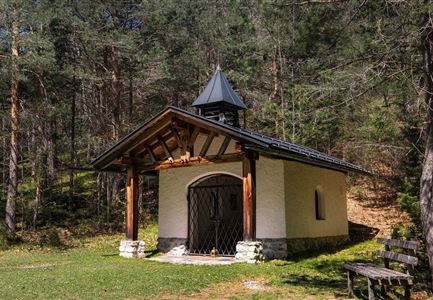
In the state memorial year of 2009, the Reith Schützenkompanie built the heritage-protected Rosary Path leading to the Frau Häusl Chapel – a contemplative hiking trail that connects nature and faith.

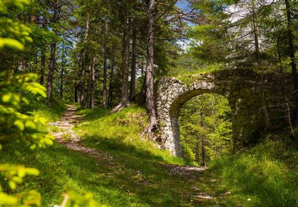
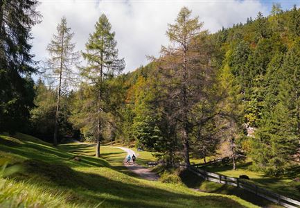
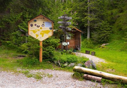
The starting point is the Reith Information Office. From here, the route leads to the Parish Church of Saint Nicholas and continues along the old Roman road onto Bichlweg. At the first bend, a signposted forest path branches off to the left, leading into the peaceful woods.

Along the path, five artistically crafted wayside shrines, carved from reddish larch wood, display a total of 15 relief panels. These depict the joyful, sorrowful, and glorious mysteries of the Rosary. The Inzing-based artist Annemarie Beiler designed and painted the panels in intricate detail using Lafarge concrete.

The Rosary Path follows a gently babbling brook and eventually leads to the Frau Häusl Chapel, a tranquil place for reflection. Those who continue a little further will discover a small waterfall – a rewarding sight for nature lovers.

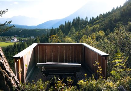
For the return journey, there are two options: either retrace the same path or take the Reither Panorama Trail/Kaiserstand Trail to complete the hike as a scenic circular

Features & Characteristics

Similar Tour Suggestions

Friedensglocke im Herbst - Frau steht am Geländer und blickt ins Inntal beim Sonnenuntergang- Sonnenstern an der Glocke.jpg

Hiking

Peace Bell Hiking Trail

Length

4,60 km

Duration

01:30 h

Uphill

92 hm

Downhill

96 hm

Altitude

1292 hm

Difficulty

Easy

Familie in der Region Seefeld - Leutascher Ache.jpg

Hiking

Hike along the Achweg

Length

10,80 km

Duration

03:00 h

Uphill

70 hm

Downhill

78 hm

Altitude

1170 hm

Difficulty

Easy

Paar vor dem Seekirchl im Sommer - Seefeld in Tirol.jpg

Hiking

Circular walk in the Möserer valley

Length

3,10 km

Duration

00:45 h

Uphill

12 hm

Altitude

1196 hm

Difficulty

Easy

Reith Wiesenweg im Frühling - Drohnenaufnahme strahlend grüne Wiese mit Blick zum Inntal.jpg

Hiking

Circular hiking traill Wiesenweg

Length

4,60 km

Duration

01:30 h

Uphill

109 hm

Altitude

1128 hm

Difficulty

Easy

Wildsee im Herbst - Drohnenaufnahme - Blick auf Golfplatz und See mit Bergpanorama.jpg

Hiking

Circular hike from Seefeld to Auland & Reith

Length

9,30 km

Duration

02:45 h

Uphill

139 hm

Downhill

141 hm

Altitude

1199 hm

Difficulty

Easy

Hofladenrunde Leutasch - Frau vor Wirtseppeler Hof.jpg

Hiking

Leutasch Farm Shop Circular Hike

Length

11,50 km

Duration

03:10 h

Uphill

111 hm

Downhill

108 hm

Altitude

1194 hm

Difficulty

Easy

Bodenalm im Sommer (4).jpg

Hiking

Circular hiking traill to the Bodenalm alpine hut

Length

8,40 km

Duration

02:30 h

Uphill

180 hm

Altitude

1198 hm

Difficulty

Easy

Schlossbachklamm mit Bahnstrecke - Reith.jpg

Hiking

Hike through the Schlossbachklamm Gorge

Length

12,20 km

Duration

04:30 h

Uphill

488 hm

Downhill

482 hm

Altitude

1129 hm

Difficulty

Easy