Start Point

Seefeld Train Station

End Point

Seefeld Train Station

Difficulty

Easy

Total Distance

3,15 km

Highest Point

1200 m

Total Time

01:10 h

Map & Elevation Profile

Start Point

Seefeld Train Station

End Point

Seefeld Train Station

Difficulty

Easy

Total Distance

3,15 km

Highest Point

1200 m

Total Time

01:10 h

Hiking

Best Time

Jan

Feb

Mar

Apr

May

Jun

Jul

Aug

Sep

Oct

Nov

Dec

Hiking tour

Village walks

This easy, wheelchair-accessible hike takes you on a 3.15 km route through the Seefeld pedestrian zone, past the Seekirchl and on to the Toni Seelos ski jumps. The path is flat, wide, and free of hazards, making it comfortable to travel along.

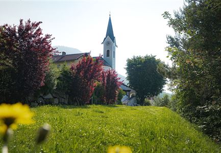
The route begins at the accessible train station in Seefeld (with accessible toilet available) and leads straight through the historic pedestrian zone, where you can enjoy a coffee or do a little window shopping before starting the tour. Passing the parish church on the right, the path curves left, soon opening up the view of Seefeld’s landmark, the Seekirchl. The asphalt surface changes to well-maintained gravel, and shortly you’ll find yourself directly in front of the chapel.

After a photo stop, continue along the stream on the left, first on gravel and then across a wooden footbridge towards the Möserer Valley. Soon, a bridge appears – once you pass underneath it, you will first pass the tennis courts, then the football pitch. At the end of the field, the path

Features & Characteristics

Start Point

Seefeld Train Station

End Point

Seefeld Train Station

Family-friendly

Yes

Stroller-friendly

Yes
Loop tour

Yes

Similar Tour Suggestions

Hofladenrunde Leutasch - Frau vor Wirtseppeler Hof.jpg

Hiking

Leutasch Farm Shop Circular Hike

Length

11,50 km

Duration

03:10 h

Uphill

111 hm

Downhill

108 hm

Altitude

1194 hm

Difficulty

Easy

Reith - Wanderung Frau Häusl Kapelle - Bank und Bildstock mit Aussicht ins Inntal.jpg

Hiking

Circular hike panoramic path

Length

6,70 km

Duration

02:15 h

Uphill

289 hm

Altitude

1306 hm

Difficulty

Easy

Scharnitz - Wanderung Dorfrunde - Kirche in Scharnitz.jpg

Hiking

Scharnitz cultural hiking trail

Length

3,00 km

Duration

01:00 h

Uphill

53 hm

Altitude

1005 hm

Difficulty

Easy

Wildsee im Sommer_Drohnenaufnahme bei Morgenstimmung.jpg

Hiking

Wheelchair Circular Hike around the Wildsee

Length

3,40 km

Duration

01:00 h

Altitude

1180 hm

Difficulty

Easy

Herbstwanderung am Oberen Wiesenweg_Paar läuft entlang von Wiese_Aufnahme gegen die Sonne mit Lärchen im Hintergrund.jpg

Hiking

Circular hiking traill Oberer & Unterer Wiesenweg

Length

6,10 km

Duration

02:00 h

Uphill

64 hm

Altitude

1194 hm

Difficulty

Easy

Scharnitz - Wanderung Dorfrunde - Scharnitz im Überblick.jpg

Hiking

Hike from Seefeld to Scharnitz

Length

9,60 km

Duration

02:45 h

Uphill

35 hm

Downhill

301 hm

Altitude

1252 hm

Difficulty

Easy

kinder_bei_infotafel_in_der_geisterklamm.jpg

Hiking

Short circular trail at the Spirit Gorge

Length

500 m

Duration

00:15 h

Uphill

10 hm

Altitude

1027 hm

Difficulty

Easy

Möserer See im Frühling - Paar läuft entlang des Seeweges.jpg

Hiking

Circular walking path from Seefeld to the lake Möserer See

Length

8,80 km

Duration

02:30 h

Uphill

231 hm

Altitude

1297 hm

Difficulty

Easy