Start Point

Leutasch Bus Stop Ostbach

End Point

Leutasch Bus Stop Ostbach

Difficulty

Easy

Total Distance

11,50 km

Descent Meters

220 m

Ascent Meters

220 m

Highest Point

1345 m

Total Time

03:30 h

Map & Elevation Profile

Start Point

Leutasch Bus Stop Ostbach

End Point

Leutasch Bus Stop Ostbach

Difficulty

Easy

Total Distance

11,50 km

Descent Meters

220 m

Ascent Meters

220 m

Highest Point

1345 m

Total Time

03:30 h

Hiking

Best Time

Jan

Feb

Mar

Apr

May

Jun

Jul

Aug

Sep

Oct

Nov

Dec

Hiking tour

Hut hike

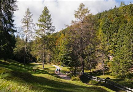
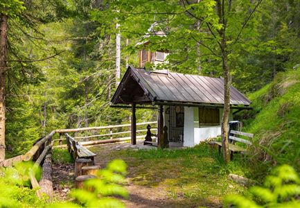
The hike starts at the bus stop in Ostbach. At first, the route follows the main road for a short stretchbe extra careful here! After a short walk, you reach the Ostbach Bridge, where the trail turns onto Schlagweg No. 3 towards Muggenmoos Alm. From here, the path steadily climbs uphill through the forest on a well-maintained trail.

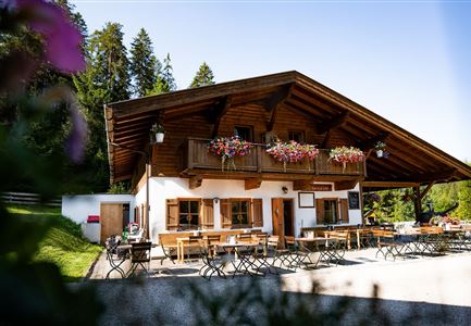
After passing through the forest, the trail leads left past Rauthgatter to Ferienheim Wildmoos (not serviced). From there, the path continues to the Wildmoosalm, which sits beautifully in an alpine meadow and offers a great place to stop and rest.

Note: There are no parking spaces directly at the starting point. Those arriving by car can park at parking lot Munde (P18) and walk to the Ostbach bus stop to begin the hike.

Features & Characteristics

Start Point

Leutasch Bus Stop Ostbach

End Point

Leutasch Bus Stop Ostbach

Similar Tour Suggestions

Familien-Weitwanderung im Gaistal - Familie spielt Engelchen.jpg

Hiking

Stage 3: To Hämmermoosalm & Wrap Up – Leutasch 3-Day Hut Hike for Families

Length

6,50 km

Uphill

10 hm

Downhill

840 hm

Altitude

2132 hm

Difficulty

Medium

Reith im Frühling bei Morgenstimmung - Drohnenaufnahme Kirche mit Blick ins Inntal.jpg

Hiking

Cultural circular walking path Reith

Length

4,57 km

Duration

01:30 h

Uphill

113 hm

Altitude

1126 hm

Difficulty

Easy

Ederkanzel

Hiking

Circular Hike via the Franzosensteig to Grünkopf and Ederkanzel

Length

7,40 km

Duration

04:00 h

Uphill

590 hm

Altitude

1569 hm

Difficulty

Medium

Wanderer auf dem Predigtstuhl.jpg

Hiking

Bike & Hike Predigtstuhl Summit, 2,234 m

Length

19,00 km

Duration

04:30 h

Uphill

1015 hm

Altitude

2234 hm

Difficulty

Hard

Isarursprung im Karwendel - Scharnitz (3).jpg

Hiking

Hike to the source of the river Isar & Kasten alpine hut

Length

28,20 km

Duration

06:00 h

Uphill

323 hm

Altitude

1227 hm

Difficulty

Medium

Wildsee im Herbst - Drohnenaufnahme - Blick auf Golfplatz und See mit Bergpanorama.jpg

Hiking

Circular hike from Seefeld to Auland & Reith

Length

9,30 km

Duration

02:45 h

Uphill

139 hm

Downhill

141 hm

Altitude

1199 hm

Difficulty

Easy

Familie beim Wandern am Kaltwassersee - Seefeld (2).jpg

Hiking

Circular hiking traill to the Rosshütte alpine hut - Hochegg Alm alpine hut

Length

8,30 km

Duration

03:45 h

Uphill

515 hm

Altitude

1740 hm

Difficulty

Medium

Wildmoosalm im Sommer - Alm aus der Distanz mit Gewässer im Vordergrund.jpg

Hiking

Circular hiking trail Wildmoos-Hochmoos

Length

10,00 km

Duration

04:00 h

Uphill

437 hm

Altitude

1544 hm

Difficulty

Medium