We use cookies for your personalized browsing experience, to personalize content and ads, to provide social media features, and to analyze traffic to our website. We also share information about your use of our website with our social media, advertising and analytics partners. Our partners may combine this information with other data that you have provided to them or that they have collected as part of your use of the Services. (incl. US providers)

Start Point

Parking area puitbach (P13)

End Point

Parking area puitbach (P13)

Difficulty

Medium

Total Distance

22,80 km

Descent Meters

1319 m

Ascent Meters

1319 m

Highest Point

2367 m

Total Time

10:00 h

Map & Elevation Profile

Start Point

Parking area puitbach (P13)

End Point

Parking area puitbach (P13)

Difficulty

Medium

Total Distance

22,80 km

Descent Meters

1319 m

Ascent Meters

1319 m

Highest Point

2367 m

Total Time

10:00 h

Hiking

Best Time

Jan

Feb

Mar

Apr

May

Jun

Jul

Aug

Sep

Oct

Nov

Dec

Hiking tour

Summit tours

+1

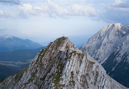
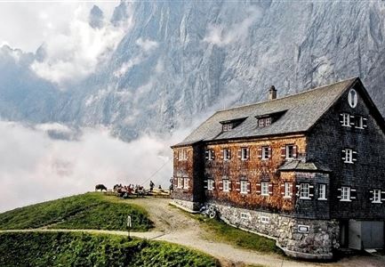
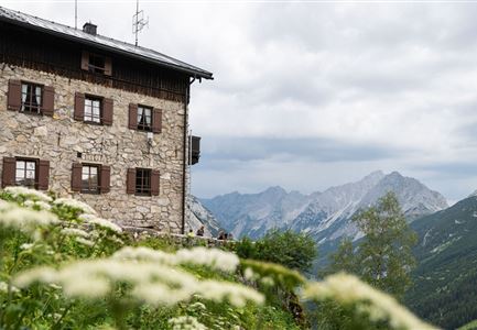
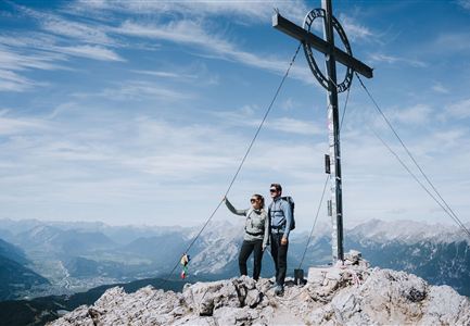
Route: Parking lot Puitbach/Ahrn (P13) – Puittal – Scharnitzjoch – Erinnerungshütte – Gehrenspitze – Wangalm – Wettersteinhütte – Parking lot Puitbach/Ahrn (P13) 

Very long hike that requires good physical condition.

Parking and public transport:

P13 "Puitbach/Ahrn parking lot".

By train to Seefeld train station and continue with the Regiobus to the stop "Leutasch Puitbach".

You can find all connections in real time with the Mobility-App "wegfinder".

Directions:

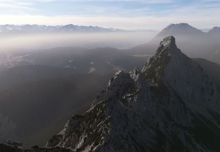
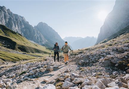
The starting point for the hike to the Gehrenspitze is the Puitbach/Ahrn parking lot (P13) in Leutasch (fee required). From here, follow the signs to the left along the path to Puitegg and further into the Puittal valley. This valley delights with untouched nature and paradisiacal views of the surrounding mountains. Under the high towers of the Öfelekopf, the Leutascher Dreitorspitze and the walls of the Gehrenspitze, you climb further and further up through the lush green valley. The flora and fauna with countless mountain herbs is also unique. With a little luck, you will encounter chamois or marmots that call the Puittal their home.

At first, you have to overcome a few steep meters in altitude, but these pay off at the Scharnitzjoch at the latest. After about 3 hours you reach it and can look forward

Read More...

Features & Characteristics

Start Point

Parking area puitbach (P13)

End Point

Parking area puitbach (P13)

Circular hike

Yes

Similar Tour Suggestions

Wildmoosalm im Sommer - Hütte mit Kuh.jpg

Hiking

Hike to the Wildmoosalm alpine hut

Length

5,80 km

Duration

01:45 h

Uphill

131 hm

Altitude

1305 hm

Difficulty

Easy

Wettersteinhuette (l) und Wangalm (r) im Wettersteingebirge (2).jpg

Hiking

Circular hike Wettersteinhütte alpine hut - Wangalm alpine hut - Hämmermoosalm alpine hut

Length

10,20 km

Duration

04:15 h

Uphill

562 hm

Altitude

1756 hm

Difficulty

Medium

Meilerhütte

Hiking

Hike to the Meilerhütte alpine hut

Length

13,00 km

Duration

09:00 h

Uphill

1352 hm

Downhill

36 hm

Altitude

2371 hm

Difficulty

Medium

Wanderung zur Eppzirler Alm im Karwendel - Scharnitz.jpg

Hiking

Hike to the Eppzirler Alm alpine hut

Length

12,40 km

Duration

04:00 h

Uphill

481 hm

Altitude

1453 hm

Difficulty

Medium

Blick ueber Wildmoos nach Seefeld.jpg

Hiking

Circular tour around the Brunschkopf

Length

12,80 km

Duration

04:00 h

Uphill

265 hm

Altitude

1371 hm

Difficulty

Easy

Kneippanlage beim Wildsee - Seefeld (2).jpg

Hiking

Kneipp facility & reflection walk in Seefeld

Length

7,60 km

Duration

02:00 h

Uphill

36 hm

Downhill

32 hm

Altitude

1250 hm

Difficulty

Easy

Spaziergang mit Hund in Unterleutasch - Mann läuft mit Hund entlang von Bäumen Aufnahme Richtung Sonne.jpg

Hiking

Hike to Unterleutasch

Length

9,10 km

Duration

02:30 h

Uphill

3 hm

Downhill

77 hm

Altitude

1174 hm

Difficulty

Easy

Katzenloch Leutasch

Hiking

Hike through the Katzenloch

Length

7,10 km

Duration

01:30 h

Uphill

150 hm

Altitude

1280 hm

Difficulty

Easy