Start Point

ErlebnisWelt Alpenbad Leutasch

End Point

ErlebnisWelt Alpenbad Leutasch

Difficulty

Medium

Total Distance

30,68 km

Descent Meters

731 m

Ascent Meters

551 m

Highest Point

1370 m

Total Time

09:30 h

Map & Elevation Profile

Start Point

ErlebnisWelt Alpenbad Leutasch

End Point

ErlebnisWelt Alpenbad Leutasch

Difficulty

Medium

Total Distance

30,68 km

Descent Meters

731 m

Ascent Meters

551 m

Highest Point

1370 m

Total Time

09:30 h

Running

Best Time

Jan

Feb

Mar

Apr

May

Jun

Jul

Aug

Sep

Oct

Nov

Dec

Attraction

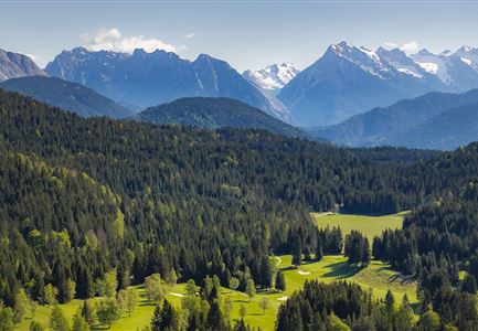
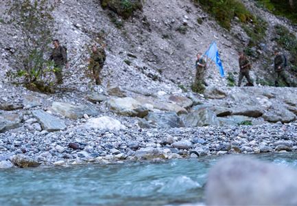
Day 2 of the 3-Day Unicorn March starts with a 31 km hike called the Inntalblick Trail. The route begins at the ErlebnisWelt Alpenbad Leutasch and follows the Ache River to the district of Obern. It continues to Muggenmoos and then to Lottensee, a seasonal lake. Next, the trail goes to the Peace Bell with a view of the Inntal Valley. From there, it passes through Mösern towards Seefeld, reaching the Toni Seelos Ski Jump, where you take the lift up. After that, you walk through Seefeld’s town center to Wildmoos and then to Katzenkopf, where you can stop at the Katzenkopf Hut for a break. Take the lift down to the valley station, then head to Weidachsee, and finally return to ErlebnisWelt Alpenbad Leutasch.

Features & Characteristics

Start Point

ErlebnisWelt Alpenbad Leutasch

End Point

ErlebnisWelt Alpenbad Leutasch

Similar Tour Suggestions

Scharnitz - Wanderung zur Adlerkanzel - Adlerkanzel mit Ausblick auf Scharnitz.jpg

Hiking

Hike to the viewpoint Adlerkanzel (Eagle's pulpit)

Length

2,80 km

Duration

01:30 h

Uphill

230 hm

Altitude

1145 hm

Difficulty

Medium

Brunschkopf während der Goldenen Stunde.jpg

Hiking

Viewpoint Brunschkopf via forest road from Mösern

Length

9,10 km

Duration

03:00 h

Uphill

279 hm

Downhill

272 hm

Altitude

1496 hm

Difficulty

Medium

Brunschkopf_inkl_Logo.jpg

Hiking

Brunschkopf viewing platform via Geiernest from Seefeld, return via Wildmoosalm

Length

9,20 km

Duration

03:15 h

Uphill

316 hm

Downhill

313 hm

Altitude

1493 hm

Difficulty

Medium

Teilnehmer vom Einhornmarsch kurz vor Kirchplatzl (1).jpg

Running

IML Unicorn March Day 2: 42 km - Olympic Hike

Length

42,29 km

Duration

12:45 h

Uphill

886 hm

Downhill

691 hm

Altitude

1370 hm

Difficulty

Medium

Einhornmarsch-Teilnehmer mit Seefeld-Beutel laufen an der Leutascher Ache entlang.jpg

Running

IML Unicorn March Day 1: 42km - Hike around the Arnspitze Mountain

Length

42,00 km

Duration

11:00 h

Uphill

820 hm

Altitude

1382 hm

Difficulty

Medium

Hölzernes Herz am Mühlberg in Scharnitz - Perspektive durch Gebüsch (1).jpg

Hiking

Hike to the Mühlberg Scharnitz

Length

6,50 km

Duration

02:30 h

Uphill

334 hm

Downhill

328 hm

Altitude

1315 hm

Difficulty

Medium

Drohnenaufnahme Geisterklamm - zwei Personen laufen auf Steg reingezoomt.jpg

Running

IML Unicorn March Day 1: 30 km - Spirit Gorge Hike

Length

30,00 km

Duration

08:45 h

Uphill

841 hm

Downhill

821 hm

Altitude

1499 hm

Difficulty

Medium

Aussichtsplattform Kurblhang - Leutasch.jpg

Hiking

Circular hiking trail viewpoint Kurblhang

Length

3,50 km

Duration

01:30 h

Uphill

181 hm

Altitude

1277 hm

Difficulty

Medium