Start Point

ErlebnisWelt Alpenbad Leutasch

End Point

ErlebnisWelt Alpenbad Leutasch

Difficulty

Easy

Total Distance

20,00 km

Descent Meters

534 m

Ascent Meters

510 m

Highest Point

1417 m

Total Time

06:15 h

Map & Elevation Profile

Start Point

ErlebnisWelt Alpenbad Leutasch

End Point

ErlebnisWelt Alpenbad Leutasch

Difficulty

Easy

Total Distance

20,00 km

Descent Meters

534 m

Ascent Meters

510 m

Highest Point

1417 m

Total Time

06:15 h

Running

Best Time

Jan

Feb

Mar

Apr

May

Jun

Jul

Aug

Sep

Oct

Nov

Dec

Attraction

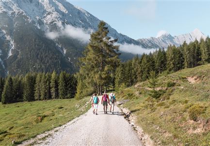
This 20km Bichlwald Walk starts at the same time, as the Wiesenweg Walk and almost takes the same route. However, at the hamlet of Moos it leads into the idyllic and enchanting Gaistal valley. From there it heads up to the Hämmermoosalm, where walkers can really feel the traditional alpine pasture atmosphere of the Alps. The trail descends from the Hämmermoosalm back in the direction of Leutasch.


Features & Characteristics

Start Point

ErlebnisWelt Alpenbad Leutasch

End Point

ErlebnisWelt Alpenbad Leutasch

Similar Tour Suggestions

Möserer See im Frühling - Paar läuft entlang des Seeweges.jpg

Hiking

Circular walking path from Seefeld to the lake Möserer See

Length

8,80 km

Duration

02:30 h

Uphill

231 hm

Altitude

1297 hm

Difficulty

Easy

Teilnehmer_innen des Einhornmarsches von hinten auf einer Brücke in Reindlau, Leutasch (1).jpg

Running

IML Unicorn March Day 1: 10km - Runst-Hike

Length

10,20 km

Duration

02:45 h

Uphill

80 hm

Altitude

1148 hm

Difficulty

Easy

Brunschkopf_inkl_Logo.jpg

Hiking

Brunschkopf viewing platform via Geiernest from Seefeld, return via Wildmoosalm

Length

9,20 km

Duration

03:15 h

Uphill

316 hm

Downhill

313 hm

Altitude

1493 hm

Difficulty

Medium

Herbst am Möserer See - Frau am Ufer (Edit 2).jpg

Hiking

Circular walking path lake Möserer See & Kalvarienberg

Length

3,00 km

Duration

01:00 h

Uphill

78 hm

Downhill

82 hm

Altitude

1291 hm

Difficulty

Easy

Hölzernes Herz am Mühlberg in Scharnitz - Perspektive durch Gebüsch (1).jpg

Hiking

Hike to the Mühlberg Scharnitz

Length

6,50 km

Duration

02:30 h

Uphill

334 hm

Downhill

328 hm

Altitude

1315 hm

Difficulty

Medium

Golfclub Wildmoos - Drohnen-Zoomaufnahme.jpg

Running

IML Unicorn March Day 2: 20 km - Wildmoos Mountain Hike

Length

21,35 km

Duration

06:30 h

Uphill

519 hm

Downhill

324 hm

Altitude

1370 hm

Difficulty

Easy

Oberer Wiesenweg in Leutasch.jpg

Running

IML Unicorn March Day 3: 10 km - Wiesenweg Hike

Length

10,00 km

Duration

03:00 h

Uphill

137 hm

Downhill

134 hm

Altitude

1198 hm

Difficulty

Easy

Aussichtsplattform Kurblhang - Leutasch.jpg

Hiking

Circular hiking trail viewpoint Kurblhang

Length

3,50 km

Duration

01:30 h

Uphill

181 hm

Altitude

1277 hm

Difficulty

Medium