Start Point

Weidach Leutasch

End Point

Weidach Leutasch

Difficulty

Hard

Total Distance

50,00 km

Descent Meters

512 m

Highest Point

1226 m

Map & Elevation Profile

Start Point

Weidach Leutasch

End Point

Weidach Leutasch

Difficulty

Hard

Total Distance

50,00 km

Descent Meters

512 m

Highest Point

1226 m

Cross-country Skiing

Best Time

Jan

Feb

Mar

Apr

May

Jun

Jul

Aug

Sep

Oct

Nov

Dec

Klassisch

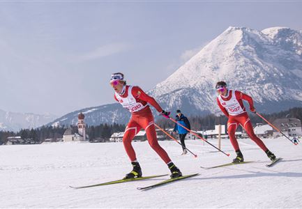
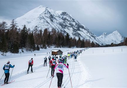
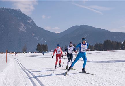
The 50 km classic route offers everything that the experienced classic racer could wish for. Sharp climbs and descents, interesting routes through the woods and and all surrounded by the beautiful panorama of the Wetterstein and Karwendel mountains. The heart of the course is the unique Plaikloipe (C9) which, after the challenging climb, offers lovely descents and wonderful views. The stretch on the Panorama track (B7) and Wald trail (B11) before the finish line is also a sleeper hit for those who love classic tracks.

The challenging classic route is taken twice (50 km in total) and it is considered as the leading discipline of the largest cross-country skiing classic in Austria. The course can of course also be run only once (25km).

More information about the program and details on registration can be found here.

Features & Characteristics

Start Point

Weidach Leutasch

End Point

Weidach Leutasch

Klassisch

Yes
Similar Tour Suggestions

Drohnenaufnahme Gschwandtkopf - Speichersee mit Bäumen und Hohe Munde bei Sonnenuntergang.jpg

Cycling

Biketour No. 545 Gschwandtkopf

Length

6,40 km

Duration

00:45 h

Uphill

267 hm

Downhill

263 hm

Altitude

1486 hm

Difficulty

Hard

C10-Mundeknie-Loipe---Leutasch.jpg

Cross-country Skiing

C10 – Mundeknie

Length

2,50 km

Uphill

84 hm

Altitude

1263 hm

Difficulty

Hard

Closed
Trailrunning auf der Seefelder Spitze - Läufer rennt im Sonnenuntergang.jpg

Running

Leutasch Trail (Salomon Zugspitz Ultratrail)

Length

68,00 km

Duration

16:00 h

Uphill

2870 hm

Downhill

3370 hm

Altitude

2049 hm

Difficulty

Hard

Einhornmarsch-Teilnehmer mit Seefeld-Beutel laufen an der Leutascher Ache entlang.jpg

Running

IML Unicorn March Day 1: 42km - Hike around the Arnspitze Mountain

Length

42,00 km

Duration

11:00 h

Uphill

820 hm

Altitude

1382 hm

Difficulty

Hard

Wintertrailrunning in der Region Seefeld - Zwei Läufer in traumhafter Winterlandschaft.jpg

Running

Wintertrail - Seefeld to Katzenkopf hut

Length

16,70 km

Uphill

360 hm

Altitude

1371 hm

Difficulty

Hard

Karwendelmarsch 2018 (13).jpg

Hiking

Karwendel March 35 km

Length

35,00 km

Duration

12:30 h

Uphill

1664 hm

Downhill

1358 hm

Altitude

1843 hm

Difficulty

Hard

Radfahrer unterwegs im Gaistal mit Blick auf die Leutascher Ache

Cycling

Biketour No. 552 Gaistal-Hochfeldern Alm

Length

20,20 km

Duration

02:00 h

Uphill

539 hm

Downhill

536 hm

Altitude

1733 hm

Difficulty

Hard

Falkenhütte neu

Hiking

Karwendelmarsch 52 km

Length

52,00 km

Duration

19:00 h

Uphill

2281 hm

Downhill

2217 hm

Altitude

1903 hm

Difficulty

Hard